
National Register of Historic Places listings in Santa Clara County, California facts for kids

Have you ever wondered about the oldest and most special buildings or places in your area? In Santa Clara County, California, there are many amazing spots that are officially recognized for their history! These places are listed on something called the National Register of Historic Places. It's like a special list of important buildings, areas, or objects across the United States that are worth protecting because of their past.
There are 119 places in Santa Clara County on this list. Six of these are even more special and are called National Historic Landmarks. Think of them as the "superstars" of historic places! One place used to be on the list but isn't anymore. Let's explore some of these cool historic spots!
Contents
What is the National Register of Historic Places?
The National Register of Historic Places is the official list of the nation's historic places that are worth saving. It's managed by the National Park Service, which is part of the U.S. government. When a place is added to this list, it means it's important to the history, architecture, archaeology, engineering, or culture of the United States.
Being on the National Register helps protect these places. It encourages people to preserve them and can even offer special grants or tax benefits to help with their care. It's a way to make sure that future generations can learn from and enjoy these pieces of history.
What Makes a Place Historic?
A place can be considered historic for many reasons. Maybe it's where an important event happened, or it was home to a famous person. It could also be a great example of a certain type of architecture, like an old Victorian house or a unique modern building. Sometimes, it's a whole area, like a historic downtown street, that tells a story about how a town grew.
Special Places: National Historic Landmarks
Out of all the places on the National Register, a few are chosen as National Historic Landmarks. These are places that are considered to be important to all of American history. Santa Clara County is lucky to have six of these very special landmarks!
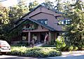
- Hanna-Honeycomb House in Stanford: This unique house was built in 1937 by a famous architect named Frank Lloyd Wright. It's called the "Honeycomb House" because of its unusual hexagonal (six-sided) shape. It's a great example of modern architecture.
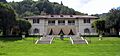
- Lou Henry Hoover House in Stanford: This was the home of Lou Henry Hoover, the wife of President Herbert Hoover. It's a beautiful house with a mix of architectural styles, and it shows how important she was in American history.
- New Almaden in San Jose: This is an old mercury mining area. It was one of the most important mercury mines in the world during the California Gold Rush. It played a huge role in the history of mining and industry in California.
- Frank Norris Cabin near Gilroy: This cabin belonged to Frank Norris, a famous American writer. He wrote important novels about life in California and the American West. This cabin was his peaceful retreat.
- Our Lady of Guadalupe Mission Chapel in San Jose: This chapel is important because of its connection to Cesar Chavez, a famous leader who fought for the rights of farmworkers. It was a key meeting place for the United Farm Workers movement.
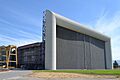
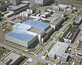
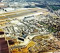
- Unitary Plan Wind Tunnel at Moffett Field: This is a huge wind tunnel used for testing aircraft and spacecraft designs. It's part of the Ames Research Center and has been very important for aerospace research and space exploration.
Other Cool Historic Spots
Beyond the landmarks, many other places in Santa Clara County are on the National Register. They tell different stories about the area's past.
Historic Homes and Buildings
Many old houses and buildings are on the list because of their unique architecture or the people who lived there.
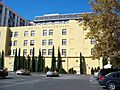
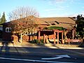
- Agnews Developmental Center in Santa Clara: This historic district includes buildings from what was once a large mental health facility. The clock tower is a well-known part of the campus.
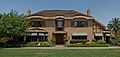
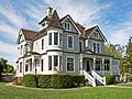
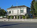
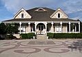
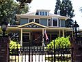
- Ainsley House in Campbell: This beautiful house was built in 1925 and is now a museum. It shows what life was like for a wealthy family in the early 20th century.
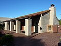
- Jose Maria Alviso Adobe in Milpitas: An adobe house is a building made from sun-dried mud bricks. This one is very old and gives us a peek into California's early history.
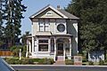
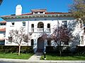
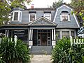
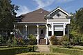
- Ashworth-Remillard House in San Jose: This grand house is a great example of Victorian architecture.
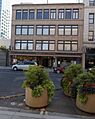
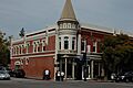
- De Anza Hotel in San Jose: A classic hotel building that shows the style of downtown San Jose in the 1930s.
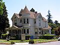
- Hayes Mansion in San Jose: This huge mansion was built in 1905 and is now a hotel and conference center. It's known for its beautiful Spanish Colonial Revival style.
- Hewlett-Packard House and Garage in Palo Alto: This is where Hewlett-Packard, one of the first big technology companies, started! It's a simple garage that became the birthplace of Silicon Valley.
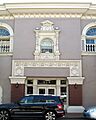
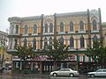
- Hotel Sainte Claire in San Jose: This fancy hotel from the 1920s is a landmark in downtown San Jose.
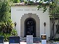
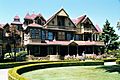
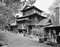
- Winchester Mystery House in San Jose: This famous mansion is known for its strange design, with stairs leading to ceilings and doors opening to walls. It was built by Sarah Winchester, the widow of the rifle magnate.
Schools and Libraries
Several old schools and libraries are recognized for their role in education and community life.
- Campbell Union Grammar School and Campbell Union High School Historic District in Campbell: These buildings represent the history of education in the city of Campbell.
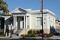
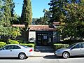
- East San Jose Carnegie Branch Library in San Jose: This library was built with money from Andrew Carnegie, a famous businessman who funded many libraries across the country.
- Gilroy Free Library in Gilroy: Another Carnegie library, showing how important these buildings were for communities to access books and learning.
- Milpitas Grammar School in Milpitas: An important building in the history of Milpitas education.
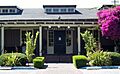
- Saratoga Village Library in Saratoga: This old library building now serves as a used book store, still supporting the community.
Other Interesting Places
- Alviso Historic District in Alviso: This district covers a whole area that was once a busy port town. It shows how important water travel was in early California.
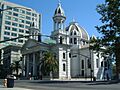
- First Unitarian Church of San Jose in San Jose: A beautiful and historic church building.
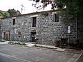
- Forbes Mill in Los Gatos: This old mill building tells the story of early industry in the area.
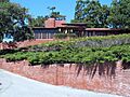
- Hakone Gardens in Saratoga: These beautiful Japanese gardens are a peaceful and historic spot.
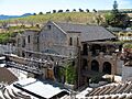
- Paul Masson Mountain Winery in Saratoga: This winery is famous for its history of winemaking in California.
- NASA Ames Wind Tunnel Historic District at Moffett Field: This area includes several important wind tunnels used by NASA for aerospace research.
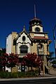
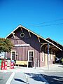
- Santa Clara Depot in Santa Clara: An old train station that was a key part of transportation in the past.
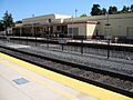
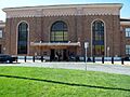
- Southern Pacific Depot (Diridon Station) in San Jose: Another important train station that connected San Jose to other parts of California.
Places That Are No Longer Listed
Sometimes, a historic place might be removed from the National Register. This can happen if the building is destroyed or changed so much that it loses its historic importance.
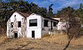
- Donner-Houghton House in San Jose: This house was sadly destroyed by a fire in 2007.
- Murphy Building in San Jose: This building was demolished in 1976.
- Santa Clara Verein in Santa Clara: This building was demolished in 1991.
- Troy Laundry in San Jose: This building no longer exists; apartments are there now.
It's a reminder that even historic places can be lost, which makes it even more important to appreciate and protect the ones that are still standing!
Images for kids
-
Agnews Developmental Center
-
Ainsley House
-
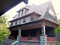
Theophilus Allen House
-
Alviso Historic District
-

Jose Maria Alviso Adobe
-
Ashworth-Remillard House
-
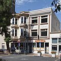
Building at 27-29 Fountain Alley
-
Campbell Union Grammar School
-
Campbell Union High School Historic District
-
Christian Church of Gilroy
-
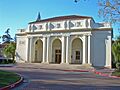
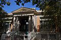
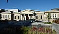
Civic Art Gallery
-
De Anza Hotel
-
Pedro de Lemos House
-
Dohrmann Building
-
T. B. Downing House
-
Dunker House
-
East San Jose Carnegie Branch Library
-
First Unitarian Church of San Jose
-
Forbes Mill
-
Fraternal Hall Building
-
Arthur Monroe Free House
-
Galindo-Leigh House
-
Gilroy Free Library
-
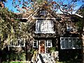
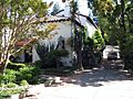
Green Gables
-
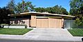
Greenmeadow
-
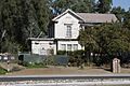
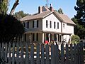
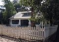
Willard Griffin House and Carriage House
-
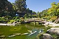
Hakone Gardens
-
Capt. James A. Hamilton House
-
Hanna-Honeycomb House
-
Hayes Mansion
-

Hensley Historic District
-
Hewlett-Packard House and Garage
-
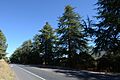
Highway 152 Tree Row
-
Edgar Holloway House
-
Lou Henry and Herbert Hoover House
-
Hostess House
-
Hotel Montgomery
-
Hotel Sainte Claire
-
Warner Hutton House
-
Kee House
-

Andrew J. Landrum House
-
Le Petit Trianon
-
Leib Carriage House
-

James Lick Mansion
-

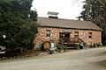
Live Oak Creamery
-
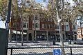
Los Gatos Historic Commercial District
-

MacFarland House
-
Malaguerra Winery
-
Paul Masson Mountain Winery
-
McCullagh-Jones House
-
Miller-Melone Ranch
-
Milpitas Grammar School
-
Moir Building
-
Charles Copeland Morse House
-
Mountain View Adobe
-
NASA Ames Wind Tunnel Historic District
-
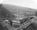
New Almaden
-
Norris House
-
Frank Norris Cabin
-
Old City Hall (Gilroy, California)
-
Palo Alto Medical Clinic
-
Palo Alto Station
-
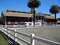
Palo Alto Stock Farm Horse Barn
-
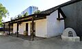
Peralta Adobe
-
Pettigrew House
-
Picchetti Brothers Winery
-
Professorville
-
Ramona Street Architectural District
-
Rengstorff House
-
Ernest & Emily Renzel House
-
Roberto-Sunol Adobe
-
Roma Bakery
-

Ross House
-
St. James Square Historic District
-
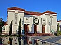
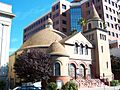
Cathedral Basilica of St. Joseph (San Jose)
-
Downtown Historic District (San Jose, California)
-
Santa Clara Depot
-
Santa Clara Verein
-
Saratoga Foothill Club
-
Saratoga Village Library
-
Paul Shoup House
-
Southern Pacific Depot
-

John Adam Squire House
-
Twohy Building
-
U.S. Post Office (Palo Alto, California)
-
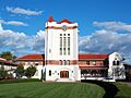
Unitary Plan Wind Tunnel
-
US Naval Air Station Sunnyvale, California, Historic District
-
Villa Mira Monte
-
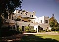
Villa Montalvo
-
We and Our Neighbors Clubhouse
-
Welch-Hurst
-

Wheeler Hospital
-
Wilson House
-
Winchester Mystery House
-
Woodhills
-
Earl and Virginia Young House
-
Yung See San Fong House
-
Donner-Houghton House


.jpg)


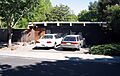
,_Prospect_Rd.,_Cupertino,_CA_9-16-2012_2-23-48_PM.JPG)


