
National Register of Historic Places listings in Santa Fe County, New Mexico facts for kids

This article is about the cool and important places in Santa Fe County, New Mexico, that are listed on the National Register of Historic Places. These are special spots that tell us a lot about history!
There are 93 places in Santa Fe County on this list. Eight of them are even more special and are called National Historic Landmarks. These landmarks are super important to the history of the whole country.
Contents
What is the National Register of Historic Places?
The National Register of Historic Places (often called the NRHP) is the official list of places in the United States that are worth saving. These places could be buildings, sites, structures, objects, or even whole areas. They are important because they have a special connection to American history, architecture, archaeology, engineering, or culture.
When a place is added to the NRHP, it means it's recognized as a valuable part of our past. This helps protect it and makes people more aware of its importance. It's like giving a medal to a building or a piece of land for being a historical superstar!
Historic Places in Santa Fe County
Santa Fe County is full of amazing historic places. Let's explore some of them!
Cool Historic Buildings
Many buildings in Santa Fe County have a long and interesting story.
- The El Rancho de las Golondrinas Acequia System is an old water system from 1980. It's part of a living history museum where you can see how people lived and farmed long ago.
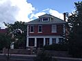
- The Ricardo Alarid House and Allison Dormitory are examples of historic homes and school buildings in Santa Fe. They show us how people lived and learned in the past.
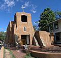
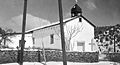
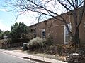
- Archbishop Lamy's Chapel is a beautiful old chapel. It was built near Santa Fe and is named after a very important religious leader.
- The Jane and Gustave Baumann House and Studio was home to famous artists. It shows how art and history are connected in Santa Fe.
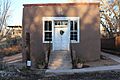
- The Alfred M. Bergere House and Gregorio Crespin House are other old homes in Santa Fe. They give us a peek into the city's past.
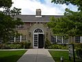
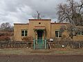
- The Hospital and Connor Hall are buildings at the New Mexico School for the Deaf. They are historic parts of this important school.
- The Palace of the Governors is a super famous building in Santa Fe. It's one of the oldest public buildings in the U.S. and has been a government center for hundreds of years! It's a National Historic Landmark.
- The New Mexico Supreme Court Building is where important legal decisions are made. It's a grand building that reflects the state's history.
- The Scottish Rite Cathedral is a unique building in Santa Fe. It has a very interesting design and history.
- The Second Ward School was an important school building in Santa Fe. It helped educate many children in the past.
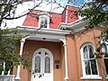
- The Spiegelberg House is another historic home in Santa Fe. It tells a story about the families who lived there.
- The Pinckney R. Tully House and Donaciano Vigil House are also historic homes. They belonged to important people in Santa Fe's history.
- The U.S. Courthouse is a significant government building in Santa Fe. It has been a center for justice for many years.
- The Carlos Vierra House belonged to an artist who helped shape the Santa Fe art style.
Amazing Ancient Sites
Santa Fe County is home to very old sites that teach us about early people.
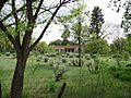
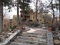
- Arroyo Hondo Pueblo is an ancient village site near Santa Fe. It tells us about the Native American communities that lived there long ago.
- Bandelier National Monument is a huge area with ancient cliff dwellings and pueblos. It's a National Historic Landmark and a great place to explore.
- The Jean Bouquet Historic/Archeological District and K'uuyemugeh are other important archaeological sites. They are protected to help us learn about the past.
- Navawi is an ancient site near White Rock. It's another place that holds secrets from long ago.
- The Pueblo of Nambe and Pueblo of Tesuque are living Native American communities with very long histories. They are still vibrant cultural centers today.
- San Ildefonso Pueblo is another historic pueblo. It's famous for its beautiful pottery and rich traditions.
- San Lazaro and San Marcos Pueblo are ancient archaeological sites. They are protected because they contain valuable information about early Native American life.
Important Roads and Bridges
Roads and bridges might seem ordinary, but some have played a huge role in history.
- The Apache Canyon Railroad Bridge is an old bridge that was part of the railroad system. It helped connect different parts of New Mexico.
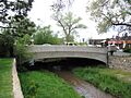
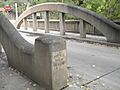
- The Delgado Street Bridge and Don Gaspar Bridge cross the Santa Fe River in Santa Fe. They are historic bridges that have been used for many years.
- The Camino Real was a very important old road. It connected Mexico City to Santa Fe and was used for trade and travel for centuries. Sections like the Canon de las Bocas Section and La Bajada Mesa Section are protected parts of this historic route.
- The Otowi Suspension Bridge crosses the Rio Grande. It was an important crossing point for people and goods.
- The Santa Fe Trail was another famous historic route. The Apache Canyon Bridge Site is a part of this trail. It was a major trade route in the 1800s.
- The Route 66 and National Old Trails Road Historic District at La Bajada is a section of the famous Route 66. This old road is a symbol of American travel and adventure.
Other Special Places
There are many other unique and historic places in Santa Fe County.
- The Barrio de Analco Historic District is one of the oldest neighborhoods in Santa Fe. It has many historic buildings and a rich cultural past. It's a National Historic Landmark.
- The Camino del Monte Sol Historic District is another historic neighborhood in Santa Fe. It's known for its unique architecture and artistic community.
- The Fairview Cemetery is a historic cemetery in Santa Fe. It's a peaceful place that tells stories of the people who lived in the area.
- The Institute of American Indian Arts is now the Museum of Contemporary Native Arts. It's a place where you can learn about and see amazing Native American art.
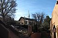
- The Fort Marcy Officer's Residence and Fort Marcy Ruins are remnants of an old fort in Santa Fe. They remind us of the military history of the area.
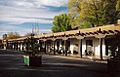
- The Madrid Historic District is a unique old mining town. It's a fun place to visit with its historic buildings and shops.
- The National Park Service Southwest Regional Office is a historic building in Santa Fe. It's where the National Park Service manages parks in the Southwest. It's a National Historic Landmark.
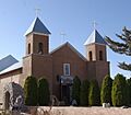
- The Nuestra Senora de Luz Church and Cemetery is a beautiful old church and cemetery. It's a place of worship and history.
- The Otowi Historic District is an area near the Rio Grande with historic buildings.
- The Plaza del Cerro in Chimayo is a historic plaza. It's a central gathering place with a long history.
- The Reredos of Our Lady of Light is a beautiful and historic altarpiece. It's now in the Christo Rey Church.
- Seton Village was the home and studio of Ernest Thompson Seton, a famous author and artist. It's a National Historic Landmark.
- The Santa Fe Historic District covers a large part of downtown Santa Fe. It includes many famous buildings and the historic Santa Fe Plaza, which is a National Historic Landmark.
- The Santa Fe National Cemetery is a place of honor for military veterans.
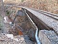
- The Santa Fe River Park Channel is a historic part of the Santa Fe River.
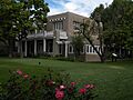
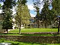
- St. John's College-Santa Fe is a historic college campus.
- The Wheelwright Museum of the American Indian is a unique museum. It's designed like a Navajo hogan and teaches about Native American cultures.
Images for kids
-
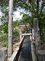
The Acequia System at El Rancho de las Golondrinas.
-
Allison Dormitory in Santa Fe.
-
The Apache Canyon Railroad Bridge.
-
Archbishop Lamy's Chapel.
-
A church in the Barrio de Analco Historic District.
-
The Jane and Gustave Baumann House.
-
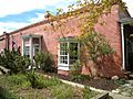
The Alfred M. Bergere House.
-
A house in the Camino del Monte Sol Historic District.
-
A section of the historic Camino Real.
-
Connor Hall at the New Mexico School for the Deaf.
-
The Gregorio Crespin House.
-
The Delgado Street Bridge over the Santa Fe River.
-
The Digneo-Valdes House.
-
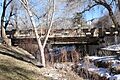
The Don Gaspar Bridge.
-
A building in the Don Gaspar Historic District.
-
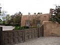
El Puente de Los Hidalgos.
-

El Santuario de Chimayo.
-
El Zaguan on Canyon Road.
-
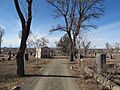
Fairview Cemetery.
-
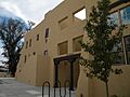
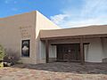
The Institute of American Indian Arts building.
-
Fort Marcy Officer's Residence.
-
The ruins of Fort Marcy.
-
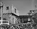
The Hayt-Wientge House.
-
The Daniel T. Kelly House.
-
La Iglesia de Santa Cruz.
-
The Laboratory of Anthropology.
-
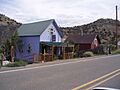
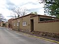
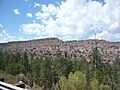
Shops in the Madrid Historic District.
-
The National Park Service Southwest Regional Office.
-
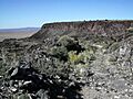
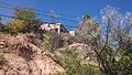
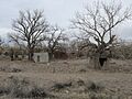
A view near Navawi.
-
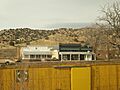
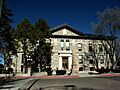
The New Mexico Supreme Court Building.
-
Nuestra Senora de Luz Church.
-
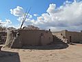
Buildings at Otowi Crossing in the Otowi Historic District.
-

The Otowi Suspension Bridge.
-
The Palace of the Governors.
-
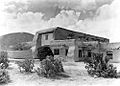
The Pflueger General Merchandise Store and Annex Saloon.
-
The Kiva at Nambe Pueblo.
-
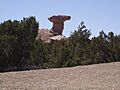
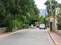
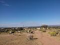
Camel Rock near Tesuque Pueblo.
-
The Reredos of Our Lady of Light.
-

St. John's College in Santa Fe.
-
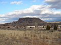
Black Mesa near San Ildefonso Pueblo.
-
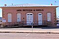
San Jose Hall.
-
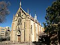
The Loretto Chapel in the Santa Fe Historic District.
-
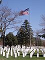
Santa Fe National Cemetery.
-
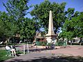
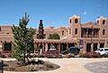
The Santa Fe Plaza.
-
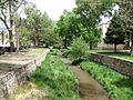
The Santa Fe River Park Channel.
-
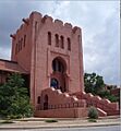
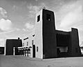
The Scottish Rite Cathedral.
-
The Second Ward School.
-
A house at Seton Village.
-

The Spiegelberg House.
-
The Pinckney R. Tully House.
-
The U.S. Courthouse.
-
The Carlos Vierra House.
-
The Donaciano Vigil House.
-
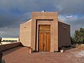
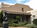
The Wheelwright Museum of the American Indian.


_Side.jpg)


