National Register of Historic Places listings in West Carroll Parish, Louisiana facts for kids
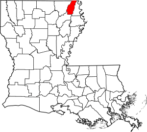
This is a list of the National Register of Historic Places listings in West Carroll Parish, Louisiana.
This is intended to be a complete list of the properties on the National Register of Historic Places in West Carroll Parish, Louisiana, United States. The locations of National Register properties for which the latitude and longitude coordinates are included below, may be seen in a map.
There are 4 properties listed on the National Register in the parish.
Current listings
| Name on the Register | Image | Date listed | Location | City or town | Description | |
|---|---|---|---|---|---|---|
| 1 | Fiske Theatre |
(#13001130) |
306 E. Main St. 32°51′40″N 91°23′15″W / 32.861216°N 91.387601°W |
Oak Grove | ||
| 2 | Marsden (16R13) |
(#04000803) |
Poverty Point Parkway 32°29′11″N 91°29′30″W / 32.486361°N 91.491666°W |
Delhi | A multimound archaeological site near Delhi, Louisiana, with a Poverty Point period component (1500 BCE) and a Coles Creek component (400 to 1200 CE). | |
| 3 | Oak Grove Community House |
(#15001006) |
414 James St. 32°51′54″N 91°23′05″W / 32.864920°N 91.384604°W |
Oak Grove | ||
| 4 | Poverty Point National Monument |
(#66000382) |
12 miles north of Delhi on Bayou Macon 32°38′12″N 91°24′41″W / 32.636667°N 91.411389°W |
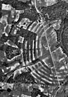
Delhi | The type site for the Poverty Point culture, a large complex of earthworks built between 1650 and 700 BCE, during the Archaic period.The site has six large concentric curving earthworks and several large mounds. |

All content from Kiddle encyclopedia articles (including the article images and facts) can be freely used under Attribution-ShareAlike license, unless stated otherwise. Cite this article:
National Register of Historic Places listings in West Carroll Parish, Louisiana Facts for Kids. Kiddle Encyclopedia.


