National Register of Historic Places listings in Whiteside County, Illinois facts for kids
Have you ever wondered about the old buildings, special places, or even ancient sites in your area? Many places have a rich history that tells us about the past. In Whiteside County, Illinois, there are several amazing spots that are so important, they've been added to a special list called the National Register of Historic Places. This list helps protect and celebrate places that are important to American history, architecture, archaeology, engineering, or culture.
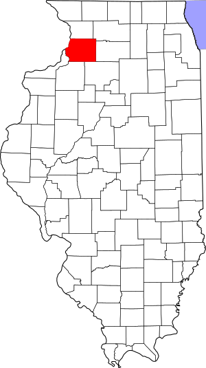
There are 14 different properties and areas in Whiteside County that are on this list. Each one has a unique story to tell!
Contents
- What is the National Register of Historic Places?
- Historic Places in Whiteside County
- Albany Mounds Site
- First Congregational Church of Sterling
- Fulton Commercial Historic District
- Col. Edward N. Kirk House
- Lock and Dam No. 13 Historic District
- Lyndon Bridge
- Main Street Historic District (Tampico)
- Malvern Roller Mill
- Martin House (Fulton, Illinois)
- McCune Mound and Village Site
- Morrison Main Street Historic District
- Odell Building
- Sinnissippi Site
- Sterling Masonic Temple
What is the National Register of Historic Places?
The National Register of Historic Places is the official list of the United States' historic places worth saving. It's like a hall of fame for buildings, structures, objects, sites, and districts that are important to our country's history. When a place is added to the Register, it means it's recognized for its special value. This helps people understand its importance and encourages efforts to preserve it for future generations.
Historic Places in Whiteside County
Let's explore some of the fascinating historic places you can find in Whiteside County!
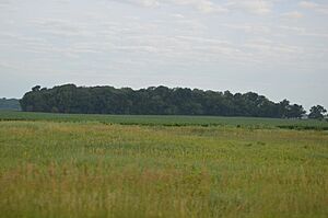
Albany Mounds Site
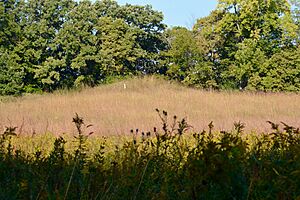
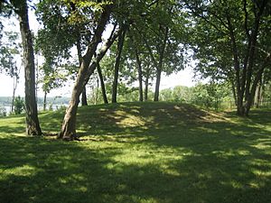
The Albany Mounds Site is a very old and important archaeological site near Albany. It was added to the National Register in 1974. This area contains ancient mounds built by Native American people long, long ago. These mounds are like giant puzzles that help archaeologists learn about the cultures and lives of the people who lived here thousands of years ago. It's a glimpse into the very first communities in this region.
First Congregational Church of Sterling
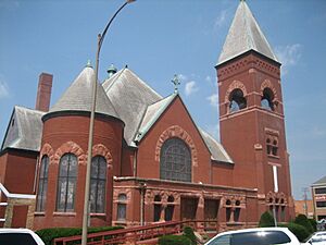
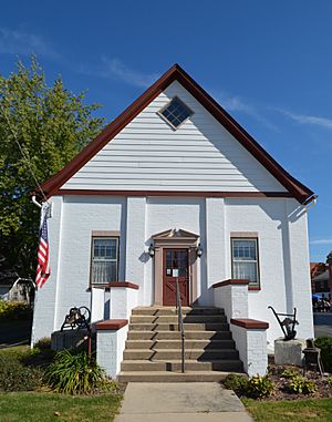
Located in Sterling, the First Congregational Church of Sterling is a beautiful old church building. It was listed on the National Register in 1995. Churches like this are often important not just for their religious history, but also for their amazing architecture and their role in the community over many years. It stands as a landmark in the city.
Fulton Commercial Historic District
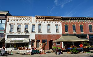
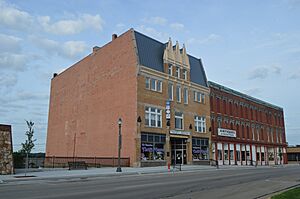
The Fulton Commercial Historic District in Fulton isn't just one building; it's a whole area! This district, added in 2012, includes many historic buildings along 4th Street. These buildings show what downtown Fulton looked like in the past, with shops and businesses that served the community for decades. Walking through it is like taking a step back in time.
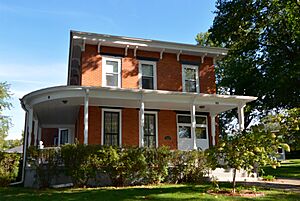
Col. Edward N. Kirk House
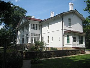
Also known as the Paul W. Dillon Home, the Col. Edward N. Kirk House is a historic house in Sterling. It was listed in 1980. Homes like this are often recognized for their unique architectural style or because important people lived there. This house tells a story about the people and families who shaped Sterling's history.
Lock and Dam No. 13 Historic District
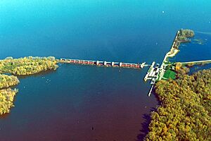
The Lock and Dam No. 13 is a very important structure on the Mississippi River. Located near Fulton, this historic district was added to the Register in 2004. Locks and dams are like giant elevators for boats, helping them move up and down rivers where the water level changes. This one played a big role in transportation and trade along the Mississippi.
Lyndon Bridge
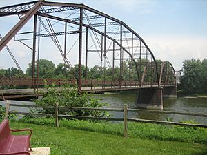
The Lyndon Bridge is an old bridge located at the south end of 6th Avenue West in Lyndon. It was recognized as a historic place in 2003. Bridges are often listed for their engineering design, how they were built, or their importance in connecting communities. This bridge has served the people of Lyndon for many years.
Main Street Historic District (Tampico)
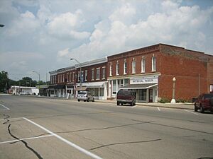
Just like Fulton, Tampico also has a Main Street Historic District, listed in 1982. This district includes a section of South Main Street. It's a collection of buildings that show the history of Tampico's downtown area. These places often have special architectural styles from different time periods.
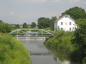
Malvern Roller Mill
The Malvern Roller Mill, also known as Appel Mill, is an old mill located near Morrison. It was added to the National Register in 1995. Mills like this were once vital for grinding grain into flour, which was a huge part of daily life and the economy in the past. It shows us how food was processed before modern factories existed.
Martin House (Fulton, Illinois)
The Martin House is another historic home, located in Fulton. It was listed in 2014. Historic houses often have unique stories about the families who lived there or the architectural styles popular when they were built. This house adds to the rich history of Fulton's residential areas.
McCune Mound and Village Site
Similar to the Albany Mounds, the McCune Mound and Village Site near Sterling is an important archaeological site. It was added to the Register in 1979. This site also contains ancient mounds and evidence of a village where Native Americans lived. Studying these sites helps us understand early human settlements and cultures in Illinois.
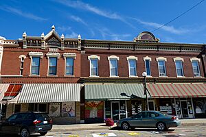
Morrison Main Street Historic District
Morrison also has its own Morrison Main Street Historic District, listed in 2014. This district covers a larger area, including parts of Lincolnway. It features many historic buildings that tell the story of Morrison's growth and development as a town. These buildings often have interesting details and designs from different eras.
Odell Building
The Odell Building is a specific historic building in Morrison, listed in 1996. It's located on East Lincolnway Road. Many historic buildings like the Odell Building were important commercial centers or community hubs in their time. They often feature unique architectural styles that were popular when they were constructed.
Sinnissippi Site
The Sinnissippi Site is another archaeological site, found within Sinnissippi Park in Sterling. It was added to the National Register in 1979. This site, like the other mound sites, provides valuable clues about the ancient peoples who lived in this area before European settlers arrived. It's a place where history is literally buried beneath our feet.
Sterling Masonic Temple
The Sterling Masonic Temple is a historic building in Sterling, listed in 1996. Located on West 3rd Street, this building served as a meeting place for the Masonic fraternity. Many Masonic Temples are known for their grand and unique architecture, often featuring symbolic designs. This one is a significant part of Sterling's architectural and social history.


