
Lock and Dam No. 13 facts for kids

Lock and Dam No. 13 on the Mississippi River. View is upriver to the north.
|
|
| Location | Clinton, Iowa / Fulton Township, Whiteside County, Illinois, USA |
|---|---|
| Coordinates | 41°53′53″N 90°09′21″W / 41.89806°N 90.15583°W |
| Construction began | 1935 |
| Opening date | May 13, 1938 |
| Operator(s) | |
Quick facts for kids Dam and spillways |
|
| Impounds | Upper Mississippi River |
| Length | 5,138 feet (1,566.1 m) |
| Reservoir | |
| Creates | Pool 13 |
| Total capacity | 192,000 acre⋅ft (0.237 km3) |
| Catchment area | 85,500 sq mi (221,000 km2) |
|
Lock and Dam No. 13 Historic District
|
|
| Lua error in Module:Location_map at line 420: attempt to index field 'wikibase' (a nil value). | |
| Location | 4999 Lock Rd., Fulton, Illinois |
| Area | 254.2 acres (102.9 ha) |
| Built | 1939 |
| Architect | U.S. Army Corps of Engineers |
| Architectural style | Moderne, Lock and Dam |
| MPS | Upper Mississippi River 9-Foot Navigation Project MPS |
| NRHP reference No. | 04000173 |
| Added to NRHP | March 10, 2004 |
Lock and Dam No. 13 is a special structure on the Upper Mississippi River. It helps boats and barges travel safely between Fulton, Illinois and Clinton, Iowa. This amazing place lets you watch huge barges and other boats move through the widest part of the Upper Mississippi River.
Contents
Lock and Dam 13: Controlling the Mighty Mississippi
Lock and Dam No. 13 is a combination of a lock and a dam. It was built to help control the water level of the Mississippi River. This makes it easier for boats to travel, especially large barges carrying goods. The facility is located where the river flows between Fulton, Illinois, and Clinton, Iowa.
What is a Lock and Dam?
Imagine a giant elevator for boats! That's basically what a lock is. It's a section of water with gates at both ends. When a boat wants to go upriver, the lower gate opens, the boat enters, and the gate closes. Then, water is pumped into the lock, raising the boat to the higher water level. To go downriver, the process is reversed.
A dam is a barrier built across a river to hold back water. This creates a deeper pool of water, which is important for navigation. Together, the lock and dam system ensures boats can move smoothly along the river, even when the natural water level changes.
How Lock and Dam 13 Works
The movable part of the dam at Lock and Dam No. 13 is about 1,066 feet (324.9 m) long. It has ten special gates called tainter gates and three roller gates. These gates can be opened or closed to let water through and control the river's flow.
The dam also has long sections that don't move. These include:
- A 200 feet (61.0 m) storage yard.
- A 728 feet (221.9 m) non-submersible dike (a wall that stays above water).
- A 1,650 feet (502.9 m) submersible dike (a wall that can go underwater).
- Another 1,315 feet (400.8 m) non-submersible dike.
On the Illinois side, there's an even longer non-submersible dike, stretching about 8,940 feet (2,724.9 m) east of the locks.
The main lock itself is quite large, measuring 110 feet (33.5 m) wide and 600 feet (182.9 m) long. This is big enough for many large barges. Like other similar projects, Lock and Dam No. 13 also has a smaller, unfinished auxiliary lock. This would be a backup lock if the main one needed repairs or if there was a lot of traffic.
A Historic Landmark
Lock and Dam No. 13 is not just important for river travel; it's also a piece of history! In 2004, the entire facility was added to the National Register of Historic Places. This means it's recognized as a significant historical site in the United States. It's officially known as the Lock and Dam No. 13 Historic District. This district covers a large area of about 2,542 acres (10.3 km2) and includes one building, six structures, and four other historical objects.
The Unique "Driftless Area"
This lock and dam is special because it marks the edge of something called the Driftless Area. This is a unique part of the Midwest that was missed by glaciers during the last Ice Age. Because of this, the landscape here is very different, with steep hills and deep river valleys, unlike the flatter areas around it.
In the Driftless Area, the river flows over bedrock, which means the bottom of the river is solid rock. The shipping channel here is kept at 9-foot (2.7 m) deep to allow boats to pass. The water level at Lock and Dam No. 13 is about 522 feet (159 m) above sea level.
Images for kids
-
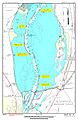
Map of Lock and Dam No. 13
-

Diagram of Lock and Dam No. 13


