Natoas Peak facts for kids
Quick facts for kids Natoas Peak |
|
|---|---|

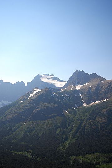
Natoas Peak is the rugged summit at right and snowy Mount Merritt is in the center
|
|
| Highest point | |
| Elevation | 9,480 ft (2,890 m) |
| Prominence | 596 ft (182 m) |
| Geography | |
| Parent range | Lewis Range |
| Topo map | USGS Ahern Pass, MT |
| Climbing | |
| First ascent | Bruce Murphy and Bill Mathews, August 1964 |
Natoas Peak is a cool mountain located in Glacier National Park in Montana, USA. It stands tall in the Lewis Range. This peak is about 9,480 feet (2,890 m) high! It's also quite close to another famous mountain called Mount Merritt.
Contents
Discover Natoas Peak
Natoas Peak is a prominent mountain in the Lewis Range. This mountain range is part of the larger Rocky Mountains system. It's known for its rugged beauty and amazing views.
Where is Natoas Peak Located?
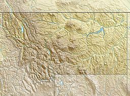
This mountain is found within the borders of Glacier National Park. The park is in the state of Montana, in the U.S.. Specifically, Natoas Peak is in Glacier County, Montana. It's located about 1.10 miles (1.77 km) northeast of Mount Merritt, another well-known peak in the area.
How Tall is Natoas Peak?
Natoas Peak reaches an elevation of 9,480 feet (2,890 m) above sea level. This makes it one of the taller peaks in its part of the Lewis Range. Mountains are measured from sea level to their highest point.
Who First Climbed Natoas Peak?
The first recorded climb to the top of Natoas Peak happened in August 1964. Two climbers, Bruce Murphy and Bill Mathews, were the first to reach its summit. Climbing mountains like Natoas Peak can be a challenging adventure.
 | John T. Biggers |
 | Thomas Blackshear |
 | Mark Bradford |
 | Beverly Buchanan |


