Neal, Kansas facts for kids
Quick facts for kids
Neal, Kansas
|
|
|---|---|

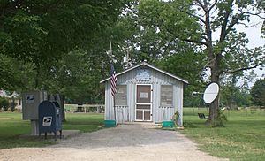
Post Office in Neal, 2012
|
|

|
|
| Country | United States |
| State | Kansas |
| County | Greenwood |
| Elevation | 958 ft (292 m) |
| Population
(2020)
|
|
| • Total | 37 |
| Time zone | UTC-6 (CST) |
| • Summer (DST) | UTC-5 (CDT) |
| ZIP code |
66863
|
| Area code | 620 |
| FIPS code | 20-49550 |
| GNIS ID | 2804491 |
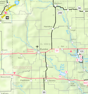
Neal is a small community in eastern Greenwood County, Kansas, United States. It's known as a census-designated place (CDP). This means it's an area the government counts for population, but it doesn't have its own official city government.
In 2020, the population of Neal was 37 people. You can find Neal about 10 miles east of the city of Eureka. It's located right along U.S. Route 54 highway.
History of Neal
The first post office in Neal opened its doors in 1882. Even though Neal isn't an official city, it still has its own post office. This post office uses the ZIP code 66863.
Neal got its name from a person who worked for the Missouri Pacific Railroad. This shows how important railroads were for naming places a long time ago!
Who Lives in Neal?
| Historical population | |||
|---|---|---|---|
| Census | Pop. | %± | |
| 2020 | 37 | — | |
| U.S. Decennial Census | |||
According to the 2020 United States census, 37 people lived in Neal. There were 20 households, which are like homes or families living together. Most of the people living in Neal were white.
About 40% of the homes had people living alone. Also, 30% of the homes had someone living alone who was 65 years old or older. The average age of people in Neal was about 57.8 years old.
Education in Neal
The public schools for the Neal community are part of the Eureka USD 389 school district. This district provides education for students in the area.
 | James B. Knighten |
 | Azellia White |
 | Willa Brown |


