Neils Island facts for kids

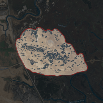
USGS aerial imagery of Neils Island
|
|
| Geography | |
|---|---|
| Location | Northern California |
| Coordinates | 38°11′27″N 122°34′41″W / 38.19083°N 122.57806°W |
| Adjacent bodies of water | Petaluma River |
| Highest elevation | 82 ft (25 m) |
| Administration | |
|
United States
|
|
| State | |
| County | Sonoma |

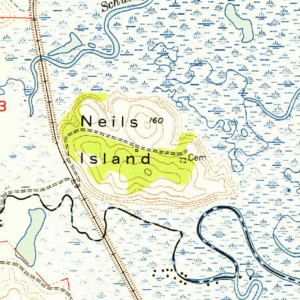
Neils Island is a place in Sonoma County, California. It is sometimes also called Neil Island. This area used to be an island. It was surrounded by wet, marshy lands near the Petaluma River.
The Petaluma River flows into San Pablo Bay. San Pablo Bay is a part of the much larger San Francisco Bay. Neils Island is located upstream from San Pablo Bay.
What is Neils Island?
Neils Island is no longer a true island. It was once surrounded by water and wetlands. Over time, changes in the land and water made it part of the mainland.
Where is Neils Island Located?
You can find Neils Island in Northern California. Its exact location is 38°11′27″N 122°34′41″W / 38.19083°N 122.57806°W. This is a special code for its spot on Earth.
In 1981, the United States Geological Survey (USGS) measured its height. They found that Neils Island is about 82 feet (25 meters) above sea level. The USGS is a science agency that studies the Earth. They create maps and gather information about land and water.


