Nemio River facts for kids
Quick facts for kids Nemio |
|
|---|---|

Map of Saint-Maurice River watershed
|
|
| Country | Canada |
| Province | Quebec |
| Region | Mauricie |
| Physical characteristics | |
| Main source | Dugré Lake La Tuque (Tassé Township), Mauricie, Quebec 443 m (1,453 ft) 48°09′41″N 74°47′43″W / 48.16139°N 74.79528°W |
| River mouth | Bureau Lake La Tuque, Mauricie, Quebec 402 m (1,319 ft) 48°30′43″N 75°00′02″W / 48.51194°N 75.00056°W |
| Length | 60.2 km (37.4 mi) |
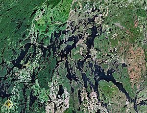
The Nemio River is a river in Quebec, Canada. It flows into the southern part of the Gouin Reservoir. The river is located in the town of La Tuque, in the Mauricie region.
The Nemio River flows through several areas called townships: Tassé, Huguenin, Sulte, Chapman, Myrand, and Lemay. The main activity in this river valley is forestry, which means cutting down trees for wood. Tourism and outdoor activities are also popular here.
A road called Route 404 helps people get to the upper parts of the Nemio River. This road connects the village of Clova, Quebec to the South Bay of Bureau Lake. Other smaller forest roads are used for logging and for people visiting the area for fun.
During winter, the Nemio River usually freezes. It's typically frozen from mid-November until the end of April. However, it's generally safe to walk or travel on the ice from early December to late March.
Contents
Where is the Nemio River located?
The Nemio River starts at a lake called Dugré Lake. This lake is shaped like a crescent and is about 9.1 kilometers long. It sits at an elevation of 443 meters above sea level.
Nemio River's starting point
The beginning of the Nemio River is located:
- About 55.9 kilometers southeast of Obedjiwan, Quebec village. Obedjiwan is on a peninsula on the north shore of the Gouin Reservoir.
- About 40.4 kilometers southeast of where the Nemio River ends, which is at Bureau Lake.
- About 56.2 kilometers southwest of the Gouin Dam. This dam is at the mouth of the Gouin Reservoir, where it meets the Saint-Maurice River.
- About 81.3 kilometers west of the village of Wemotaci, Quebec, which is along the Saint-Maurice River.
- About 170 kilometers northwest of downtown La Tuque.
Nemio River's journey
The Nemio River flows for about 60.2 kilometers. Its journey can be divided into two main parts:
Upper part of the Nemio River (about 43.2 kilometers)
- It flows north, then southeast, reaching the north shore of Lajoie Lake.
- It then goes east, going around a peninsula and crossing Lajoie Lake.
- The river continues northwest through a marshy area, crossing Francoeur Lake.
- It flows east, then turns north, crossing Huguenin Lake.
- It then heads north to the southern tip of Nemio Lake.
- Finally, it flows northwest across the entire length of Nemio Lake.
Lower part of the Nemio River (about 17 kilometers)
- It flows north, going around a mountain on its east side, and crosses the southern part of an unnamed lake.
- It then goes west to where another unnamed lake drains into it.
- The river flows north to meet a stream coming from the northeast.
- Lastly, it flows northwest, going around an island that splits the river's mouth.
In its lower section, the Nemio River flows through Nemio Bay.
Nemio River's ending point
The Nemio River ends by joining the North Bay of Bureau Lake. From this point, the water flows for about 100.8 kilometers until it reaches the Gouin Dam. Here's how the water travels:
- It flows north for 8.0 kilometers to the mouth of Bureau Lake.
- It then goes north for 24.0 kilometers, passing south of Obedjiwan, Quebec village, and then southeast, crossing Marmette Lake.
- The water flows south for 18.0 kilometers, crossing a large bay.
- It continues northeast for 14.3 kilometers, going around a large island and crossing Nevers Lake, then Brochu Lake.
- It flows southeast for 24.1 kilometers, crossing the southeast arm of Brochu Lake.
- Finally, it travels east for 12.4 kilometers across Kikendatch Bay to the Gouin Dam.
From the Gouin Dam, the water flows into the Saint-Maurice River all the way to Trois-Rivières.
What is the origin of the Nemio River's name?
The name "Nemio River" was officially recognized on December 5, 1968. This happened when the Commission de toponymie du Québec (Quebec's place name commission) was created.
 | DeHart Hubbard |
 | Wilma Rudolph |
 | Jesse Owens |
 | Jackie Joyner-Kersee |
 | Major Taylor |

