Nevada State Route 165 facts for kids
Quick facts for kids
State Route 165 |
||||
|---|---|---|---|---|
| Nelson Road | ||||

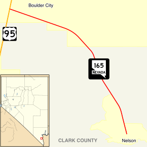
Nevada State Route 165, highlighted in red
|
||||
| Route information | ||||
| Maintained by NDOT | ||||
| Length | 11.002 mi (17.706 km) | |||
| Existed | 1976–present | |||
| Major junctions | ||||
| West end | ||||
| East end | Nelson | |||
| Location | ||||
| Counties: | Clark | |||
| Highway system | ||||
Nevada highways
|
||||
State Route 165 (SR 165) is a state highway in the U.S. state of Nevada. This road connects the small town of Nelson to U.S. Route 95. It's about 11 miles (18 km) long and offers a scenic drive through a historic mining area. The road was once part of a longer highway called State Route 60 until the 1970s.
Exploring State Route 165
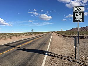
SR 165 begins where it meets U.S. Route 95. This spot is about 10 miles (16 km) south of Boulder City. From there, the highway, also known as Nelson Road, travels southeast. It goes through a wide, open area called Eldorado Valley. The road ends after about 11 miles (18 km), just outside the town of Nelson.
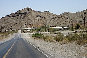
The town of Nelson has a rich history. It was founded in 1905 after people discovered valuable minerals there. Even though it's a small community today, you can still see old mining sites and abandoned buildings nearby. These structures remind visitors of the area's past.
The History of State Route 165
The path that is now SR 165 first appeared on Nevada's state highway maps in 1941. At that time, it was part of a larger road called State Route 60. This older route had three different sections, all leading to the town of Nelson.
One section, which is now SR 165, was about 16 miles (26 km) long. It connected Nelson to US 95, about 4 miles (6.4 km) south of Boulder City. Another section, about 10 miles (16 km) long, went southwest from Nelson to US 95 using Nelson Cutoff Road. The third part of SR 60 ran east from Nelson for about 7 miles (11 km) to the Colorado River. By 1951, both the northwest section (our current SR 165) and the eastern section were fully paved.
State Route 60 stayed mostly the same for many years. However, Nevada decided to reorganize its state highway system starting on July 1, 1976. During this process, the northwest part of the old SR 60 was given a new number: State Route 165. By then, its path had been slightly changed, making it about 12 miles (19 km) long. The other parts of the original SR 60 no longer have state highway numbers.
Where SR 165 Connects
This section lists the main intersections along State Route 165. The entire route is in Clark County.
| Location | Mile | Roads intersected | Notes | |
|---|---|---|---|---|
| Boulder City | 0.00 | 0.00 | This is the western start of SR 165. | |
| Nelson | 11.00 | 17.70 | Western Street | This is the eastern end of SR 165. The road continues as Nelson Road. |
| 1.000 mi = 1.609 km; 1.000 km = 0.621 mi | ||||
See also
 In Spanish: Ruta Estatal de Nevada 165 para niños
 | Kyle Baker |
 | Joseph Yoakum |
 | Laura Wheeler Waring |
 | Henry Ossawa Tanner |


