
New York State Route 431 facts for kids
Quick facts for kids
|
||||
|---|---|---|---|---|
| Whiteface Mountain Veterans Memorial Highway | ||||
|
NY 431 highlighted in red
|
||||
| Route information | ||||
| Maintained by NYSDEC | ||||
| Length | 7.96 mi (12.81 km) | |||
| Existed | by 1932–present | |||
| History | Completed in 1935 | |||
| Major junctions | ||||
| South end | ||||
| North end | Peak of Whiteface Mountain | |||
| Location | ||||
| Counties: | Essex | |||
| Highway system | ||||
| Numbered highways in New York Interstate • U.S. • N.Y. (former) • Reference • County
|
||||

New York State Route 431 (NY 431) is a special road in Essex County, New York. It's also known as the Whiteface Mountain Veterans Memorial Highway. This highway starts in Wilmington at NY 86. From there, it climbs all the way up Whiteface Mountain in the Adirondacks.
The New York State Department of Environmental Conservation takes care of this road. It is about 7.96 miles (12.81 km) long. A man named Marcellus Leonard first thought of building this road a long time ago. Serious plans for the highway began in the 1920s. Construction started in 1929 and finished in 1935. Sadly, Leonard passed away just before the road opened.
The speed limit on the highway is 25 miles per hour (40 km/h). The road goes from over 2,000 feet (610 m) high to over 4,500 feet (1,372 m) high. This means it climbs about 450 feet (137 m) for every mile you drive. The Whiteface Highway was added to the National Register of Historic Places in 2008. This means it's an important historical site.
Contents
Driving Up Whiteface Mountain

The Whiteface Highway, or NY 431, begins in Wilmington. It starts at an intersection with NY 86. The road then heads west, going higher and higher as it gets closer to Whiteface Mountain.
The highway goes through a pass between two smaller mountains, Morgan and Esther Mountains. After this, you'll reach an intersection with County Route 72 (CR 72). This is the last road that NY 431 crosses. Just past CR 72, you'll see a toll booth. Here, NY 431 becomes a road where you pay a fee to drive.
The NY 431 route continues to the Union Falls Overlook. This is a beautiful viewing spot about 2,700 feet (823 m) high. It's about one mile (1.6 km) into the scenic drive.
Views from the Highway
At the Union Falls Overlook, NY 431 turns south. It climbs up the western side of both Esther Mountain and Whiteface Mountain. When you reach about 3,300 feet (1,006 m) high, you can see "The Castle." This is a large building at the top of Whiteface Mountain. You can also see Union Falls Pond more clearly below.
The scenic drive keeps going up Whiteface Mountain to its very top. NY 431 gets there by making two sharp turns, called hairpin turns. These turns are just north of the mountain's peak. At the first hairpin turn, the highway reaches an overlook about 3,700 feet (1,128 m) high. From here, you can see parts of Lake Placid and the Olympic Village.
The road and the NY 431 designation end at a parking lot. This lot is about 300 feet (91 m) below the very top of Whiteface Mountain. "The Castle" building is located at this parking lot.
History of the Whiteface Highway

The idea for a road up Whiteface Mountain came from Marcellus Leonard. He was a businessman from Saranac Lake in the late 1800s and early 1900s. In the 1920s, plans for the highway really started to happen. The land for the road was given to the state of New York. The only condition was that the road would be named after America's veterans from World War I. Later, the road was renamed to honor veterans from all wars.
In 1929, Governor Franklin Delano Roosevelt signed the official paper to dedicate the highway.
Plans for a Memorial
After the road construction was announced, plans for a World War I monument at the top of Whiteface Mountain began in 1929. The American Legion supported this idea. They wanted a tower that was 130 feet (40 m) tall. It would have a light that could be seen from over 75 miles (121 km away).
Later, the tower's height was made smaller, to 80 feet (24 m). But some groups still didn't like the idea. The Association for Protection of the Adirondacks and the New York Fish Game and Forest League were against it. Lithgow Osborne, who worked for the New York State Conservation Department, said the tower would ruin the look of Whiteface Mountain.
Even with the arguments, the bill for the memorial passed in the New York State Legislature in April 1934. Governor Herbert Lehman received the bill. He promised to say no to it, and he did on May 16, 1934. Governor Lehman said that while he supported memorials for veterans, putting a tower on the mountain's top would "deface" it.
Building the Road
Plans for the Whiteface Mountain Highway were made in 1929. In 1931, a company offered to build the road for about $687,572. The final plans were for an 8-mile (13 km) long road. It would be 20 feet (6 m) wide and climb 3,500 feet (1,067 m) high. The road would have slopes of 8-10%.
Drivers would pay a toll to use the new highway. It would cost $1 for a car and its driver, and $1 for each extra passenger. Construction started in 1931. Crews worked until almost Christmas when too much snow stopped them. Work on the road began again on March 15, 1932. The new stone walls along the highway cost about $100,000 to build. The highway officially opened to cars on July 20, 1935.
Opening and Legacy
On September 14, 1935, President Franklin D. Roosevelt officially opened the highway. He cut a ribbon at a special ceremony. The entire road cost about $1.2 million to build. President Roosevelt also asked for an elevator to be built. This elevator would help visitors get from the parking lot to the very top of Whiteface Mountain.
Sadly, Marcellus Leonard, who first dreamed of the highway, did not live to see it open. He passed away at 90 years old on February 23, 1935. This was just a few months before the road was finished. The completed highway was given the name NY 431. This name had been saved for the road since 1932.
The road was added to the National Register of Historic Places in October 2008. It was listed as the "Whiteface Veterans Memorial Highway Complex." The National Park Service announced this listing nine months later.
Major Intersections
The entire route is in Wilmington, Essex County.
| Mile | Roads intersected | Notes |
|---|---|---|
| 0.00 | Southern end of the highway | |
| 2.55 | ||
| 7.96 | Summit of Whiteface Mountain | Northern end of the highway |
Images for kids
-
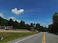
NY 431 heading south near Santa's Workshop.

