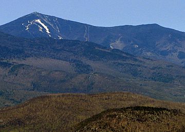
Esther Mountain facts for kids
Quick facts for kids Esther Mountain |
|
|---|---|

|
|
| Highest point | |
| Elevation | 4,239 ft (1,292 m) |
| Prominence | 302 ft (92 m) |
| Listing | Adirondack High Peaks 28th |
| Geography | |
| Location | Wilmington, Essex County, New York, U.S. |
| Parent range | Adirondack Mountains |
| Topo map | USGS Wilmington |
| Climbing | |
| First ascent | 1839 by Esther McComb |
Esther Mountain is a special mountain located in Essex County, New York. It's part of the famous Adirondack Mountains. This mountain is the northernmost of the High Peaks, which are a group of very tall mountains in the Adirondacks. Esther Mountain is the 28th highest peak among them. For a long time, it was the only High Peak named after a woman. It was named in honor of Esther McComb, who was the first person to officially climb to its top in 1839. She was only 15 years old at the time! She was actually trying to climb the taller Whiteface Mountain from the north, but ended up making history on Esther.
Contents
Why is Esther Mountain Special?
Esther Mountain is one of the 46 "High Peaks" in the Adirondack Mountains. To be a High Peak, a mountain must be over 4,000 feet (about 1,219 meters) tall. Many hikers try to climb all 46 of these peaks. Esther Mountain is 4,239 feet (about 1,292 meters) high.
The Story of Esther McComb
The mountain got its name from a brave young girl named Esther McComb. In 1839, when she was just 15 years old, she set out to climb Whiteface Mountain. Whiteface is a much taller mountain right next to Esther. During her climb, she accidentally reached the summit of the mountain that now bears her name. Her climb was the first recorded time anyone reached the top of this peak. It's a cool story about how a mountain got its name from a teenage adventurer!
Where Does the Water Go?
Esther Mountain is an important part of a watershed. A watershed is an area of land where all the water drains into a common point, like a river or a lake. Water from Esther Mountain flows into Lake Champlain.
Rivers Flowing from Esther Mountain
- Water from the southeast side of Esther Mountain flows into White Brook.
- From White Brook, the water goes into the West Branch of the Ausable River.
- The Ausable River then flows into Lake Champlain.
- Water from the southwest and north sides of Esther Mountain flows into Frenchs Brook.
- From Frenchs Brook, the water joins the Saranac River.
- The Saranac River also flows into Lake Champlain.
Journey to the Ocean
From Lake Champlain, the water travels north into Canada's Richelieu River. The Richelieu River then empties into the mighty Saint Lawrence River. Finally, the Saint Lawrence River flows into the Gulf of Saint Lawrence, which is part of the Atlantic Ocean. So, a raindrop falling on Esther Mountain could end up in the Atlantic Ocean!
Whiteface Mountain Memorial Highway
The Whiteface Mountain Memorial Highway is a road that was opened in 1935. This highway travels along the north and west sides of Esther Mountain. It's a scenic route that leads all the way to the top of Whiteface Mountain. This road makes it easier for people to visit and enjoy the beautiful mountain views in the area.
 | Lonnie Johnson |
 | Granville Woods |
 | Lewis Howard Latimer |
 | James West |


