
Newaukum River facts for kids
Quick facts for kids Newaukum River |
|
|---|---|
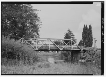
South Fork crossing SR 508
|
|

Location of the mouth of the Newaukum River in Washington
|
|
| Country | United States |
| State | Washington |
| County | Lewis |
| Physical characteristics | |
| Main source | Confluence of North and South Forks 46°36′18″N 122°51′19″W / 46.60500°N 122.85528°W |
| River mouth | Chehalis River 161 ft (49 m) 46°39′4″N 122°58′54″W / 46.65111°N 122.98167°W |
| Length | 10.9 mi (17.5 km) |
| Basin features | |
| Basin size | 173 sq mi (450 km2) |
The Newaukum River is a river in the United States state of Washington. It flows into the Chehalis River.
This river has three main parts, called "forks." They are the North Fork, South Fork, and Middle Fork Newaukum Rivers. If you add up the length of all three forks and the main river, it's about 56.7 miles (91.2 km) long.
The name Newaukum comes from an old local language, Upper Chehalis. It means "big prairie," which is a large, open grassy area.
Contents
Main River Flow
The main part of the Newaukum River starts where its North and South Forks meet. This meeting point is in an area called Newaukum Prairie.
From there, the river flows mostly west and then north. After flowing for about 10.9 miles (17.5 km), it reaches the city of Chehalis. Here, the Newaukum River joins the Chehalis River.
South Fork Newaukum River
The South Fork Newaukum River begins in the Cascade Range mountains. It starts at a place called Newaukum Lake.
This fork generally flows west. As it leaves the mountains, it enters wide valleys and open prairie lands. It flows past the community of Onalaska. In Newaukum Prairie, the river turns north. It then meets the North Fork to form the main Newaukum River.
North Fork Newaukum River
The North Fork Newaukum River also starts in the Cascade Range mountains. It flows mostly west for about 19 miles (31 km).
It then enters a wide valley near where it meets Mitchell Creek. After that, it flows south and southwest. In Newaukum Prairie, the Middle Fork Newaukum River joins it. Soon after, the North Fork meets the South Fork to create the main Newaukum River.
The cities of Chehalis and Centralia use some of the North Fork's water. They take water from the river about 12.5 miles (20.1 km) from its mouth for their communities.
Middle Fork Newaukum River
The Middle Fork Newaukum River is the shortest of the three forks. It flows southwest into an area called Alpha Prairie.
Then, it turns west and flows through hillier land. Finally, it enters the Newaukum Prairie and flows into the North Fork Newaukum River.
River Life: Fish and Nature
The main Newaukum River and some of its smaller branches are home to different types of fish. These include Chinook salmon and Coho salmon.
You can find both spring and fall Chinook salmon here. These fish are an important part of the river's natural environment.
