Chehalis River (Washington) facts for kids
Quick facts for kids Chehalis River |
|
|---|---|

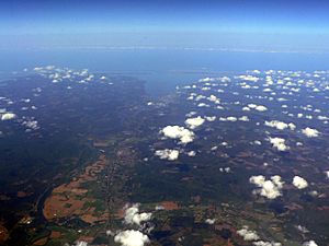
Chehalis River Valley (left), Grays Harbor (middle distance) and Satsop River Valley (along bottom)
|
|

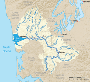
Map of the Chehalis River watershed
|
|
|
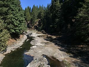
Mouth of the Chehalis River in Washington
|
|
| Country | United States |
| State | Washington |
| Counties | Grays Harbor, Thurston, Lewis |
| Cities | Aberdeen, Centralia, Chehalis |
| Physical characteristics | |
| Main source | Lewis County 1,000 ft (300 m) 46°27′6″N 123°17′30″W / 46.45167°N 123.29167°W |
| River mouth | Pacific Ocean Grays Harbor, Aberdeen 0 ft (0 m) 46°57′29″N 123°50′5″W / 46.95806°N 123.83472°W |
| Length | 115 mi (185 km) |
| Discharge (location 2) |
|
| Basin features | |
| Basin size | 2,660 sq mi (6,900 km2) |
| Tributaries |
|
The Chehalis River (pronounced shə-HAY-lis) is an important river in Washington State, USA. It starts in the southwestern part of Washington. The river flows in a big curve, first heading east, then north, and finally west. It eventually empties into Grays Harbor, which is a large bay connected to the Pacific Ocean.
Long, long ago, during the Ice Age, the Chehalis River was much larger. A huge sheet of glacial ice covered the area. When this ice melted, it created a massive torrent of water. This powerful water carved out the wide valley we see today. After the Ice Age ended, sea levels rose. This caused the broad Chehalis Valley to flood, forming Grays Harbor.
Contents
River's Journey: Where the Chehalis Flows
The Chehalis River begins in southwestern Lewis County. It forms where the West Fork Chehalis River and East Fork Chehalis River meet. From there, the Chehalis flows north and east. It collects water from smaller streams that drain the Willapa Hills.
Key Tributaries and Cities Along the Way
The South Fork Chehalis River joins the main river near the city of Chehalis. The Newaukum River also joins at Chehalis. After this, the river turns north. It flows past the city of Centralia, where the Skookumchuck River adds its waters.
As the Chehalis River continues, it flows north and west. It collects more water from other rivers. These include the Black River, which comes from the Black Hills. In the area called the Chehalis Gap, the Satsop River and Wynoochee River join. These rivers drain the southern part of the Olympic Mountains.
Reaching the Pacific: Grays Harbor
The Wynoochee River joins the Chehalis near Montesano. After this point, the Chehalis River starts to widen. It becomes more affected by the ocean's tides. This wider part is called the Grays Harbor estuary. The city of Aberdeen is located at the mouth of the Chehalis River. Just east of Aberdeen, the Wishkah River joins. A bit further west, between Aberdeen and Hoquiam, the Hoquiam River also joins. At this point, the river has fully become Grays Harbor. Before Grays Harbor empties into the Pacific Ocean, the Humptulips River joins as well.
Chehalis River Floods: A Look at History
The Chehalis River can sometimes flood, especially after heavy rains. These floods can cause big problems for local communities and transportation.
The Great Flood of 2007
On December 3, 2007, a very strong storm hit the coast. This storm caused the Chehalis River to flood severely. About 20 miles of Interstate 5 had to be closed. This important highway was under about 10 feet of water in some places. The closure meant that people had to take a very long detour. It added about four hours and 280 miles to their journey. Amtrak train service was also stopped. The governor of Washington, Christine Gregoire, declared a state of emergency. This helped get aid to the affected areas.
Another Flood in 2009
On January 7, 2009, another big storm hit the Pacific Northwest. Again, the Chehalis River flooded. This caused the same 20-mile stretch of Interstate 5 to close. The highway was under several feet of water. This flood was particularly difficult because other main mountain passes were also closed. This meant there was no easy way for traffic to get to the Puget Sound area. The Chehalis River flooding essentially cut off traffic to that region.
 | Emma Amos |
 | Edward Mitchell Bannister |
 | Larry D. Alexander |
 | Ernie Barnes |


