Newton Grove, North Carolina facts for kids
Quick facts for kids
Newton Grove, North Carolina
|
|
|---|---|
| Nickname(s):
Circle City
|
|
| Motto(s):
"Circle of Opportunity"
|
|
| Country | United States |
| State | North Carolina |
| County | Sampson |
| Area | |
| • Total | 3.10 sq mi (8.02 km2) |
| • Land | 3.08 sq mi (7.98 km2) |
| • Water | 0.01 sq mi (0.04 km2) |
| Elevation | 187 ft (57 m) |
| Population
(2020)
|
|
| • Total | 585 |
| • Density | 189.81/sq mi (73.29/km2) |
| Time zone | UTC-5 (Eastern (EST)) |
| • Summer (DST) | UTC-4 (EDT) |
| ZIP code |
28366
|
| Area codes | 910, 472 |
| FIPS code | 37-47020 |
| GNIS feature ID | 2406990 |
| Website | http://www.newtongrove.net/ |
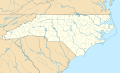
Newton Grove is a small town in Sampson County, North Carolina, United States. It became an official town in 1879. In 2020, about 585 people lived there. Newton Grove is located about 18 miles north of Clinton.
Contents
History of Newton Grove
The town of Newton Grove has an interesting past. It was first made an official town in 1879. Back then, it was called "New Town at the Grove" because of a large, important oak grove nearby. Later, in 1935, its name was shortened to Newton Grove.
The town is run by a mayor and five commissioners. These people help make decisions for the community.
Early records show that the Newton Grove post office was once known as Blackman's Store. Another post office, called Blackman's Mills, was located six miles west of Newton Grove. It operated from 1858 to 1914. The Blackman family were wealthy farmers who settled in the area in the early 1700s. They were related to Jeremiah Blackman, a sailor from London. He captained ships that brought English settlers to the Colony of Virginia in the 1600s.
During the Civil War, a major battle called the Battle of Bentonville was fought near Newton Grove.
Two historic places in Newton Grove are listed on the National Register of Historic Places. These are Thirteen Oaks and the Isaac Williams House.
Geography and Layout
According to the United States Census Bureau, the town covers a total area of about 3.1 square miles (8.0 square kilometers). Most of this area, about 3.1 square miles (7.98 square kilometers), is land. A very small part, about 0.04 square miles (0.10 square kilometers), is water.
Newton Grove has a unique feature in its center: a six-way roundabout. This is a circular intersection where traffic flows in one direction around a central island. Around this roundabout, there is a hexagonal (six-sided) loop road called Circle Street. It's interesting because its name is "Circle Street," but its shape is actually a hexagon!
Population and Demographics
| Historical population | |||
|---|---|---|---|
| Census | Pop. | %± | |
| 1880 | 61 | — | |
| 1890 | 63 | 3.3% | |
| 1900 | 75 | 19.0% | |
| 1910 | 73 | −2.7% | |
| 1920 | 125 | 71.2% | |
| 1930 | 150 | 20.0% | |
| 1940 | 339 | 126.0% | |
| 1950 | 374 | 10.3% | |
| 1960 | 477 | 27.5% | |
| 1970 | 546 | 14.5% | |
| 1980 | 564 | 3.3% | |
| 1990 | 511 | −9.4% | |
| 2000 | 606 | 18.6% | |
| 2010 | 569 | −6.1% | |
| 2020 | 585 | 2.8% | |
| U.S. Decennial Census | |||
2020 Census Information
The 2020 United States census counted 585 people living in Newton Grove. There were 249 households, which means 249 different homes or living units. Out of these, 154 were families.
Here's a look at the different groups of people living in Newton Grove in 2020:
| Race | Number | Percentage |
|---|---|---|
| White (non-Hispanic) | 400 | 68.38% |
| Black or African American (non-Hispanic) | 80 | 13.68% |
| Native American | 4 | 0.68% |
| Asian | 4 | 0.68% |
| Other/Mixed | 19 | 3.25% |
| Hispanic or Latino | 78 | 13.33% |
Education in Newton Grove
Newton Grove is home to Hobbton High School. This is a smaller 1A division school that first opened in 1957. Students from Newton Grove and the surrounding areas attend this school.
See also
 In Spanish: Newton Grove para niños
 | Isaac Myers |
 | D. Hamilton Jackson |
 | A. Philip Randolph |


