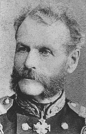
Nikolay Rudanovsky facts for kids
Nikolay Vasilyevich Rudanovsky (Russian: Николай Васильевич Рудановский) was an important Russian naval officer and explorer. He is best known for leading several expeditions between 1853 and 1854. During these trips, he explored and mapped the southern part of Sakhalin island. He was also the first person to map the areas inside the island, away from the coast.
Contents
Nikolay Rudanovsky was born in 1819 in a town called Vyatka in Russia. His father was an army officer who fought in the War of 1812. After the war, his father left the army and started working for the government.
In 1841, Nikolay finished his naval training in Kronstadt. He then served in the Baltic Fleet for ten years. In 1851, he moved to the Kamchatka Flotilla, a group of naval ships based in Petropavlovsk-Kamchatsky. By 1853, he had been promoted to the rank of lieutenant.
Exploring Sakhalin Island
In 1853, Russia began to settle Sakhalin Island. Rudanovsky volunteered to be part of this effort. He put together and trained a group of 70 soldiers. This group, along with Rudanovsky, was sent to the island. He worked for the Russian-American Company, which was a trading company.
The leader of the Amur Expedition, Gennady Nevelskoy, placed Rudanovsky and his team under the command of Nikolay Busse. Busse later became the military governor of the Amur region. Rudanovsky's expedition left Petropavlovsk in August 1853. In September, they reached Sakhalin and set up Muravyovsky Post. This was the first Russian settlement on the island. Today, it is known as the town of Korsakov.
Mapping the Island's Interior
While at Muravyovsky Post, Rudanovsky was given the job of exploring and mapping Sakhalin. In late 1853 and early 1854, he mapped the eastern coast of Aniva Bay. He also crossed the island to the east, reaching the Sea of Okhotsk. His work was very important because he was the first to map the inland parts of Sakhalin.
Impact of the Crimean War
In 1854, the Crimean War began. Russia was worried that Great Britain might attack its settlements on the Pacific coast. Because of this, the Amur Expedition was stopped. On June 30, 1854, Muravyovsky Post was abandoned. Rudanovsky was then moved to Nikolayevsk-on-Amur, where he mainly mapped the shores of the Amur River.
After the War
After the Crimean War ended, a new military post was set up in Due in July 1856. This became the first Russian settlement on Sakhalin again. In August 1856, Rudanovsky was made the military commander of this post. He had about 20 people working under him.
In July 1857, he was told to establish another new settlement called Ilyinsky Post. This post was abandoned later that same year but was re-established in the same spot in 1858.
Surveying for a Border
At that time, Sakhalin Island was managed by both Russia and Japan. However, the Russian government expected that the island would eventually be divided between the two countries. So, in July 1858, Rudanovsky was ordered to survey the island. His task was to find a good location for a future border. He explored and later mapped the western coast of Sakhalin. This area was between the 47th and 50th parallels.
Later Life
In 1858, Rudanovsky was transferred back to the Baltic Fleet. On November 7, 1881, he was promoted to the rank of counter admiral. At the same time, he retired from military service. Nikolay Rudanovsky passed away on January 3, 1882.
 | Precious Adams |
 | Lauren Anderson |
 | Janet Collins |


