Ninety Mile Beach, New Zealand facts for kids
Quick facts for kids Te-Oneroa-a-Tōhē / Ninety Mile Beach |
|
|---|---|

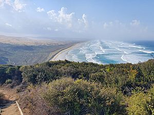
Te-Oneroa-a-Tōhē / Ninety Mile Beach, as viewed from Tiriparepa / Scott Point
|
|
| Location | Northland Region |
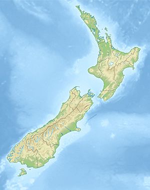
| Coordinates | 34°43′S 172°56′E / 34.717°S 172.933°E |
| Offshore water bodies | Tasman Sea |
| Highest point | Te Paki dunes |
| Length | 88 kilometres (55 mi) |
| Geology | Beach |
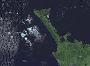
Te-Oneroa-a-Tōhē / Ninety Mile Beach is a very long beach on the western coast of New Zealand's North Island. It's located in the far north of the country. Even though it's called "Ninety Mile Beach," it's actually about 88 kilometers (55 miles) long. This famous beach stretches along the Aupōuri Peninsula.
The beach starts near Ahipara Bay, close to a town called Kaitaia. From there, it goes mostly northwest along the Aupōuri Peninsula. It finally ends at Tiriparepa / Scott Point, which is not far from Cape Reinga / Te Rerenga Wairua. Cape Reinga is the very top of the North Island.
This beach is special because it's officially a public highway. People can drive on it, but it's mostly used for fun tourist trips. It's also a helpful alternative if the main road, State Highway 1, is closed. This can happen because of landslides or floods.
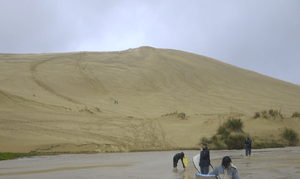
The beach and the large sand dunes at Te Paki are a popular place for visitors. These dunes look a lot like a desert. Many people enjoy sandboarding down them, which is like snowboarding but on sand!


History of the Beach
In the past, when sailing ships were common, several boats were unfortunately wrecked on this beach. The strong winds and waves made it a dangerous place for ships.
In 1932, the beach became a special runway. It was used for some of the first airmail flights between Australia and New Zealand. This was an important step in connecting the two countries by air.
The beach was also included as part of Te Araroa when it officially opened in 2011. Te Araroa is a very long walking trail that goes all the way through New Zealand.
In 2013, the beach was featured on the British TV show Top Gear. The host, Jeremy Clarkson, drove a car along the beach. He was racing against a special sailing boat with famous British sailor Sir Ben Ainslie on board.
Understanding the Name
Te-Oneroa-a-Tōhē / Ninety Mile Beach has a dual name. This means it has both its traditional English name and its Māori name. Many places in New Zealand now have these dual names.
The dual name was made official in 2014. This happened as part of an agreement between the New Zealand government and Ngāti Kurī. Ngāti Kurī is a Māori tribe who live in the area around the beach.
The Māori name, Te-Oneroa-a-Tōhē, means "the long beach of Tōhē." Tōhē was an important ancestor of the Ngāti Kurī tribe.
The English name, "Ninety Mile Beach," often causes confusion. This is because the beach is only about 55 miles (88 kilometers) long, not 90 miles! There's a common story about how it got this name. Early European travelers supposedly took three days to ride their horses along the beach. They thought their horses could cover 30 miles each day. So, they believed the beach must be 90 miles long. However, they didn't realize their horses moved slower on the sand.
See also
 In Spanish: Playa de las noventa millas para niños
 | Precious Adams |
 | Lauren Anderson |
 | Janet Collins |


