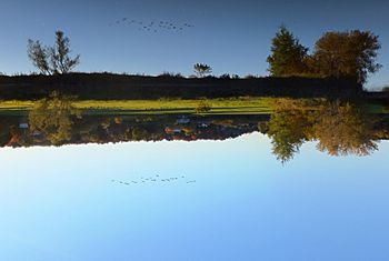
Noire River (Yamaska River tributary) facts for kids
Quick facts for kids Rivière Pot au Beurre |
|
|---|---|

Noire River at Roxton Falls
|
|
| Country | Canada |
| Province | Quebec |
| Region | Estrie and Montérégie |
| MRC | Memphrémagog Regional County Municipality, Le Val-Saint-François Regional County Municipality, Acton Regional County Municipality, Les Maskoutains Regional County Municipality, La Haute-Yamaska Regional County Municipality |
| Municipality | Saint-Pie, Stukely-Sud |
| Physical characteristics | |
| Main source | Mountain streams Stukely-Sud 262 m (860 ft) 45°21′19″N 72°27′38″W / 45.35528°N 72.46056°W |
| River mouth | Yamaska River Saint-Pie 26 m (85 ft) 45°32′46″N 72°57′45″W / 45.54611°N 72.96250°W |
| Length | 1,046 km (650 mi) |
| Basin features | |
| Tributaries |
|
The Noire River (which means Black River in English) is a very important river in Quebec, Canada. It is the biggest river that flows into the Yamaska River. The Noire River flows through many towns and regions on the South Shore of the Saint Lawrence River.
Contents
Where the Noire River Flows
The Noire River starts in Stukely-Sud, a town in the Estrie region. From there, it travels about 104.6 kilometers (65 miles) before joining the Yamaska River.
Towns Along the River
The Noire River passes through several towns and areas. These include:
- In the Estrie region:
- Stukely-Sud
- Sainte-Anne-de-la-Rochelle
- Lawrenceville
- Valcourt
- Maricourt
- In the Montérégie region:
- Sainte-Christine
- Roxton
- Roxton Falls
- Acton Vale
- Saint-Théodore-d'Acton
- Upton
- Saint-Valérien-de-Milton
- Saint-Pie
- Sainte-Cécile-de-Milton
Neighboring Rivers
Rivers often have "neighbors" that share the same water system. The main rivers near the Noire River are:
- To the north: David River, Saint-Germain River, Chibouet River
- To the east: Rivière le Renne, Saint-François River, Jaune River (Noire River tributary), Rouge River (Noire River tributary)
- To the south: North Yamaska River
- To the west: Yamaska River
The River's Journey
The Noire River begins its journey from a small lake in Stukely-Sud. It then flows through different landscapes, including marshy areas.
Upper Part of the River
The first part of the river's journey covers about 22.5 kilometers (14 miles).
- It flows northeast, passing through two marshy areas.
- It then reaches the Rouge River.
- This section ends near Valcourt.
Middle Part of the River
After passing Valcourt, the river continues for about 24.6 kilometers (15.3 miles).
- It flows north, then southwest.
- Along this path, it meets streams like the Bombardier stream and Beauregard brook.
- This section leads to the famous Roxton Falls in the village of Roxton Falls.
Lower Part of the River
From Roxton Falls, the river flows for another 27.1 kilometers (16.8 miles).
- It flows northwest, passing by places like Île aux Pins Rapide.
- It goes southwest, passing "Place-Lavallée" and meeting the Runnels stream.
- The river then flows northwest, passing south of Acton Vale, and meets the rivière le Renne.
- This part of the journey ends near the Père-Tarte dam.
Final Stretch of the River
The last part of the Noire River's journey is about 30.4 kilometers (18.9 miles) long.
- From the Père-Tarte dam, it flows southwest through towns like Saint-Valérien-de-Milton.
- It passes north of Mont Yamaska and goes through the hamlet of Émileville.
- Finally, the Noire River flows into the Yamaska River at a spot called "Pointe aux Fourches" in Saint-Pie. This meeting point is about 6.7 kilometers (4.2 miles) upstream from the Douville Bridge.
River's Name
The original name for this river by the Aboriginal people was "Mkazawitekw River." The name "Rivière Noire" was officially recorded on December 5, 1968, by the Commission de toponymie du Québec, which is like a government office that names places in Quebec.
Related Articles
- Yamaska River, a watercourse
- Rivière le Renne, a stream
- Jaune River (Noire River tributary), a stream
- Rouge River (Noire River tributary), a stream
- Saint-Pie, a municipality
- List of rivers of Quebec
 | John T. Biggers |
 | Thomas Blackshear |
 | Mark Bradford |
 | Beverly Buchanan |

