Nome River facts for kids
Quick facts for kids Nome River |
|
|---|---|

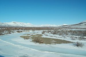
Nome River Valley
|
|
|
Location of the mouth of the Nome River in Alaska
|
|
| Country | United States |
| State | Alaska |
| District | Nome Census Area |
| Physical characteristics | |
| Main source | Seward Peninsula 4.5 miles (7.2 km) west of Salmon Lake 781 ft (238 m) 64°53′06″N 165°14′05″W / 64.88500°N 165.23472°W |
| River mouth | Norton Sound, Bering Sea 4 miles (6.4 km) southeast of Nome 7 ft (2.1 m) 64°28′58″N 165°18′18″W / 64.48278°N 165.30500°W |
| Length | 40 mi (64 km) |
The Nome River is a waterway located on the Seward Peninsula in Alaska, a state in the United States. This river starts in a narrow valley on the southern edge of the Kigluaik Mountains. Its source is about 4.5 miles (7.2 km) (7.2 km) west of Salmon Lake.
Contents
Geography of the Nome River
The Nome River begins where two smaller streams, Buffalo and Deep Canyon creeks, meet. This spot is about 26 miles (42 km) north of the city of Nome. The river flows through a wide valley filled with deep gravel. The river channel itself has cut into this gravel, creating banks that are between 5 to 50 feet (1.5 to 15.2 m) high.
River's Journey to the Sea
As the Nome River flows south, it travels for about 40 miles (64 km). It eventually reaches Norton Sound, which is part of the Bering Sea. The place where the river meets the sea is about 3 miles (5 km) southeast of Nome.
Near Dexter Creek, the Nome River is less than 50 feet (15 m) above sea level. This means the river flows gently in this area. Further upstream, the river rises more steeply. For example, between Dexter Creek and Hobson Creek, the river's level goes up by 107 feet.
Valley Features
The Nome River Valley is similar to the Eldorado River valley. It has a wide upper area that connects to the Kruzgamepa River waters through a broad pass. Below this, the valley becomes narrower. Closer to the sea, the valley widens again and blends into the flat coastal plain. Most of the mining activities in the Nome mining district are west of the Nome River, but some mining has also happened on the east side.
Tributaries of the Nome River
Many smaller streams, called tributaries, flow into the Nome River. These streams add water to the main river as it travels.
Streams from the Hills
- Stevens Gulch and Washington Gulch are two streams that flow from a hill south of Osborn Creek. They cross the tundra before joining the Nome River.
Creeks Joining the River
- Buster Creek flows from the northeast and meets the Nome River a short distance below Dexter Creek.
- Lillian Creek is a smaller stream that flows into Buster Creek.
- Dewey Creek starts in the limestone hills about 1.5 miles (2.4 km) (2.4 km) north of where Lillian Creek begins. It joins the Nome River about 4 miles (6 km) above Buster Creek.
- Banner Creek is a small stream that flows into the Nome River from the west. It joins the river about 3 miles (5 km) above Dexter Creek.
- Basin Creek is a stream that flows from the east into the Nome River. It joins the river about 4 miles (6 km) below Hobson Creek.
- Hobson Creek meets the Nome River about 10 miles (16 km) from the sea. It flows through a narrow valley with a southerly direction.
- Dorothy Creek flows into the upper part of the Nome River. It travels through a small canyon, generally flowing north.
 | Valerie Thomas |
 | Frederick McKinley Jones |
 | George Edward Alcorn Jr. |
 | Thomas Mensah |


