North Hampton, Ohio facts for kids
Quick facts for kids
North Hampton, Ohio
|
|
|---|---|
|
Village
|
|

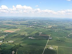
Countryside surrounding North Hampton,
with the village in the distance |
|

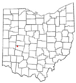
Location of North Hampton, Ohio
|
|

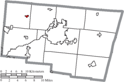
Location of North Hampton in Clark County
|
|
| Country | United States |
| State | Ohio |
| County | Clark |
| Township | Pike |
| Area | |
| • Total | 0.39 sq mi (1.00 km2) |
| • Land | 0.39 sq mi (1.00 km2) |
| • Water | 0.00 sq mi (0.00 km2) |
| Elevation | 1,070 ft (330 m) |
| Population
(2020)
|
|
| • Total | 457 |
| • Density | 1,187.01/sq mi (458.50/km2) |
| Time zone | UTC-5 (Eastern (EST)) |
| • Summer (DST) | UTC-4 (EDT) |
| ZIP code |
45349
|
| Area code(s) | 937, 326 |
| FIPS code | 39-56588 |
| GNIS feature ID | 2399515 |
North Hampton is a small village located in Clark County, Ohio, in the United States. In 2020, about 457 people lived there. It is part of the larger Springfield area.
Contents
History of North Hampton
North Hampton was first planned out in 1829. A post office opened in the village in 1839.
The Rock and Roll Mix-Up
In 1969, North Hampton became famous in rock and roll history because of a funny mistake. The rock band Vanilla Fudge was supposed to play a concert at the Blossom Amphitheater. This concert venue is near a place called Northampton Township, Ohio.
However, the band got confused. They thought the concert was in North Hampton, which is about 200 miles away from the real location! After arriving in North Hampton, they realized their mistake. The band then had to quickly get on a plane to fly to the correct concert place. They arrived four hours late!
The band's singer, Mark Stein, later explained the mix-up. He said their agent kept talking about "Blossom Center in Northampton Township." But when the band looked at a map, they saw "North Hampton" near Dayton. They thought it was a strange place for a concert, but they decided to go there anyway.
Geography of North Hampton
North Hampton is located at coordinates 39°59′26″N 83°56′30″W / 39.99056°N 83.94167°W.
The United States Census Bureau says that the village covers about 0.43 square miles (1.11 square kilometers). All of this area is land.
Population of North Hampton
| Historical population | |||
|---|---|---|---|
| Census | Pop. | %± | |
| 1850 | 147 | — | |
| 1860 | 140 | −4.8% | |
| 1870 | 205 | 46.4% | |
| 1880 | 173 | −15.6% | |
| 1930 | 369 | — | |
| 1940 | 383 | 3.8% | |
| 1950 | 424 | 10.7% | |
| 1960 | 495 | 16.7% | |
| 1970 | 489 | −1.2% | |
| 1980 | 421 | −13.9% | |
| 1990 | 417 | −1.0% | |
| 2000 | 370 | −11.3% | |
| 2010 | 478 | 29.2% | |
| 2020 | 457 | −4.4% | |
| U.S. Decennial Census | |||
North Hampton in 2010
In 2010, about 478 people lived in North Hampton. There were 173 homes, and 123 of these were families. The village had about 1111 people per square mile.
Most people living in the village were White (96.9%). A small number of people were Native American (0.2%), Asian (0.2%), or from two or more races (2.5%). About 1% of the population was Hispanic or Latino.
Many homes (44.5%) had children under 18 living there. More than half of the homes (53.8%) were married couples. About 22% of all homes had just one person living in them.
The average age of people in the village was 37.4 years old. About 28.9% of residents were under 18. About 11.3% of residents were 65 years old or older. The population was almost evenly split between males (48.3%) and females (51.7%).
See also
 In Spanish: North Hampton (Ohio) para niños
 | Chris Smalls |
 | Fred Hampton |
 | Ralph Abernathy |

