Nutt, New Mexico facts for kids
Quick facts for kids
Nutt, New Mexico
|
|
|---|---|

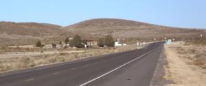
Nutt in January 2013, looking northeast
|
|
| Country | United States |
| State | New Mexico |
| County | Luna |
| Founded | 1881 |
| Elevation | 4,721 ft (1,439 m) |
| Population
(2010)
|
|
| • Total | 12 |
| Time zone | UTC-7 (MST) |
| • Summer (DST) | UTC-6 (MDT) |
| ZIP codes |
88030
|
| Area code(s) | 575 |
| GNIS feature ID | 898578 |
Nutt is a small, unincorporated community. It is located in Luna County, in southern New Mexico. This area is part of the American Southwest.
You can find Nutt about 19 miles southwest of Hatch. It sits where two state roads, NM 26 and NM 27, meet.
History of Nutt
Before Nutt became a town, the area had ranches. These included Lloyd's Ranch and Slocum's Ranch. People living there sometimes faced challenges from the Apache people.
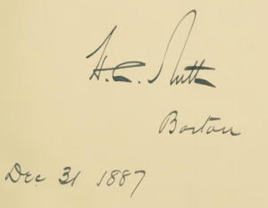
The town of Nutt was started in 1881. It began as a depot and water station for the Atchison, Topeka and Santa Fe Railway. The town was named after Colonel Henry Clay Nutt. He was a member of the railway's board of directors. Colonel Nutt helped pass laws in New Mexico. These laws allowed the railway to build a southern line.
Wagon trains used to leave Nutt. They traveled to mining towns in the Black Range mountains. This continued until 1884. That year, the Santa Fe railway built a new line. It went directly to Lake Valley. After this new line was built, Nutt quickly became less important. Its history after 1884 is not very well known. People sometimes called Nutt the "Middle of Nowhere."
Nutt had a post office for a few years. It was open from 1881 to 1884. Then it reopened from 1899 until 1939.
Geography of Nutt
Nutt is located on a raised area of land. This area is a pass through the Good Sight Mountains. To the east is the Los Uvas Valley. To the west is the Macho Creek Valley.
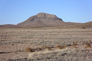
The tallest point nearby is Nutt Mountain. It stands at 5,940 feet (1,811 meters) tall. This mountain is about 2.5 miles north of Nutt. Nutt Mountain is a type of volcano called a volcanic plug. It is made of layers of rock called rhyolites. It is also sometimes called Sunday Cone. The soil in Nutt is made from eroded volcanic rocks. These include tuffs, andesites, latites, and rhyolites.
People of Nutt
The United States Census Bureau collects information about people. For the 2010 census, Nutt was part of the Deming North area. In 2010, the census recorded that twelve people lived in Nutt.
 | Aaron Henry |
 | T. R. M. Howard |
 | Jesse Jackson |


