Nyamuragira facts for kids
Quick facts for kids Nyamuragira |
|
|---|---|
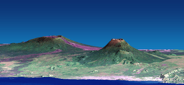
Nyamuragira (left) and Nyiragongo (right). Vertical scale exaggerated (1.5×).
|
|
| Highest point | |
| Elevation | 3,058 m (10,033 ft) |
| Prominence | 784 m (2,572 ft) |
| Geography | |
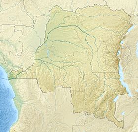
| Location | Nord-Kivu, Democratic Republic of the Congo |
| Parent range | Virunga Mountains |
| Geology | |
| Mountain type | Shield volcano |
| Last eruption | September 10, 2024 (Ongoing) |
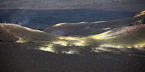
Nyamuragira, also known as Nyamulagira, is a very active shield volcano in Africa. It's found in the Virunga Mountains in the Democratic Republic of the Congo, about 25 kilometers (15 miles) north of Lake Kivu. Its name comes from a local language, Kinyarwanda, and means "to herd animals."
Many people call it Africa's most active volcano. It has erupted more than 40 times since 1885! Sometimes, lava comes out from the top, and other times it bursts from the sides, forming smaller, temporary volcanoes.
Some of its recent eruptions happened in 2010, 2011, and 2021.
Contents
Where is Nyamuragira Located?
Nyamuragira is an active volcano located near the city of Goma in the Democratic Republic of the Congo. It sits about 25 kilometers (15 miles) north of Lake Kivu. This volcano is part of the Nord-Kivu Province.
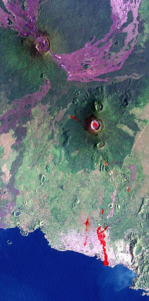
It is also about 13 kilometers (8 miles) north-north-west of Nyiragongo. Nyiragongo is another volcano that caused a lot of damage to Goma in its 2002 eruption.
Nyamuragira is a very large volcano. It holds about 500 cubic kilometers (120 cubic miles) of material. It also covers an area of 1,500 square kilometers (580 square miles). It has a wide, gentle slope, like a shield lying on the ground. This is different from the steep sides of its neighbor, Nyiragongo.
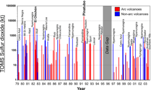
Nyamuragira volcano releases a lot of sulfur dioxide into the air. This gas is a big part of what volcanoes put into the atmosphere.
Recent Eruptions and Activity
Nyamuragira has had several notable eruptions and changes in its lava lake over the years.
2010 Eruption
On January 2, 2010, Nyamuragira started to spew out lava flows. There were no towns or villages very close to the volcano. However, wildlife experts were worried that the eruption might harm the chimpanzees living in the area. Another concern was that the lava could flow into the southern part of Virunga National Park. This area has many settlements and villages.
Satellite photos showed that the lava flows from the 2010 eruption traveled very far. They reached 25 kilometers (15 miles) to the southwest towards Lake Kivu. They also flowed about 22 kilometers (14 miles) to the north-west and 35 kilometers (22 miles) to the north-north-east.
2011 Eruption
The volcano erupted again on November 5, 2011.
This eruption created a column of lava that was 400 meters (1,300 feet) high. People said it was the volcano's biggest eruption in 100 years.
2014 Lava Lake
In 2014, something new happened: a lava lake appeared inside the volcano's crater. This was the first time a lava lake had been there in 75 years! The last one had drained away during a lava flow in 1938.
The new lake formed between June and August 2014. It became very deep, reaching about 500 meters (1,640 feet). This eruption did not affect nearby communities. However, it did create a lot of ash and air pollution. Tiny particles called sulfate aerosols, formed from the volcano's sulfur dioxide, were seen as far away as the central Amazon rainforest in South America.
By 2018, the lava lake had cooled and hardened. It seemed like the activity had stopped for a while. But eruptive activity continued in 2021 at the summit crater.
2021 Lava Lake
In 2021, a new lava lake was seen at the volcano. This was confirmed by a satellite image taken on June 11.
2024 Caldera Overflow
On July 26, 2024, lava began to spill over the northern edge of the volcano's caldera. The lava then flowed towards the northwest. This event came with a large increase in how much lava was coming out. The lava flow moved 5 kilometers (3 miles) in just the first day.
See also
 In Spanish: Monte Nyamuragira para niños
 | Victor J. Glover |
 | Yvonne Cagle |
 | Jeanette Epps |
 | Bernard A. Harris Jr. |


