
O'Fallon, Illinois facts for kids
Quick facts for kids
O'Fallon, Illinois
|
|||||
|---|---|---|---|---|---|

The Illinois Central Railroad Downtown Caboose
|
|||||
|
|||||
| Nickname(s):
"O-Town"
|
|||||

Location of O'Fallon in St. Clair County, Illinois.
|
|||||
| Country | |||||
| State | |||||
| County | St. Clair | ||||
| Township | O'Fallon | ||||
| Government | |||||
| • Type | Home rule | ||||
| Area | |||||
| • Total | 15.71 sq mi (40.67 km2) | ||||
| • Land | 15.59 sq mi (40.39 km2) | ||||
| • Water | 0.11 sq mi (0.29 km2) | ||||
| Elevation | 541 ft (165 m) | ||||
| Population
(2020)
|
|||||
| • Total | 32,289 | ||||
| • Density | 2,070.60/sq mi (799.48/km2) | ||||
| Time zone | UTC−6 (CST) | ||||
| • Summer (DST) | UTC−5 (CDT) | ||||
| ZIP code(s) |
62269
|
||||
| Area code(s) | 618 | ||||
| FIPS code | 17-55249 | ||||
| GNIS feature ID | 2395302 | ||||
| Wikimedia Commons | O'Fallon, Illinois | ||||


O'Fallon is a city in St. Clair County, Illinois, United States. In 2020, about 32,289 people lived there. It is the second-largest city in the Metro East area. This region is part of the larger St. Louis metropolitan area and Southern Illinois. O'Fallon is only about 5 miles from Scott Air Force Base. It is also about 18 miles from Downtown St. Louis.
Did you know there is another city named O'Fallon in St. Charles County, Missouri? Both O'Fallon, Illinois, and O'Fallon, Missouri, are part of the same big St. Louis area. This is pretty unique!
Contents
History of O'Fallon
.jpg)
O'Fallon was founded in 1854. It was named after Colonel John O'Fallon, a rich man from St. Louis. A Baltimore and Ohio Railroad train station was built in downtown O'Fallon. This helped the city grow and become known.
Land was divided into lots and sold on May 18, 1854. A post office opened the next year. Many German settlers came to O'Fallon looking for good farming land. On January 27, 1874, O'Fallon officially became a village. Later, on March 14, 1905, citizens voted for it to become a city. Since it was founded, O'Fallon's population has grown in almost every census year. Only in 1930 did it lose a few residents.
The city center is about two miles east of Interstate 64 and U.S. Route 50. O'Fallon grew a lot during the 1980s. It grew even more after Interstate 64 was expanded in the 1990s. Many new neighborhoods were built, like Thornbury Hill and Fairwood Hills. O'Fallon Township High School has also added many buildings. This helps make sure there is enough space for all the students.
City Seal and Flag
O'Fallon's city seal was created in 1974. A freshman from OTHS, Michael Donovan, designed it. He won a contest held by a local club. In May 1975, the design was made final and became the city's official flag.
The design uses yellow-gold and blue colors. These are the colors of the high school. The pick and shovel on the seal show the coal mines. These mines were very important to O'Fallon's economy for over 100 years. The train represents the railroad, which helped O'Fallon start and grow. The planes stand for Scott Air Force Base. Many people in O'Fallon work there, both military and civilians.
Major Events
- Tornado outbreak of April 2, 2006: This was a significant weather event that affected the area.
Geography of O'Fallon
O'Fallon is located at 38°35′N 89°54′W / 38.583°N 89.900°W. It is:
- About 5 miles from Scott Air Force Base
- About 10 miles from McKendree University
- About 17 miles from St. Louis, Missouri
In 2010, the city covered about 14.48 square miles. Most of this area, about 14.35 square miles, is land. A small part, about 0.12 square miles, is water.
Population and People
| Historical population | |||
|---|---|---|---|
| Census | Pop. | %± | |
| 1870 | 1,117 | — | |
| 1880 | 921 | −17.5% | |
| 1890 | 865 | −6.1% | |
| 1900 | 1,267 | 46.5% | |
| 1910 | 2,018 | 59.3% | |
| 1920 | 2,379 | 17.9% | |
| 1930 | 2,373 | −0.3% | |
| 1940 | 2,407 | 1.4% | |
| 1950 | 3,022 | 25.6% | |
| 1960 | 4,018 | 33.0% | |
| 1970 | 7,268 | 80.9% | |
| 1980 | 12,173 | 67.5% | |
| 1990 | 16,073 | 32.0% | |
| 2000 | 21,910 | 36.3% | |
| 2010 | 28,281 | 29.1% | |
| 2020 | 32,289 | 14.2% | |
| U.S. Decennial Census 2018 Estimate |
|||
As of the census in 2020, O'Fallon had 32,289 people. There were 12,093 households living in the city. About 39.5% of these households had children under 18 living with them.
The city's population is made up of different groups. About 70.59% of the people were White. About 16.38% were African American. About 2.75% were Asian. Other groups made up smaller percentages. About 4.49% of the population was Hispanic or Latino.
The median age in O'Fallon was 37.3 years old. This means half the people were younger than 37.3, and half were older. The median household income was $102,560. This is the middle income for all households in the city.
Annual Events
O'Fallon hosts several special events each year:
- May: A Memorial Day event is held to honor those who served the nation. This takes place at the O'Fallon Veterans Monument.
- November: A Veterans Day Celebration is held at the O'Fallon Veterans Monument. There is also a Veterans Day Parade, which is the largest in the area.
- November: On the Saturday after Thanksgiving, there is a Lighted Holiday Parade.
Parks and Recreation
.jpg)

O'Fallon has many great parks and recreation spots:
- Family Sports Park
- Hesse Park
- Katy Cavin's Community Center
- O'Fallon Community Park
- O'Fallon Memorial Pool
- Rock Springs Nature Park, which has:
- A nature center
- Paths for jogging and cycling
- Nature trails
- A natural prairie area
- A dog park
- MCT Goshen Trailhead
- St. Clair Recreation Complex
- St. Ellen Mine Park
- Thoman Park
- Veteran's Monument
Library
- O'Fallon Public Library
Historic Places
- Scott Field Historic District: This area is listed as a historic place.
Schools in O'Fallon

O'Fallon has several school districts and schools:
- O'Fallon Community Consolidated School District #90
- Delores Moye Elementary School
- Estelle Kampmeyer Elementary School
- J. E. Hinchcliffe Sr. Elementary School
- Laverna Evans Elementary School
- Marie Schaefer Elementary School
- Amelia V. Carriel Junior High School
- Edward A. Fulton Junior High School
- O'Fallon Central School District #104
- O'Fallon Township High School District No. 203
- O'Fallon Township High School
Private Schools
- Discovery School
- St. Clare Catholic School
- First Baptist Academy
Notable People from O'Fallon
Some famous people have connections to O'Fallon:
- Bob Cryder: A professional football player.
- Bernie Fuchs: A well-known illustrator.
- William Holden: An actor who won an Academy Award.
- Joseph W. Schmitt: A spacesuit technician for NASA.
Images for kids
-
City Civil defense siren
-
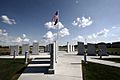
O’Fallon War Memorial
-

Hesse Park
-

Tornado damage in 2006


See also
 In Spanish: O'Fallon (Illinois) para niños
