Southern Illinois facts for kids
Quick facts for kids
Southern Illinois
Little Egypt |
|
|---|---|
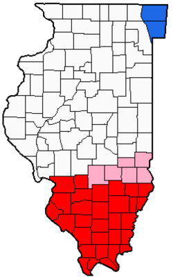
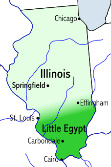
Counties in red are usually or always included in southern Illinois, while those in pink are sometimes included.
|
|
| Country | United States |
| State | Illinois |
| Largest city | Belleville |
| Population | 1.2 million |
Southern Illinois is a special part of Illinois, located in the southern third of the state. It's mostly south of Interstate 70. This area is bordered by two of the biggest rivers in the United States: the Mississippi River to the west and the Ohio River to the east and south. The Wabash River also forms part of its southeastern border. Many people call parts of Southern Illinois "Little Egypt."
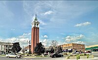
The biggest city in Southern Illinois is Belleville, with about 44,000 people. Other important cities include Alton, Centralia, Collinsville, Edwardsville, Granite City, O'Fallon, Marion, and Carbondale. Southern Illinois University has its main campus in Carbondale. Many residents also travel to nearby big cities like St. Louis in Missouri, Evansville, Indiana, and Paducah, Kentucky. The region is also home to Scott Air Force Base, a large military base.
About 1.2 million people live in Southern Illinois. Most live in small towns and cities surrounded by huge farms and the beautiful Shawnee National Forest. The two most populated areas are Metro East, which is the part of Illinois near St. Louis, and the area around Carbondale and Marion, which has about 123,000 residents.
The first European settlers here were French colonists. Later, people from the southern United States moved in, often traveling by the Ohio River. This region used to have an economy based on farming, and some people owned slaves before Illinois became a state and slavery was banned. Later, many areas became important for coal mining.
Even though Southern Illinois is in the Midwest, some parts feel more like the Upland South (like Kentucky or Missouri). People in these areas often speak with a southern accent.
Contents
- Exploring the Past: History of Southern Illinois
- Understanding the Regions of Southern Illinois
- Media and Communication
- Natural Wonders: Geography of Southern Illinois
- Getting Around: Transportation
- Learning and Growing: Colleges and Universities
- Making a Living: Economy of Southern Illinois
- Local Life: Culture and Fun in Southern Illinois
Exploring the Past: History of Southern Illinois
Ancient Times: Early Inhabitants
People first arrived in Illinois around 12,000 BC. They were hunter-gatherers, meaning they hunted animals and gathered plants for food. Over time, they started farming. After AD 1000, they grew enough food to create complex societies with leaders.
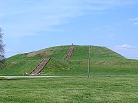
The Mississippian culture built amazing cities with large earthworks (mounds of earth). These mounds were used for religious, political, and special ceremonies. Cahokia, near Collinsville, was a major center for this culture. It has the largest prehistoric earthworks in the Americas and is a UNESCO World Heritage Site. The Mississippian culture faded between AD 1400–1500, and Cahokia was abandoned before Europeans arrived.
Around AD 1500, the Illinois Indian tribes, who gave the state its name, moved into Southern Illinois. They left behind many items like pottery, tools, and weapons. You can still see a stone fort they built in Giant City State Park near Makanda.
European Settlers Arrive
Around 1673, French explorers from Quebec were the first Europeans to reach Illinois. They named the area after the friendly Illinois Indians. The French explored the Mississippi River, setting up small outposts for trade and travel. These settlements became important stops between Canada and French ports further south.
After the French and Indian War in 1763, the English took control of the region. Many French settlers moved to the west side of the Mississippi River, which was then ruled by Spain.
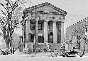
After the American Revolutionary War, American settlers slowly moved into Illinois. By 1800, fewer than 2,000 European Americans lived here. Soon, more people came from states like Kentucky, Tennessee, and Virginia. These early settlers were mostly of English, German, and Scots-Irish backgrounds.
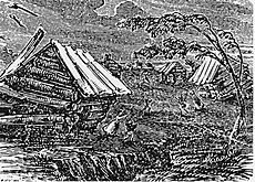
In 1787, Illinois became part of the Northwest Territory. Slavery was not allowed in this territory, but some slaveholders already living there were allowed to keep their slaves for a time. Illinois became a separate territory in 1809 and a free state in 1818. In 1811 and 1812, huge earthquakes, known as the New Madrid earthquakes, shook the region.
The first bank in Illinois opened in Old Shawneetown in 1816. Crops like cotton and tobacco were grown in the very southern part of Illinois. During the American Civil War, cotton was grown for export when supplies from the South were cut off.
Turbulent Times: The 19th Century
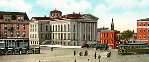
In the mid-1800s, there was a long-lasting family feud in Williamson County called the Bloody Vendetta. It led to many conflicts and deaths. This was unusual because crime was rare in Illinois before this period.
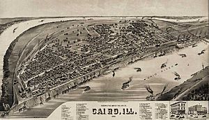
In 1858, Abraham Lincoln debated Stephen A. Douglas for a U.S. Senate seat. One debate was held near Jonesboro. Many people in Southern Illinois had family ties to the South. Cairo, Illinois, at the very tip of Illinois where the Ohio and Mississippi rivers meet, was a very important location during the American Civil War.
During the Civil War, some residents of Southern Illinois supported the Confederate Army. However, the Union Army used Cairo as a key base for its operations into Missouri, Kentucky, Tennessee, and Mississippi.
Growth and Change: The 20th Century
Coal mining became a major industry in Southern Illinois in the early 1900s. Cities like Harrisburg grew quickly. In 1922, a strike by coal miners led to a riot in Herrin, where 20 men were killed. This event was called the Herrin Massacre, and Williamson County became known as Bloody Williamson.
In the 1920s, during Prohibition (when alcohol was illegal), criminal gangs operated in Southern Illinois. Shoot-outs between rival gangs and with police were common.
The Great Depression in the 1930s caused many coal mines to close, and farmers lost their land. Many young people left the region to find work in cities. After World War II, jobs slowly returned, but unemployment remained a challenge for decades. When the Clean Air Act of 1990 required cleaner coal, Southern Illinois's high-sulfur coal lost its market, hurting the economy. Today, farming is the main economic driver.
Southern Illinois is slowly developing its own cultural identity. Towns like Marion and Belleville are growing. Marion has seen huge growth since 1970.
Why "Little Egypt"?
The nickname "Egypt" might have started in the 1830s. At that time, poor harvests in northern Illinois meant people had to come to Southern Illinois to buy grain. Some say it's because the land along the Mississippi and Ohio River valleys looked like Egypt's Nile delta. The town of Cairo, Illinois, still sits where the Ohio River joins the Mississippi.
Many towns in the area have names from Egypt, Greece, or the Middle East. Examples include Metropolis, Thebes, Dongola, Palestine, Lebanon, New Athens, Sparta, and Karnak. Even the Southern Illinois University sports teams are called the Salukis, after an Egyptian dog breed.
Before the American Civil War, Illinois was a free state, but some people in "Little Egypt" still had slaves. This was due to special rules for salt works and for slaveholders who lived in the area before it became a state.
The nickname also came from the political differences during the Civil War. Southern Illinois was settled by people from the South, so they often supported Southern ideas, including slavery. They tended to vote for Democrats, while northern Illinois supported Republicans.
During the war, some worried that Southern Illinois might try to join the Confederacy. President Lincoln even told a general to "keep Egypt right side up."
After the war, other ideas for the nickname appeared. In 1871, a judge wrote that the name came from Southern Illinois supplying grain to northern Illinois after a very harsh winter in 1830–31. This was like the Bible story of Jacob's sons going to Egypt for grain during a famine.
The famous Belly dancer Farida Mazar Spyropoulos, known as "Little Egypt," performed at the 1893 World's Columbian Exposition in Chicago. While she made the name popular, she had no connection to the Illinois region.
Understanding the Regions of Southern Illinois
"Southern Illinois" isn't an official area, so its exact borders can vary. Many people think the area along and south of Interstate 70 is the dividing line between central and southern Illinois. As you travel south, the land becomes hillier and less flat, with more trees and fewer large farms.
Metro East: A Busy Area
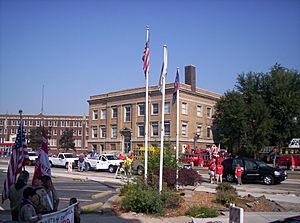
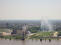
The most populated part of Southern Illinois is the Metro East area, which is the Illinois side of the St. Louis Metropolitan Area. This region includes important historical sites like Cahokia Mounds and the American Bottom. East St. Louis is also here, known for its industrial past.
- Population: About 700,000
- Main cities: Belleville, Alton, Granite City, O'Fallon, East St. Louis, Collinsville, Edwardsville.
East-Central Southern Illinois: The Wabash Valley
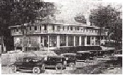
This area is located along the Wabash River. It includes Salem, the birthplace of famous speaker William Jennings Bryan and where Miracle Whip salad dressing was invented.
- Population: About 156,000
- Main cities: Centralia, Olney, Salem, Mount Carmel.
West-Central Southern Illinois: Home of Popeye
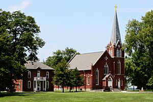
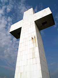
Chester in this region is known as the "Home of Popeye" the sailor man. Kaskaskia, Illinois' first state capital, is also nearby. Rend Lake is a large lake in this area.
- Population: About 149,000
- Main cities: Mount Vernon, Chester, West Frankfort, Benton.
Southwest Illinois: University Town
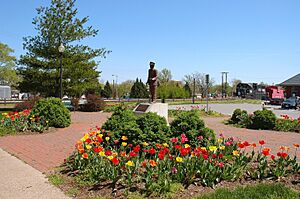
This region is home to the main campus of Southern Illinois University in Carbondale. Carbondale is a growing city and has won awards for its community. Marion and Herrin are also important cities here. The large Crab Orchard Lake is the biggest lake in the region. Historic Cairo is at the very southern tip, where the Ohio and Mississippi Rivers meet.
- Population: About 159,000
- Main cities: Carbondale, Marion, Herrin, Murphysboro, Anna/Jonesboro, Cairo.
Southeastern Illinois: Forest and Hills
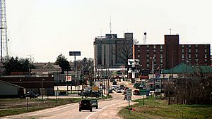
This is the least populated region, known for its beautiful Shawnee Hills and the Shawnee National Forest. It has many state parks and the famous Garden of the Gods Wilderness. Shawneetown is a historic town on the Ohio River. The Saline River also flows through this area.
- Population: About 90,000
- Main cities: Harrisburg, Eldorado, Metropolis, Carmi.
Media and Communication
Southern Illinois has many TV and radio stations. WSIL-TV in Carterville is a main news source. WSIU channel 8 in Carbondale is also important. Many radio stations are operated by River Radio and Withers Broadcasting, offering different music and news. People also watch TV stations from nearby states like Missouri and Kentucky.
Natural Wonders: Geography of Southern Illinois
Illinois was once covered by huge ice sheets, but Southern Illinois was only partly covered. This is why Southern Illinois has more hills and rocks compared to the flat central and northern parts of the state. It looks more like the the Ozarks in Missouri.
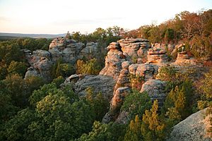
The rich farmland found in northern and central Illinois is not as common here. However, there are fertile areas along the Mississippi River, known as the American Bottom, and in the river valleys.
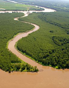
The Ohio River flows southwest through towns like Shawneetown and Cave-in-Rock, joining the Mississippi at Cairo. In ancient times, the Ohio River flowed through a different path, carving a wide valley that is now home to smaller rivers like Bay Creek and the Cache River.
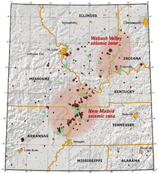
The hills of Southern Illinois can be divided into two areas. The western hills are similar to the Ozarks in Missouri. The eastern hills are more connected to the Wabash Valley Seismic Zone. The Shawnee National Forest covers a large part of this region, with seven wilderness areas for hiking and horseback riding.
Only the Mississippi and Ohio rivers are large enough for modern commercial boats. Other rivers in Southern Illinois include the Big Muddy River, Marys River, Saline River, and Cache River. The Kaskaskia River and Wabash River are also nearby.
Exploring the Shawnee National Forest
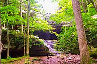
The Shawnee National Forest covers over 270,000 acres (1100 km²) in Southern Illinois. It's a great place for outdoor activities! The forest has 1250 miles (2010 km) of roads, 150 miles (240 km) of streams, and many waterfalls, ponds, and lakes. Some lakes are as big as 2,700 acres (11 km²) and have swimming beaches. There are 13 campgrounds and many picnic spots. Seven wilderness areas offer trails for hiking and horseback riding.
The forest is home to many different plants and over 500 types of wildlife, including mammals, birds, reptiles, amphibians, and fish. It's a very important natural area.
Weather and Climate

Southern Illinois has four distinct seasons. It can get very cold in winter and very hot and humid in summer. The humidity often makes summer temperatures feel much hotter. Spring is the wettest season and can bring severe weather like tornadoes. Fall is mild with less humidity.
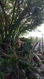
Even with these temperature changes, you can find a few cold-hardy palm trees growing here! These are some of the northernmost naturally growing palms in the United States.
The average high temperature in July is 90°F (32°C), and the average low in January is 21°F (−6°C). Temperatures can reach over 100°F (38°C) or below 0°F (−18°C) a few days each year. The record low was −23°F (−31°C) in Harrisburg, and the record high was 117°F (47°C) in East St. Louis.
Southern Illinois experiences thunderstorms about 50 days a year. These storms bring more than half of the yearly rain. In spring, they can be severe, with strong winds, large hail, and tornadoes.
Sometimes, there's a period of warm weather in late autumn called Indian summer. Roses can even still be blooming in November or December in some years!
Earthquake Zones
Southern Illinois is located near two major fault systems: the New Madrid Seismic Zone and the Wabash Valley Seismic Zone. In the 1970s, after an earthquake, scientists discovered a fault under Saline County called the Cottage Grove Fault. This fault is a small crack in the Earth's rock.
The region has experienced earthquakes from both the Wabash Valley Seismic Zone and the New Madrid Fault. The New Madrid Fault was responsible for the very powerful New Madrid earthquakes in 1812, which were some of the strongest ever in the United States.
Getting Around: Transportation
Train Travel
Southern Illinois used to have many railroads. Today, Amtrak, the U.S. passenger train system, serves the area. Carbondale has daily trains to Chicago, Memphis, and New Orleans. Trains also run daily between Chicago and St. Louis, with Alton being a main stop in Southern Illinois. Other train stations include Centralia and Du Quoin station.
The St. Louis MetroLink is a light rail system that connects the Metro East area in Illinois to downtown St. Louis. It has two lines and 37 stations, carrying many people each weekday.
Local Transit
Several local transit services help people get around Southern Illinois, including:
- Bond County Transportation
- Jackson County Mass Transit District
- Madison County Transit
- Rides Mass Transit District
- Saluki Express (in Carbondale)
- Shawnee Mass Transit District
- St. Clair County Transit District
Major Highways
Southern Illinois has four main interstate freeways that connect to Missouri, Indiana, and Kentucky.
 Interstate 24
 Interstate 57 (the main north-south freeway)
 Interstate 64
 Interstate 70 (in the Metro East area)
Other important roads include:
- U.S. Route 45 (the longest numbered route in Illinois)
- U.S. Route 51
- Historic U.S. Route 66
Bridges and Ferries
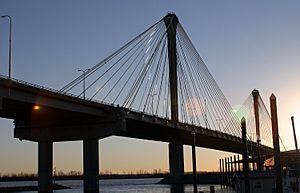
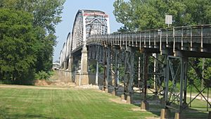
Bridges and ferries are very important because Southern Illinois is surrounded by the Ohio, Wabash, and Mississippi rivers.
Some notable bridges include:
- Connecting to Indiana: Red Skelton Memorial Bridge, Mount Carmel Bridge, Interstate 64 Bridge.
- Connecting to Kentucky: Brookport Bridge, Interstate 24 Bridge, Cairo Ohio River Bridge.
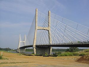
- Connecting to Missouri: Cairo Mississippi River Bridge, Cairo I-57 Bridge, Bill Emerson Memorial Bridge, Chester Bridge.
- In the St. Louis Area: Clark Bridge, Eads Bridge, Jefferson Barracks Bridge, Martin Luther King, Jr. Bridge, Poplar Street Bridge, Stan Musial Veterans Memorial Bridge.
A free ferry crosses the Ohio River at Cave-in-Rock. A toll ferry crosses the Mississippi at Ste. Genevieve, Missouri, near Chester, Illinois.
Airports
Southern Illinois has several airports, including:
- MidAmerica St. Louis Airport / Scott Air Force Base
- Southern Illinois Airport
- Williamson County Regional Airport
- St. Louis Downtown Airport
- St. Louis Regional Airport
Larger airports outside the state that serve the region include Lambert-St. Louis International Airport in Missouri and Evansville Regional Airport in Indiana.
Learning and Growing: Colleges and Universities
Southern Illinois is home to many colleges and universities, offering different types of education:
- Blackburn College (Carlinville)
- Greenville College (Greenville)
- John A. Logan College (Carterville)
- Kaskaskia College (Centralia)
- Lewis and Clark Community College (Godfrey)
- McKendree University (Lebanon)
- Olney Central College (Olney)
- Principia College (Elsah)
- Rend Lake College (Ina)
- Shawnee Community College (Ullin)
- Southeastern Illinois College (Harrisburg)
- Southern Illinois University Carbondale (Carbondale)
- Southern Illinois University Edwardsville (Edwardsville)
- Southwestern Illinois College (Belleville)
- Wabash Valley College (Mount Carmel)
Making a Living: Economy of Southern Illinois
The two main economic centers in Southern Illinois are the St. Louis, Missouri area and the Carbondale, Marion, Herrin, Harrisburg area.
Farming is very important here. The main crops are corn and soybeans. You'll also find apples, peaches, grapes, and sometimes sunflowers, cotton, and wheat. In recent years, wineries have grown in the Shawnee Hills region. There's also a focus on local foods, as the climate is good for growing fruits and vegetables. Southern Illinois also raises livestock like cattle, pigs, and sheep.

Southern Illinois has a lot of coal, but the coal industry declined in the late 1980s because of less demand for high-sulfur coal, which causes more pollution. This greatly affected the region's economy. However, with new technology to clean coal, demand has started to return.
The Illinois oil basin is mostly in "Little Egypt." In the 1940s and 1950s, there was a small oil boom. Oil production has since dropped, and there hasn't been much new drilling since the late 1970s.
Manufacturing is often found in the larger towns, with people from smaller towns traveling to work in factories. These factories produce things like electronics, car parts, and packaging materials. Many local jobs are in these light industries.
Local Life: Culture and Fun in Southern Illinois
Southern Illinois' culture is a mix of influences from the rest of Illinois, nearby Missouri and Indiana, and Southern states like Kentucky and Tennessee. Early settlers came from these Southern states, bringing their traditions and ways of speaking.
The way people speak in Southern Illinois is a blend of different American English dialects. As you get closer to the Ohio River, you'll hear more Southern accents. This is because many early settlers came from the Southern Appalachian region.
Fun Things to Do: Tourism
Southern Illinois is proud of its tourism, offering a charming rural experience. There are many state parks and beautiful scenery in the Shawnee National Forest. It's also the oldest part of Illinois, with many historical landmarks and markers to explore.
Casinos
If you're looking for entertainment, there are casinos in:
- Alton (Argosy Casino)
- Metropolis (Harrah's)
- East St. Louis (Casino Queen)
Wineries and Orchards
The Shawnee Hills region is known for its many wineries and orchards where you can enjoy local fruits and wines. Some popular spots include:
- Alto Vineyards (Alto Pass)
- Blue Sky Vineyard (Makanda)
- Flamm Orchards (Cobden)
- Honker Hill Winery (Carbondale)
- Pomona Winery (Pomona)
- Rendleman Orchards (Alto Pass)
- Walker's Bluff (Carterville)
Parks and Outdoor Adventures
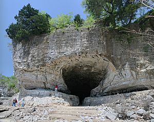
Southern Illinois has many amazing state parks, especially within the Shawnee Hills and Shawnee National Forest region. Some popular ones are:
- Cave-in-Rock State Park
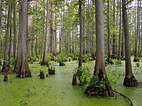
- Cache River State Natural Area
- Ferne Clyffe State Park
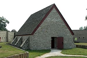
- Fort Massac State Park
- Giant City State Park
- Garden of the Gods
- Lake Murphysboro State Park
- Pyramid State Recreation Area
- Rend Lake State Fish and Wildlife Area
- Tunnel Hill State Trail
- Trail of Tears State Forest
Sports in Southern Illinois
Southern Illinois has several sports teams and venues:
| Team | Sport | League | Venue |
|---|---|---|---|
| Gateway Grizzlies | Baseball | Frontier League | GCS Ballpark |
| Southern Illinois Salukis | Many sports, including Basketball, football, softball, swimming | Missouri Valley Conference and Missouri Valley Football Conference | Various venues, like SIU Arena and Saluki Stadium |
| SIU Edwardsville Cougars | Many sports, including Baseball, basketball, soccer, softball, wrestling | Ohio Valley Conference | Various venues, like Ralph Korte Stadium and the Vadalabene Center |
 | Jackie Robinson |
 | Jack Johnson |
 | Althea Gibson |
 | Arthur Ashe |
 | Muhammad Ali |


