U.S. Route 66 in Illinois facts for kids
Quick facts for kids
U.S. Route 66 |
||||
|---|---|---|---|---|
| Will Rogers Highway Main Street of America |
||||
|
Route 66 highlighted in red
|
||||
| Route information | ||||
| Maintained by IDOT | ||||
| Length | 301 mi (484 km) | |||
| Existed | November 11, 1926–June 25, 1974 | |||
| Major junctions | ||||
| West end | ||||
|
||||
| East end | Invalid type: US 1961 in Chicago | |||
| Location | ||||
| Highway system | ||||
| United States Numbered Highways List • Bannered • Divided • Replaced Illinois state highway system
|
||||
U.S. Route 66 (also known as US 66 or just Route 66) was a famous highway in Illinois. It connected the cities of St. Louis, Missouri, and Chicago, Illinois. This historic road, often called the Mother Road or Main Street of America, helped people travel long distances by car from Chicago all the way to Southern California. Before it was Route 66, much of this path was part of Illinois Route 4 (IL 4). Today, a lot of the old Route 66 has been replaced by Interstate 55 (I-55). Even so, many parts of the original road are still used, and six sections in Illinois are special enough to be listed on the National Register of Historic Places.
Contents
Why was Route 66 built?
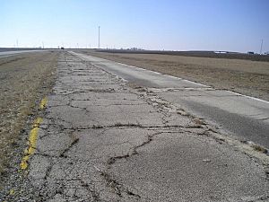
Route 66 was officially named on November 11, 1926. It was first known as the Main Street of America. Later, in 1939, a writer named John Steinbeck called it the Mother Road. When it was first planned, builders tried to use roads that already existed. This helped them finish the highway quickly without needing to build too many new sections. Illinois was actually the first of the eight states that Route 66 passed through to have its part of the road completely paved. At that time, many other parts of Route 66 were still just dirt or gravel.
Building Route 66 was a big deal for small towns, especially in Illinois and the Midwest. These towns saw a lot of new business when the road came through. However, some communities in Illinois were already benefiting from paved roads thanks to a law passed in 1916. This law, called the Federal Aid Post Road Act, was the first time the U.S. government actively helped states build roads. Five roads in Illinois got money from this law, including parts of IL 4, which later became Route 66.
The path from Chicago to St. Louis was very old. It started as a Native American trail and then became a stagecoach road. In 1915, it was named the Pontiac Trail. Route 66 followed this trail through many towns like Joliet, Odell, Bloomington, Lincoln, Springfield, Edwardsville, and East St. Louis.
Most of the Pontiac Trail was also part of IL 4. This road ran very close to the Chicago and Alton Railroad tracks. In 1922, workers used horses to prepare the roadbed for IL 4. They worked hard for 40 cents an hour! By 1924, almost all of IL 4 between Chicago and St. Louis was paved. The last parts of Route 66 in Illinois were built starting in 1926.
By the 1930s, Route 66 stretched from Chicago to St. Louis. Much of the original pavement was still in use in the early 1940s. However, the road became known as "Bloody 66" because of the many dangerous car accidents that happened on it. When World War II started, Route 66 became even more important for moving military vehicles and supplies. The heavy military trucks made the old road wear out even faster. In 1941, Illinois received money to fix the road and make it safer.
Exploring Route 66 in Illinois
From St. Louis to Hamel
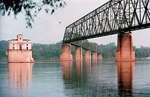
When you entered Illinois from St. Louis, Missouri, Route 66 first crossed the Mississippi River on the McKinley Bridge. This path went through towns like Venice and Madison. In 1930, the famous Chain of Rocks Bridge opened. This bridge allowed travelers to go around St. Louis. It's famous for its unique 22-degree bend in the middle! Along this part of the road, you can still find old places like the Luna Cafe, the Bel-Air Drive-In sign, and the Old Greenway Motel.
Later, in 1951, the Veterans' Memorial Bridge (now called the Martin Luther King Bridge) was built, making it easier to cross the river. Route 66 then joined US 40 and went through East St. Louis and Fairmont City. Near Fairmont City, Route 66 passed by Cahokia Mounds, which is now a UNESCO World Heritage Site because of its ancient history.
From Hamel to Springfield
The Original Path
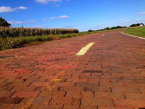
The first path of Route 66 north of Hamel followed IL 4. It wound through towns like Staunton, Gillespie, and Carlinville. A section of this road from Nilwood to Girard is now on the National Register of Historic Places. Route 66 continued north through Virden and Auburn. North of Auburn, there's a special section that's the last brick-paved part of Route 66 in Illinois! The road then entered Springfield, passing by the Illinois State Capitol and the Old State Capitol.
The Eastern Alternate Path
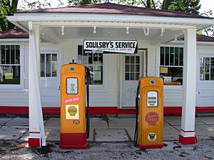
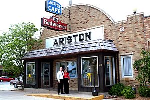
In 1930, a new path opened from Hamel. It went northeast through Mount Olive, where you can still see the historic Soulsby Service Station. This path also went through Litchfield. The Ariston Café in Litchfield is the oldest restaurant still open along the entire Route 66! This alternate path eventually rejoined the original route in Springfield.
During World War II, the heavy military traffic damaged parts of Route 66. So, in the 1940s, some sections were rebuilt as four-lane roads.
From Springfield to Gardner
From Springfield to Gardner, much of Historic Route 66 is now a road that runs next to I-55. Route 66 originally went north through Springfield, past the Illinois State Fairgrounds. It continued through towns like Sherman and Broadwell, before reaching Lincoln.
From Lincoln, the route went northeast through towns like Atlanta, McLean, and Funk's Grove. McLean is home to the famous Dixie Travel Plaza, a truck stop that opened way back in 1928! In Funks Grove, you can find pure "maple sirup" made by the Funk family.
Route 66 then entered Bloomington and Normal, passing by Illinois State Normal University. North of Normal, in Towanda, there's a bike trail along an abandoned section of the highway. It has exhibits about all eight states Route 66 goes through and even classic "Burma Shave" signs!
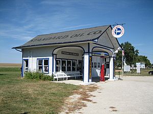
The road continued northeast through Lexington and Chenoa to Pontiac. In Odell, you can see a restored Standard Oil Gasoline Station, and in Dwight, the Ambler's Texaco Gas Station is still there. A long section of Route 66 from Cayuga to Chenoa was added to the National Register of Historic Places in 2007.
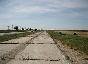
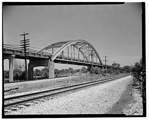
Along this part of the highway, you can see old bridges made of concrete. Many of these bridges were built as part of the original road in 1926. Some parts of the road here were rebuilt in 1943 after they wore out from heavy use in the 1940s.
From Gardner to Welco Corners
Near Gardner, Route 66 split into different paths that later came back together at Welco Corners (which is now part of Bolingbrook).
The 1926 Path through Joliet
The first path of Route 66 went through towns like Gardner, Braceville, and Braidwood before reaching Wilmington. The section from Wilmington to Joliet is on the National Register of Historic Places. This part of the road goes through farmland and past the old Joliet Arsenal.
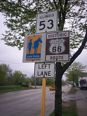
In Joliet, IL 53 follows the old Route 66. North of Joliet, the road became four lanes wide by 1936. It passed by the famous Stateville Penitentiary. This original path is now called Historic US 66 in some places.
When this path was bypassed in 1940, it became Alternate US 66. In downtown Joliet, this route split into one-way streets: Scott Street for northbound traffic and Ottawa Street for southbound traffic. These streets have many historic buildings to see.
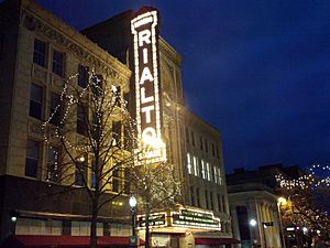
Some interesting places in Joliet include the Joliet Union Station, the historic Church of St. Anthony, the Joliet Public Library, and the beautiful Rialto Square Theatre. You can also see the Louis Joliet Hotel and the Joliet Area Historical Museum.
For pop culture fans, the very first Dairy Queen opened in Joliet on June 22, 1940, at 501 N. Chicago Street. Although it's closed now, the building is a local landmark. Across the river, you can find the Rich & Creamy ice cream stand, famous for its statues of the Blues Brothers on the roof!
The 1940 Path through Plainfield
A new western path opened in 1940. Its main goal was to go around Joliet. This route also served Braceville, Godley, and Braidwood, but then curved north through Channahon, Shorewood, and Plainfield. It rejoined the original route at Welco Corners. After this new road opened, the old path through Joliet became known as Alternate US 66.
The 1957 Freeway Path
In 1957, a new freeway (which is now I-55) opened as Route 66 between Gardner and Welco Corners. This new freeway bypassed both Braidwood and Plainfield. This freeway was the main Route 66 for 19 years, from 1957 to 1976. Today, parts of I-55 still look much like they did when they were Route 66 in 1957, with old motels and gas stations still operating.
From Welco Corners to Chicago
From Welco Corners in Bolingbrook to Indian Head Park, I-55 was built right on top of much of the old Route 66. Here, Route 66 passed through areas that are now suburbs like Woodridge, Darien, and Willowbrook. These towns didn't even exist when Route 66 was created in 1926!
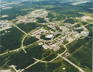
Today, this section of I-55 is sometimes signed as Historic US 66. You can also drive on the old Route 66 by taking the north frontage road in Darien, Willowbrook, and Burr Ridge. This road takes you past historic spots like Cass Cemetery and the former Martin B. Madden mansion. Near Cass Avenue, Route 66 and I-55 pass by the Argonne National Laboratory.
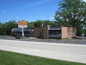
A little further east, you'll find Dell Rhea's Chicken Basket in Willowbrook, which is still a popular stop for travelers. When I-55 was built, it cut off the restaurant from the main highway, but it's still a favorite spot. At the Indian Head Park interchange, I-55 turns south, and Historic US 66 continues east on Joliet Road. This road goes through Countryside, Hodgkins, and McCook. In McCook, you can see the Steak N Egger on Route 66, which used to be Snuffy's 24-Hour Grill.
The route continues northeast on Joliet Road through McCook and Lyons. Then it turns north onto Harlem Avenue to Ogden Avenue in Berwyn, where it meets US 34. From Berwyn, Route 66 goes northeast on Ogden Avenue, passing the Berwyn Route 66 Museum and going through Cicero before entering Chicago.
In Chicago, Route 66 turned east onto Jackson Boulevard. In 1955, Jackson Boulevard became a one-way street going east. So, the westbound lanes of Route 66 were moved to Adams Street.
The eastern end of Route 66 was always at US 41. In 1926, the end was at Jackson Boulevard and Michigan Avenue. But in 1938, Route 66 was extended two blocks further east on Jackson Drive through Grant Park, past Buckingham Fountain, to end at Lake Shore Drive by Lake Michigan.
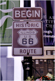
Today, you can find "End Historic Illinois U.S. Route 66" signs on Jackson (eastbound) and "Start Historic Illinois U.S. Route 66" signs on Adams (westbound) at Michigan Avenue. The historic eastern end is marked by the Art Institute of Chicago and the Fountain of the Great Lakes.
Major intersections
Distances listed are based on entering Illinois via the Veterans Memorial Bridge and following an alignment through Plainfield, using the last known non-freeway route where drivable.
| County | Location | Mile | Roads intersected | Notes | |
|---|---|---|---|---|---|
| St. Clair | East St. Louis | 0 | 0.0 | Missouri state line (Veterans Memorial Bridge over the Mississippi River) | |
| west end of US 67 Alt. overlap | |||||
| east end of US 50 overlap | |||||
| | east end of US 67 Alt. overlap; now IL 203 north | ||||
| Fairmont City | west end of IL 111 overlap | ||||
| St. Clair–Madison county line |
east end of IL 111 overlap | ||||
| Madison | Collinsville | west end of IL 157 overlap | |||
| | east end of IL 157 overlap | ||||
| Collinsville | west end of IL 159 overlap | ||||
| Troy Crossing | east end of IL 159 overlap | ||||
| | interchange; east end of US 40 overlap | ||||
| | interchange; now IL 162 | ||||
| | interchange | ||||
| Hamel | interchange | ||||
| | interchange | ||||
| Macoupin | | ||||
| Montgomery | | 51 | 82 | ||
| | |||||
| | |||||
| Sangamon | Pawnee Junction | interchange | |||
| | |||||
| Springfield | |||||
| 96 | 154 | west end of US 54 overlap | |||
| | east end of US 54 overlap | ||||
| | |||||
| | |||||
| Logan | Lincoln | west end of IL 121 overlap | |||
| east end of IL 121 overlap | |||||
| McLean | | interchange | |||
| | interchange | ||||
| Bloomington | |||||
| | |||||
| | interchange | ||||
| | |||||
| Livingston | | ||||
| | |||||
| | interchange | ||||
| | |||||
| Grundy | | 225 | 362 | now IL 53 north | |
| Will | Braidwood | 229 | 369 | ||
| | interchange | ||||
| Troy | |||||
| Plainfield | west end of US 30 overlap | ||||
| east end of US 30 overlap | |||||
| Plainfield | |||||
| | 263 | 423 | |||
| Welco Corners | 264 | 425 | |||
| DuPage | Darien | 274 | 441 | interchange | |
| Cook | | 275 | 443 | ||
| McCook | now 1st Avenue | ||||
| Lyons–Stickney line | west end of IL 42A overlap; now IL 43 south | ||||
| Lyons–Berwyn line | 280 | 450 | east end of IL 42A overlap; west end of US 34 overlap; now IL 43 north | ||
| Cicero | interchange | ||||
| Chicago | |||||
| one-block overlap (westbound only) | |||||
| 291 | 468 | ||||
| 1.000 mi = 1.609 km; 1.000 km = 0.621 mi | |||||
What can you see along Route 66?
Old Gas Stations
Gas stations were super important for a long road like Route 66. They had different designs over the years. The first ones were right by the curb, but these caused traffic jams. So, new types of stations appeared, like the "house" or "cottage" style, or the "oblong box" type. You can still find old gas stations along Route 66 in Illinois. Some are falling apart, but a few have been beautifully restored!
Cool Restaurants
In the early days of Route 66, many travelers brought their own food. They didn't trust roadside food or didn't have much money. But by the 1930s, more people started eating out. Fast food places began to pop up. The White Castle chain, started in 1921, has one of its oldest restaurants still open on Route 66 in Berwyn.
Many small, family-run restaurants, often called "mom and pop" places, became popular. The Steak 'n Shake chain, which started in Normal, was famous for its curbside service where you ordered from your car.
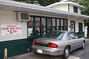
Springfield, the state capital, is known for its food. The "Cozy Dog" (a corn dog on a stick) was invented there! The Cozy Dog Drive In has been a Route 66 favorite since 1950. Also, one of the first drive-thru restaurant windows in the U.S. is still open in Springfield at the Maid-Rite Sandwich Shop.
The Ariston Café in Litchfield is the oldest restaurant still operating along the entire Route 66! Other famous spots include the Palms Grill Café in Atlanta, White Fence Farm in Romeoville, and Dell Rhea's Chicken Basket in Willowbrook. Both White Fence Farm and Dell Rhea's Chicken Basket are known for their fried chicken and unique atmosphere.
Places to Stay: Camps, Courts, and Motels
In the 1920s, travelers on Route 66 often just camped by the side of the road. Then, "tourist camps" started appearing, offering simple cabins for a small fee. These camps slowly added more comforts like shared bathrooms. Over time, these camps turned into "motor courts" (rows of cabins) and then "motor hotels," which were long buildings with rooms side-by-side and parking right outside. This name was later shortened to "motel."
Amazing Bridges
Most bridges along old Route 66 in Illinois are made of concrete and are quite simple. They were usually built with two lanes between 1926 and 1940. Later, after 1940, new bridges often had two lanes in each direction.
One special bridge, a steel arch bridge in Braceville, was sadly torn down in 2000. But three amazing movable bridges still exist in the Chicago area: the Jackson Boulevard and Adams Street Bridges over the South Branch of the Chicago River, and the Ruby Street Bridge over the Des Plaines River in Joliet. These are the only three movable bridges left on the entire Route 66! They are special "bascule" bridges that can open up to let boats pass. The Jackson and Adams bridges are also among the oldest and busiest bridges in Chicago.
Museums and Fun Attractions
Illinois has many museums dedicated to Route 66 history. You can visit the Berwyn Route 66 Museum in Berwyn, the Joliet Area Historical Museum's Route 66 Welcome Center, and the Illinois Route 66 Association Hall of Fame and Museum in Pontiac. In Pontiac, you can even see the van of artist Bob Waldmire, which inspired the character Fillmore in the movie Cars! The newest museum is the Litchfield Museum and Route 66 Welcome Center, which opened in 2012.
Route 66 in Illinois is also famous for its giant, quirky attractions! These include:
- The Paul Bunyan statue (a "Muffler Man") in Atlanta.
- The similar Gemini Giant in Wilmington.
- The Twin Groves Wind Farm near Bloomington, with over 240 huge wind turbines.
- The Railsplitter Covered Wagon in Lincoln, which is the world's largest covered wagon!
- The Route 66 mural in Pontiac, showing the world's largest Route 66 shield.
- The Tall Bunny at Henry's Ra66it Ranch in Staunton.
Some historic places, like Sprague's Super Service gas station in Normal and The Mill on 66 restaurant in Lincoln, are being restored so future travelers can enjoy them.
Along the central Illinois section of Route 66, you can also explore places related to Abraham Lincoln. In Springfield, you can visit the Abraham Lincoln Presidential Library and Museum, Lincoln's Tomb, and the Lincoln Home National Historic Site. In the town of Lincoln, which was named by Lincoln himself, you can see the Lincoln Heritage Museum. You can also visit the David Davis Mansion in Bloomington to learn about Lincoln's friend and campaign manager.
Why is Route 66 so important?
Route 66 has become a symbol of the American travel experience. It holds a special place in American popular culture because it reminds people of the excitement of the open road. Looking at the historic roadway in Illinois, you can see how roads and travel have changed over time. It also shows how the Interstate Highway System developed and how cars became more and more popular.
Besides the six sections of the road in Illinois that are listed on the National Register of Historic Places, the entire stretch of Route 66 through Illinois is a National Scenic Byway. It's officially called the Illinois Route 66 Scenic Byway. This 436-mile road was given this special title on September 22, 2005, by the U.S. Department of Transportation.
 | Calvin Brent |
 | Walter T. Bailey |
 | Martha Cassell Thompson |
 | Alberta Jeannette Cassell |


