
Grundy County, Illinois facts for kids
Quick facts for kids
Grundy County
|
|||
|---|---|---|---|
.jpg)
Grundy County Courthouse
|
|||
|
|||

Location within the U.S. state of Illinois
|
|||
 Illinois's location within the U.S. |
|||
| Country | |||
| State | |||
| Founded | February 17, 1841 | ||
| Named for | Felix Grundy | ||
| Seat | Morris | ||
| Largest city | Morris | ||
| Area | |||
| • Total | 430 sq mi (1,100 km2) | ||
| • Land | 418 sq mi (1,080 km2) | ||
| • Water | 12 sq mi (30 km2) 2.9% | ||
| Population
(2020)
|
|||
| • Total | 52,533 | ||
| • Density | 122.2/sq mi (47.2/km2) | ||
| Time zone | UTC−6 (Central) | ||
| • Summer (DST) | UTC−5 (CDT) | ||
| Congressional district | 16th | ||


Grundy County is a county in the U.S. state of Illinois. A county is a part of a state, like a smaller region. In 2020, about 52,533 people lived here. The main town, or county seat, is Morris.
Grundy County is part of the larger Chicago area. This means it's connected to the big city of Chicago and its nearby towns. In 2010, the very center of Illinois's population was found in Grundy County, near the village of Mazon.
This county is home to some cool and important things. The Tully Monster, Illinois's official state fossil, was first discovered here. Grundy County also has the Dresden Generating Station. This was the first nuclear power plant in the U.S. that was built with private money. It also has the Morris Operation, which is a special place for storing certain types of used nuclear materials.
Contents
History of Grundy County
Grundy County was created on February 17, 1841. It was formed from a part of LaSalle County. The county was named after Felix Grundy (1777–1840), who was a U.S. Attorney General.
The county became well known for its coal mines. Many miners came from other states, like Pennsylvania, to work in these mines.
A sad event happened in Grundy County called the 1883 Diamond Mine Disaster. In 1883, 69 men and boys working in a mine became trapped underground. Heavy rains caused water to flood the mine, and the pumps could not remove it fast enough. Only 22 bodies were found. The other 44 were left in the mine, and the mine was sealed. Today, a marker stands near the site to remember those who were lost.
-
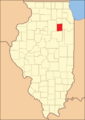
Grundy County when it was first created in 1841

Geography of Grundy County
Grundy County covers a total area of 430 square miles. Most of this area, 418 square miles, is land. The remaining 12 square miles, which is about 2.9%, is covered by water.
Climate and Weather
The weather in Grundy County changes with the seasons. In the county seat of Morris, average temperatures in January are around 13°F. In July, they can reach about 85°F. The coldest temperature ever recorded was -24°F in January 1985. The hottest was 103°F in June 1988.
The amount of rain and snow also changes throughout the year. February usually has the least amount of precipitation, about 1.59 inches. June typically has the most, with about 4.16 inches.
Major Highways
Several important roads pass through Grundy County:
 I-55
I-55 I-80
I-80 US 6
US 6 US 66
US 66 IL 17
IL 17 IL 47
IL 47 IL 53
IL 53 IL 113
Adjacent Counties
Grundy County shares its borders with five other counties:
- Kendall (to the north)
- Will (to the east)
- Kankakee (to the southeast)
- Livingston (to the south)
- LaSalle (to the west)
Population of Grundy County
| Historical population | |||
|---|---|---|---|
| Census | Pop. | %± | |
| 1850 | 3,023 | — | |
| 1860 | 10,379 | 243.3% | |
| 1870 | 14,938 | 43.9% | |
| 1880 | 16,732 | 12.0% | |
| 1890 | 21,024 | 25.7% | |
| 1900 | 24,136 | 14.8% | |
| 1910 | 24,162 | 0.1% | |
| 1920 | 18,580 | −23.1% | |
| 1930 | 18,678 | 0.5% | |
| 1940 | 18,398 | −1.5% | |
| 1950 | 19,217 | 4.5% | |
| 1960 | 22,350 | 16.3% | |
| 1970 | 26,535 | 18.7% | |
| 1980 | 30,582 | 15.3% | |
| 1990 | 32,337 | 5.7% | |
| 2000 | 37,535 | 16.1% | |
| 2010 | 50,063 | 33.4% | |
| 2020 | 52,533 | 4.9% | |
| 2023 (est.) | 53,578 | 7.0% | |
| U.S. Decennial Census 1790-1960 1900-1990 1990-2000 2010 |
|||
In 2010, there were 50,063 people living in Grundy County. The population density was about 119.8 people per square mile. The average age of people living here was 36.1 years old.
The median income for a household in the county was $64,297. This means half of the households earned more than this amount, and half earned less. For families, the median income was $75,000.
Communities in Grundy County

Grundy County has one city and several villages. It also has many townships, which are smaller local government areas.
City
Villages
- Braceville
- Carbon Hill
- Channahon (part)
- Coal City (part)
- Diamond (part)
- Dwight (part)
- East Brooklyn
- Gardner
- Godley (part)
- Kinsman
- Mazon
- Minooka (mostly)
- Seneca (part)
- South Wilmington
- Verona
Former Communities
Townships
Grundy County is divided into seventeen townships:
- Aux Sable
- Braceville
- Erienna
- Felix
- Garfield
- Goodfarm
- Goose Lake
- Greenfield
- Highland
- Maine
- Mazon
- Morris
- Nettle Creek
- Norman
- Saratoga
- Vienna
- Wauponsee
Unincorporated communities
See also
- In Spanish: Condado de Grundy (Illinois) para niños
