
Kendall County, Illinois facts for kids
Quick facts for kids
Kendall County
|
|
|---|---|

|
|

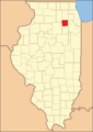
Location within the U.S. state of Illinois
|
|
 Illinois's location within the U.S. |
|
| Country | |
| State | |
| Founded | 1841 |
| Named for | Amos Kendall |
| Seat | Yorkville |
| Largest village | Oswego |
| Area | |
| • Total | 322 sq mi (830 km2) |
| • Land | 320 sq mi (800 km2) |
| • Water | 2.0 sq mi (5 km2) 0.61% |
| Population
(2020)
|
|
| • Total | 131,869 |
| • Density | 412/sq mi (159/km2) |
| Time zone | UTC−6 (Central) |
| • Summer (DST) | UTC−5 (CDT) |
| Congressional district | 14th |

Kendall County is a cool place in Illinois, USA. It's part of the big Chicago metropolitan area. In 2020, about 131,869 people lived here. Its main town, called the county seat, is Yorkville. The town with the most people is Oswego.
Kendall County grew super fast between 2000 and 2010. It was the fastest-growing county in the whole United States!
History
Kendall County was created in 1841. It was formed from parts of LaSalle and Kane Counties.
The county got its name from Amos Kendall. He was an important person who advised President Andrew Jackson. Amos Kendall also became the U.S. Postmaster General in 1835. This job meant he was in charge of all the mail in the country.
Early Settlers and Native American Tribes
Before European settlers arrived, different Native American tribes lived in this area. These included the Potawatomi, Fox, and Kickapoo tribes. They had villages along the Fox River. They found food by hunting, fishing, and farming. Their way of life influenced the first European settlers.
Pioneer Life and New Towns
The first European-American settlers came in the 1820s. Many came from New England and New York. They liked the rich soil and many waterways here. These early pioneers faced tough challenges. They dealt with cold winters, prairie fires, and sometimes conflicts with Native American tribes.
Even with these problems, they built homes and farms. Small communities started to grow. Towns like Newark, Lisbon, and Plattville began to form. These towns became places for trade and social gatherings.
The Underground Railroad
Kendall County played a big part in the Underground Railroad. This was a secret network of safe routes and houses. Enslaved African Americans used it to escape to free states and Canada. Many people in the area strongly believed in ending slavery. They helped runaway slaves.
Families like the Lewis and Sackett families in Oswego offered safe places. They risked their own safety to help people find freedom.
Civil War Contributions
During the American Civil War, Kendall County helped the Union side a lot. Hundreds of local men joined the Union Army. They served in groups like the 36th and 104th Illinois Volunteer Infantry Regiments.
People in Kendall County also helped in other ways. They organized relief efforts and raised money. They supported the families of soldiers who were fighting.
Industry and Economic Growth
In the late 1800s and early 1900s, Kendall County became more industrial. New railroads were built, like the Chicago, Burlington and Quincy Railroad. These railroads helped the economy grow. They made it easier to move goods and materials.
Factories and mills appeared in towns like Yorkville, Plano, and Sandwich. These places made farm tools, machines, and other products.
Importance of Agriculture
Farming was very important to Kendall County's economy for a long time. The county has rich soil and good weather for growing crops. Farmers grew corn and soybeans. They also produced dairy products.
Family farms and farming groups were key to supporting rural communities. They provided food and goods for cities.
Suburban Growth
After World War II, Kendall County's population grew a lot. More people moved to the suburbs across the U.S. Better roads, like Interstate 88 and Interstate 55, made it easy to travel to Chicago.
New neighborhoods and housing areas were built all over the county. They offered a quieter life for the growing population.
Geography
The U.S. Census Bureau says Kendall County covers about 322 square miles. Most of this, 320 square miles, is land. Only 2.0 square miles (0.6%) is water.
Kendall County is small but growing fast. Most people live in the northeast and along the Fox River. The Fox River is the only river in the county. It flows through the northwestern part. Many new neighborhoods have been built here, causing the population to grow a lot.
The southern part of Kendall County is still mostly farmland. The county has two main ranges of low hills. These hills were formed by something called an end moraine. The Ransom moraine is bigger. It runs through the west and north-central parts of the county. This moraine creates higher spots, over 800 feet tall. In southern Kendall County, the land drops to below 500 feet.
The Minooka moraine is the other main ridge. It runs along the eastern border with Will County. These two moraines meet almost at a right angle in Oswego township. The county's only state park is Silver Springs State Fish and Wildlife Area.
Climate and Weather
| Weather chart for Yorkville, Illinois | |||||||||||||||||||||||||||||||||||||||||||||||
|---|---|---|---|---|---|---|---|---|---|---|---|---|---|---|---|---|---|---|---|---|---|---|---|---|---|---|---|---|---|---|---|---|---|---|---|---|---|---|---|---|---|---|---|---|---|---|---|
| J | F | M | A | M | J | J | A | S | O | N | D | ||||||||||||||||||||||||||||||||||||
|
1.6
29
10
|
1.5
35
16
|
2.6
46
26
|
3.9
59
36
|
3.9
71
46
|
4.3
81
56
|
4.4
84
61
|
4.4
82
58
|
3.5
75
50
|
2.7
63
38
|
3.2
47
28
|
2.4
34
16
|
||||||||||||||||||||||||||||||||||||
| temperatures in °F precipitation totals in inches source: The Weather Channel |
|||||||||||||||||||||||||||||||||||||||||||||||
|
Metric conversion
|
|||||||||||||||||||||||||||||||||||||||||||||||
In Yorkville, the main town, temperatures change a lot. In January, it can be as cold as 10°F. In July, it can get as hot as 84°F. The coldest temperature ever recorded was -26°F in January 1985. The hottest was 111°F in July 1936.
The amount of rain and snow also changes. February usually gets about 1.52 inches of precipitation. July gets the most, around 4.39 inches.
Major Roads
 Interstate 80
 U.S. Highway 30
 U.S. Highway 34
 U.S. Highway 52
 Illinois Route 25
 Illinois Route 31
 Illinois Route 47
 Illinois Route 71
 Illinois Route 126
Neighboring Counties
- DeKalb County - northwest
- Kane County - north
- DuPage County - northeast
- Will County - east
- Grundy County - south
- LaSalle County - west
Population Information
| Historical population | |||
|---|---|---|---|
| Census | Pop. | %± | |
| 1850 | 7,730 | — | |
| 1860 | 13,074 | 69.1% | |
| 1870 | 12,399 | −5.2% | |
| 1880 | 13,083 | 5.5% | |
| 1890 | 12,106 | −7.5% | |
| 1900 | 11,467 | −5.3% | |
| 1910 | 10,777 | −6.0% | |
| 1920 | 10,074 | −6.5% | |
| 1930 | 10,555 | 4.8% | |
| 1940 | 11,105 | 5.2% | |
| 1950 | 12,115 | 9.1% | |
| 1960 | 17,540 | 44.8% | |
| 1970 | 26,374 | 50.4% | |
| 1980 | 37,202 | 41.1% | |
| 1990 | 39,413 | 5.9% | |
| 2000 | 54,544 | 38.4% | |
| 2010 | 114,736 | 110.4% | |
| 2020 | 131,869 | 14.9% | |
| 2023 (est.) | 139,976 | 22.0% | |
| U.S. Decennial Census 1790-1960 1900-1990 1990-2000 2010 2020 |
|||

In 2010, about 114,736 people lived in Kendall County. There were 38,022 households, which are groups of people living together. The population density was about 358 people per square mile.
Most people in the county were White (83.6%). There were also African American (5.7%), Asian (3.0%), and Native American (0.3%) residents. About 15.6% of the population was of Hispanic or Latino origin.
Many families in Kendall County (47.9%) had children under 18 living with them. Most households (65.8%) were married couples. The average household had about 3 people. The average family had about 3.4 people. The average age of people in the county was 32.9 years old.
The average income for a household was $79,897. For families, it was $87,309. About 3.9% of all people in the county lived below the poverty line. This means they had very low incomes.
Kendall County was the fastest-growing county in the U.S. from 2000 to 2009. Its population grew by over 110%! This happened because many people moved from the Chicago area to the suburbs here.
Communities
Cities
Villages
- Lisbon
- Millbrook
- Millington (mostly)
- Minooka (mostly)
- Montgomery (part)
- Newark
- Oswego (mostly)
- Plainfield (part)
- Plattville
Census-designated place
Other Unincorporated Communities
- Ament Corners
- Bristol
- Fox
- Helmar
- Little Rock
Townships
Kendall County is shaped like a square, about 18 miles on each side. It is divided into 9 smaller areas called townships. Each township is usually divided into 36 one-mile-square sections.
However, the Fox River acts as a border for some townships. This makes Bristol the smallest township. The extra land was given to Oswego and Kendall Townships. Also, there were two special land grants from an old treaty in 1829. These were the Mo-Ah-Way Reservation and the Waish-Kee-shaw Reservation. These areas were later sold to European settlers.
- Big Grove Township
- Bristol Township
- Fox Township
- Kendall Township
- Lisbon Township
- Little Rock Township
- Na-au-say Township
- Oswego Township
- Seward Township
Education
Kendall County has several school districts:
- Lisbon Community Consolidated School District 90
- Newark Community Consolidated School District 66
- Newark Community High School District 18
- Oswego Community Unit School District 308
- Plano Community Unit School District 88
- Yorkville Community Unit School District 115
- School District #101
- School District #201
- School District #202
- School District #429
- School District #430 (Sandwich Community School District #430)
For college, the northern part of the county is served by Waubonsee Community College. It has campuses in Sugar Grove, Aurora, and Plano. The southern part of the county is served by Joliet Junior College in Joliet.
Images for kids
-
Kendall County when it was first created in 1841.

See also
 In Spanish: Condado de Kendall (Illinois) para niños
