
Livingston County, Illinois facts for kids
Quick facts for kids
Livingston County
|
|
|---|---|

|
|

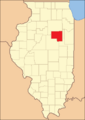
Location within the U.S. state of Illinois
|
|
 Illinois's location within the U.S. |
|
| Country | |
| State | |
| Founded | 1837 |
| Named for | Edward Livingston |
| Seat | Pontiac |
| Largest city | Pontiac |
| Area | |
| • Total | 1,046 sq mi (2,710 km2) |
| • Land | 1,044 sq mi (2,700 km2) |
| • Water | 1.6 sq mi (4 km2) 0.2% |
| Population
(2020)
|
|
| • Total | 35,815 |
| • Estimate
(2021)
|
35,664 |
| • Density | 34.240/sq mi (13.220/km2) |
| Time zone | UTC−6 (Central) |
| • Summer (DST) | UTC−5 (CDT) |
| Congressional districts | 2nd, 16th |
Livingston County is a county located in the U.S. state of Illinois. In 2020, about 35,815 people lived there. The main town and county seat is Pontiac. Livingston County is part of a larger area called the Bloomington-Pontiac Combined Statistical Area in central Illinois.
Contents
History of Livingston County
Livingston County was created on February 27, 1837. It was formed from parts of three other counties: McLean, LaSalle, and Iroquois.
The county was named after Edward Livingston. He was a very important politician. Edward Livingston was once the mayor of New York City. He also represented New York and later Louisiana in the U.S. Congress. He even worked for President Andrew Jackson as his Secretary of State. Later, he became the U.S. Ambassador to France. Even though he had no direct ties to Illinois, the state's leaders thought he was accomplished enough to name a county after him.
-
Livingston County when it was first created in 1837.

Geography and Climate
According to the U.S. Census Bureau, Livingston County covers about 1,046 square miles. Most of this area, about 1,044 square miles, is land. Only a small part, about 1.6 square miles, is water. This makes Livingston County the fourth-largest county in Illinois by land area.
Weather in Livingston County
| Weather chart for Pontiac, Illinois | |||||||||||||||||||||||||||||||||||||||||||||||
|---|---|---|---|---|---|---|---|---|---|---|---|---|---|---|---|---|---|---|---|---|---|---|---|---|---|---|---|---|---|---|---|---|---|---|---|---|---|---|---|---|---|---|---|---|---|---|---|
| J | F | M | A | M | J | J | A | S | O | N | D | ||||||||||||||||||||||||||||||||||||
|
1.6
30
14
|
1.4
36
18
|
2.8
48
29
|
3.4
62
39
|
3.8
73
50
|
4.1
82
60
|
4.1
85
64
|
3.6
83
62
|
3
77
54
|
2.7
65
42
|
3
49
31
|
2.5
35
20
|
||||||||||||||||||||||||||||||||||||
| temperatures in °F precipitation totals in inches source: The Weather Channel |
|||||||||||||||||||||||||||||||||||||||||||||||
|
Metric conversion
|
|||||||||||||||||||||||||||||||||||||||||||||||
The weather in Livingston County changes with the seasons. In Pontiac, the county seat, average temperatures in January are around 14°F (about -10°C). In July, they can reach up to 85°F (about 29°C).
The coldest temperature ever recorded was -24°F (-31°C) in January 1927. The hottest was 108°F (42°C) in July 1936. The county gets the most rain in June, with about 4.11 inches (104 mm). February is usually the driest month, with about 1.44 inches (37 mm) of rain.
Transportation in the County
Livingston County has several ways to get around.
- SHOW Bus
- Pontiac station (for trains)
Main Roads
Many important roads pass through Livingston County:
 Interstate 55
 U.S. Highway 24
 U.S. Highway 66
 Illinois Route 17
 Illinois Route 18
 Illinois Route 23
 Illinois Route 47
 Illinois Route 116
 Illinois Route 170
Neighboring Counties
Livingston County shares borders with several other counties:
- LaSalle County - to the northwest
- Grundy County - to the north
- Kankakee County - to the northeast
- Ford County - to the southeast
- McLean County - to the southwest
- Woodford County - to the west
Population Information
| Historical population | |||
|---|---|---|---|
| Census | Pop. | %± | |
| 1840 | 759 | — | |
| 1850 | 1,552 | 104.5% | |
| 1860 | 11,637 | 649.8% | |
| 1870 | 31,471 | 170.4% | |
| 1880 | 38,450 | 22.2% | |
| 1890 | 38,455 | 0.0% | |
| 1900 | 42,035 | 9.3% | |
| 1910 | 40,465 | −3.7% | |
| 1920 | 39,070 | −3.4% | |
| 1930 | 39,092 | 0.1% | |
| 1940 | 38,838 | −0.6% | |
| 1950 | 37,809 | −2.6% | |
| 1960 | 40,341 | 6.7% | |
| 1970 | 40,690 | 0.9% | |
| 1980 | 41,381 | 1.7% | |
| 1990 | 39,301 | −5.0% | |
| 2000 | 39,678 | 1.0% | |
| 2010 | 38,950 | −1.8% | |
| 2020 | 35,815 | −8.0% | |
| 2023 (est.) | 35,320 | −9.3% | |
| U.S. Decennial Census 1790-1960 1900-1990 1990-2000 2010-2013 |
|||
In 2010, there were 38,950 people living in Livingston County. Most people were white (about 91.8%). Other groups included black or African American (4.9%), Asian (0.5%), and American Indian (0.2%). About 3.9% of the population was of Hispanic or Latino background.
Many families in the county have German (36.6%), Irish (17.2%), or English (10.7%) roots. About 30.7% of homes had children under 18 living there. The average age of people in the county was 40.8 years old.
Towns and Villages
Livingston County has several cities, towns, and villages where people live.
Cities
Town
Villages
Townships
Livingston County is divided into thirty smaller areas called townships:
- Amity
- Avoca
- Belle Prairie
- Broughton
- Charlotte
- Chatsworth
- Dwight
- Eppards Point
- Esmen
- Fayette
- Forrest
- Germanville
- Indian Grove
- Long Point
- Nebraska
- Nevada
- Newtown
- Odell
- Owego
- Pike
- Pleasant Ridge
- Pontiac
- Reading
- Rooks Creek
- Round Grove
- Saunemin
- Sullivan
- Sunbury
- Union
- Waldo
Unincorporated Communities
These are smaller places that are not officially cities, towns, or villages.
Famous People from Livingston County
Many interesting people have lived in Livingston County:
- Donald Attig – a businessman and adventurer.
- Libbie Beach Brown (1858-1924) – a kind person who helped others and worked for temperance.
- Calistus Bruer – an Illinois state representative and farmer.
- M. C. Eignus – an Illinois state representative.
- Moira Harris – an actress, married to actor Gary Sinise.
- William Harris – the first President of the Illinois Senate.
- Irene Hunt – an author who won the Newbery Medal for her books.
- Francis Townsend – a doctor and activist who helped create the U.S. Social Security program.
- Skottie Young – a comic book artist known for his Oz series. He was born and grew up in Fairbury.
See also
 In Spanish: Condado de Livingston (Illinois) para niños
