El Paso, Illinois facts for kids
Quick facts for kids
El Paso, Illinois
|
|
|---|---|
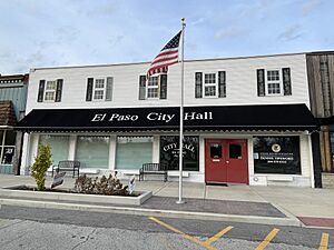
City hall
|
|
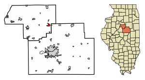
Location in Woodford County, Illinois
|
|
| Country | United States |
| State | Illinois |
| Counties | Woodford, McLean |
| Townships | El Paso, Gridley |
| Area | |
| • Total | 2.15 sq mi (5.56 km2) |
| • Land | 2.15 sq mi (5.56 km2) |
| • Water | 0.00 sq mi (0.00 km2) |
| Elevation | 748 ft (228 m) |
| Population
(2020)
|
|
| • Total | 2,756 |
| • Density | 1,284.85/sq mi (496.04/km2) |
| Time zone | UTC-6 (CST) |
| • Summer (DST) | UTC-5 (CDT) |
| ZIP code |
61738
|
| Area code(s) | 309 |
| FIPS code | 17-23737 |
| FIPS code | 17-23737 |
| GNIS ID | 2394632 |
| Wikimedia Commons | El Paso, Illinois |
El Paso is a city in Illinois, located in Woodford and McLean counties. In 2020, about 2,756 people lived there. The part of El Paso in Woodford County is part of the larger Peoria area, which is a group of connected cities and towns.
El Paso is a small town in central Illinois. It became more of a highway town after Interstate 39 was built. This new highway replaced the older U.S. Highway 51. The city's location was very important in the 1800s. It was where the Illinois Central Railroad and the Toledo, Peoria, and Western Railroad crossed. This made El Paso a key place for trade and business.
In February 2022, El Paso was in the news because of a big car crash. About 100 cars piled up on Interstate 39 near the city. The highway had to close for 12 hours.
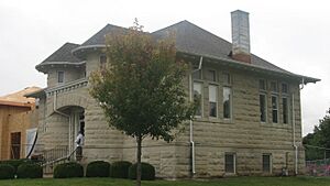
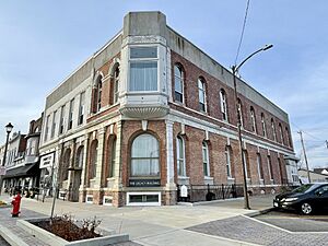
El Paso is also home to the El Paso District Library, which was built in 1907. It is a Carnegie library, named after Andrew Carnegie who helped build many libraries. The city also has the Legacy Building, built in 1874. It now holds local businesses and the Project XV Museum. El Paso's history and location help make it a special place.
Contents
El Paso's History: From Railroads to Today
El Paso was started by George Gibson and James Wathen. Gibson gave it the Spanish name El Paso. He may have named it after El Paso, Texas, or because of a nearby railroad crossing.
How Railroads Shaped El Paso
In the 1800s, El Paso's location was very important. It was where two major railroads, the Illinois Central and the Toledo, Peoria, and Western, crossed. This helped the city grow into a busy trade center. The Illinois Central Railroad brought many businesses and people to the area. This helped the economy grow and connected El Paso to bigger cities. This connection helped El Paso expand in the late 1800s. It boosted both business and social life.
Trying to Become a County Seat
In 1867, El Paso tried to become the main city, or "county seat," of Woodford County. They offered $30,000 to Metamora to give up the title. A vote was very close, and at first, El Paso seemed to win. But a recount changed the decision by just ten votes. Over the years, several towns, including Eureka, El Paso, and Roanoke, wanted to be the county seat. Eureka finally became the county seat in 1894. During this time, El Paso's growing business area was supported by shops along its newly paved Front Street. This street became a key part of the city's identity.
Important Buildings and Streets
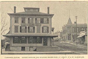
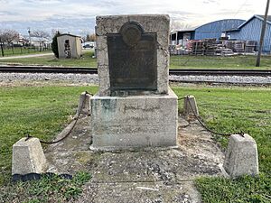
The Campbell House in El Paso was built in 1854 by William Campbell. He was an early settler and an important local person. The house was a key stop for stagecoaches traveling on the Peoria and Bloomington Road. This house is now a historic landmark. It shows the pioneering spirit of the area and how the city first grew. A memorial at the house honors the Campbell family. It celebrates their role in shaping the community.
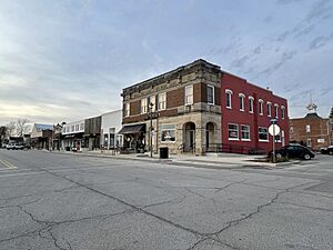
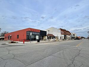
In 1869, a map by Albert Ruger showed El Paso's early buildings. It highlighted its growing streets and churches, like the Baptist Church from 1864. This map shows El Paso as a growing town with a busy railroad crossing at its heart. By the late 1800s, Front Street was the main business area. A big project in 1894 rebuilt the street with brick roads and new shops. This made it a very busy center for trade. The Eagle Block Building, built in 1874, was also a key social spot. It had businesses, a library, and even the city's opera house. Today, Front Street still has its historic charm. It is a vital part of the community, with new sidewalks added in 2022.
Education in El Paso's Past
Education was very important in El Paso's growth. By 1878, Panola Township had ten school districts. These districts had a total of 480 students. This shows how much the community cared about education early on. In 1948, Unit School District 375 was formed. This helped organize schools better. New school buildings also helped support the growing number of people. El Paso also showed its commitment to learning by building the Carnegie library in 1907. This library was a key place for public education and community learning. It still helps people of all ages to read, learn, and grow.
These historic places and changes show how El Paso grew. It went from a railroad crossing to a busy community. It is rich in culture, education, and business. Keeping buildings like the Campbell House and the Eagle Block Building helps remember the town's history. Front Street and the El Paso Public Library are still important today. They make sure the legacy of this pioneering town is remembered for many years.
Where is El Paso Located?
El Paso is in southeastern Woodford County. Its exact location is 40.738800 degrees North and -89.016034 degrees West. A small part of the city also reaches east into northern McLean County along U.S. Route 24. Route 24 goes east about 15 miles to Interstate 55 in Chenoa. It goes west about 32 miles to Peoria.
Interstate 39 runs along the west side of El Paso. You can get on it from Exit 14 (US 24). This highway goes south about 14 miles to Interstate 55 in Normal. It goes north about 45 miles to La Salle. Illinois Route 251 follows the old path of U.S. Route 51 through the middle of El Paso. It goes north about 11 miles to Minonk and south about 5 miles to Kappa.
The U.S. Census Bureau says El Paso covers about 2.15 square miles, and it's all land. The city is on high ground. Water from the city flows north to the East Branch of Panther Creek. It also flows south to the start of Wolf Creek. Both of these creeks flow south into the Mackinaw River. The Mackinaw River is part of the Illinois River system.
El Paso has a climate with warm, humid summers and cold, snowy winters. In July, the average high temperature is around 85.6°F. In January, the average low is about 15°F. The city gets about 35 inches of rain each year, mostly from April to October. It also gets about 13 inches of snow each year. The city is about 499 feet above sea level. El Paso's location places it within the Peoria Metropolitan Statistical Area. This helps connect it to the wider region.
Who Lives in El Paso?
| Historical population | |||
|---|---|---|---|
| Census | Pop. | %± | |
| 1860 | 890 | — | |
| 1870 | 1,564 | 75.7% | |
| 1880 | 1,390 | −11.1% | |
| 1890 | 1,353 | −2.7% | |
| 1900 | 1,441 | 6.5% | |
| 1910 | 1,470 | 2.0% | |
| 1920 | 1,638 | 11.4% | |
| 1930 | 1,578 | −3.7% | |
| 1940 | 1,621 | 2.7% | |
| 1950 | 1,818 | 12.2% | |
| 1960 | 1,964 | 8.0% | |
| 1970 | 2,291 | 16.6% | |
| 1980 | 2,676 | 16.8% | |
| 1990 | 2,499 | −6.6% | |
| 2000 | 2,695 | 7.8% | |
| 2010 | 2,810 | 4.3% | |
| 2020 | 2,756 | −1.9% | |
| U.S. Decennial Census | |||
In 2020, the city of El Paso, Illinois, had 2,756 people living there. This means there were about 1,284 people per square mile. Most of the people, about 95%, were White. About 2% were African American, and about 1% were Asian. Some people identified as two or more races. About 2% of the population were Hispanic or Latino.
The average age in El Paso was 35.3 years old. Males had an average age of 30.3 years, and females had an average age of 38.9 years. The median household income in El Paso was $70,063. This means half of the households earned more than this, and half earned less. About 4.7% of families lived below the poverty line.
The population is spread out among different age groups. About 9% are under 10 years old. About 16% are aged 10–17. About 15% are 65 and older. Most residents, about 97%, were born in the U.S.
Schools in El Paso
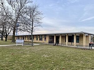
El Paso's school district is called CUSD #11. It joined with the school district of Gridley, IL. The schools in CUSD #11 are in both El Paso and Gridley:
- El Paso Gridley High School: This school is for all high school students in the district.
- El Paso Gridley Junior High School: This school is for students in grades 5, 6, 7, and 8.
- Centennial School: This school is for elementary students in grades 3 and 4.
- Jefferson Park: This school is for preschool, kindergarten, and elementary students in grades 1 and 2.
A Look at El Paso's School History
Education in El Paso has changed a lot since the mid-1800s. The first school in the area was taught by Reverend Abner Peeler in 1850. By 1857, El Paso built its first schoolhouse. Henry Hewitt was the first teacher there.
By 1859, the Illinois Central Railroad tracks split the city into East and West sides. This led to two separate school districts. The East Side school was built in 1869 and finished in 1870. It was later named McKinley School.
Both schools first offered two-year high school programs. The East Side school had its first high school graduate in 1874. By 1893, both schools had expanded to offer four-year high school courses. In 1910, all high school programs moved to Jefferson Park. However, the grade schools stayed separate until 1944.
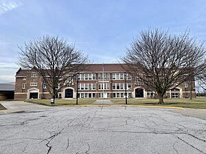
El Paso Township High School District #375 was created in 1916 after voters approved it. A new brick high school was built in 1921. It had modern features like an auditorium and a gym.
In 1948, El Paso Community Unit District #375 was formed. This joined the high school and grade school districts. The district grew to include nearby areas like Secor. Many small, one-room country schools were closed. Students were then bused to bigger schools in El Paso.
In March 2004, voters approved combining El Paso Unit #375 with Gridley Unit #10. This created the El Paso-Gridley Community Unit School District 11. This new district started on July 1, 2004. The high school is in El Paso, and the junior high is in Gridley. Today, the district serves students in Woodford, McLean, and Livingston counties. It continues a long history of educational progress.
Other Schools and Learning Options
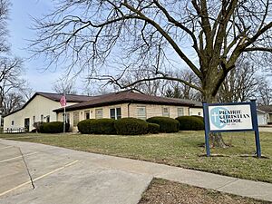
Prairie Christian School in El Paso started in 1991. It offers a Christian learning environment for students from kindergarten through eighth grade. It began with 10 students and two teachers. Over the years, the school has added more buildings, including a gym in 2002.
Families who homeschool in El Paso can find help and resources. The El Paso District Library has information about state rules for homeschooling. It also connects families to homeschooling groups. The library hosts events for homeschoolers, creating a supportive place for students learning at home.
Fun Things to Do in El Paso
El Paso has many places to visit and enjoy. These places show the city's history and culture.
Popular Attractions in El Paso
- El Paso Public Library: A Carnegie library built in 1907.
- Archbishop Fulton John Sheen Spiritual Centre: A place honoring a famous religious leader.
- The Legacy Building and Project XV Museum: Historic buildings with shops and a museum about voting rights.
- Illinois Central Railroad and Toledo, Peoria, and Western Railroad Freight House: An old train station.
- El Paso Golf Club: A place for golfing.
El Paso District Library: A Place to Learn
The El Paso District Library has a long history. It started in 1873 when a group of women created a volunteer library. In 1906, they received money from Andrew Carnegie. This led to the building of a beautiful two-story library.
The library has served the community for over 100 years. It is in Jefferson Park, close to the elementary, middle, and high schools. It has been a key place for learning, offering books and services to everyone. It helps people of all ages love reading.
In 2010, the library decided to expand. They needed more space for books and to make it easier for everyone to use. They raised money in 2012 and 2013. Construction started in 2013. The expanded library opened on May 3, 2014, with many community members celebrating. This expansion was paid for only by grants and donations.
The new part of the library added many improvements. It became fully accessible for everyone. It had more space for books and technology. There were separate rooms for library programs and quiet study. It also had special areas to store and show El Paso's history. Some notable rooms include the Edward and Marjory Heiken Children’s Room and the Lester Pfister History and Genealogy Room.
Today, the El Paso District Library is still a central gathering place. It continues to help people learn and grow.
The Legacy Building and Project XV Museum
The Legacy Building is at 1 West Front Street in El Paso. It was first built in 1874 as the Eagle Block Building. This historic building has been used for many things. It held the American Dairy Association, the First National Bank, and even the city's opera house. In 1894, a big fire destroyed much of Front Street, including the original building. But the bank's vault survived the fire. The building was rebuilt in 1895.
Today, the Legacy Building has several local businesses. These include Can Do Kids International and Heirloom Photography. It also has The Legacy Opera House, which can hold up to 200 guests. It is a popular place for weddings and special events.
Next to the Legacy Building is the Project XV Museum. This museum honors the history of voting rights in the United States. The museum is named after the 15th Amendment. This amendment gave African American men the right to vote. A special exhibit focuses on David A. Strother. He was a local barber who became the first African American to vote in Illinois in 1870. The museum teaches people about the important history of voting rights.
The Legacy Building and the Project XV Museum are important cultural and historical places in El Paso. They help preserve the town's rich heritage and teach about voting rights.
The Old Train Station: A Hub of History
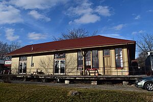
The Illinois Central Railroad and Toledo, Peoria, and Western Railroad Freight House is at 8-10 East Front Street. Locals called it "The Depot." It was a key transportation center for both railroads. El Paso was founded in the 1850s by landowners who wanted to secure the spot where these two major train lines crossed. This was a big moment for the city's growth. The depot was built in 1889-90 after the first building was destroyed. It was very important for shipping farm products and helping the local economy.
The depot was used for many years. It was a cornerstone of the city's economy until train travel started to decline in the 1930s. It stopped being used completely by the 1960s. Even after it closed, it was the longest-surviving building connected to both railroads until it was moved.
The freight depot was recognized as historically important in 1994. It was listed on the National Register of Historic Places. Even though it was moved to 17 East Main Street, it is still on the register. This helps remember its role in the city's development. The depot was once a busy place. It shows how important railroads were to the economy of the American Midwest in the late 1800s and early 1900s.
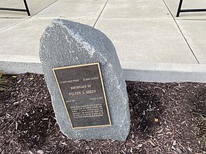
In 2000, the building got a new purpose. It became the Archbishop Fulton John Sheen Spiritual Centre. Archbishop Sheen was born in El Paso in 1895. He was a famous Catholic leader known for his TV shows. The center has exhibits about his life and work. These include his 1953 Emmy Award, magazines, photos, and videos. The center helps keep his memory alive and teaches visitors about his contributions. The restored depot has become a place of inspiration and reflection for people from all over the country.
Parks and Outdoor Fun in El Paso
El Paso has several public parks. They offer places for fun and green spaces for everyone. These parks are centers for community events and outdoor activities. They show the city's dedication to making life better for its residents. The parks have a mix of history and modern features, from old bandstands to new playgrounds.
Jefferson Park: A Historic Green Space
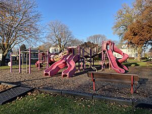
Jefferson Park is one of El Paso's first parks. It was given to the city by James Wathen when the city was being planned. In 1877, an iron fence was put around the park to keep out wandering cattle. The park also had a bandstand, which was a popular spot for community events and summer concerts. The fence was removed in 1904, but the bandstand stayed until the 1930s. In 1912, diagonal walking paths were added, paid for by community donations. Each square had a donor's name. In 1913, ornamental lights were added. In 1914, a big project added 227 wagonloads of dirt to improve the park. Today, Jefferson Park is still a green space for public use. It has picnic tables, playground equipment, and flower beds.
Franklin Park: The "Elephant Park"
Franklin Park was also one of the city's first parks. It was given by the Gibson family. Like Jefferson Park, it had an iron fence in 1877. It also got diagonal walking paths in 1912. During the 1914 community improvement project, 536 wagonloads of dirt were added to raise the park's ground level. Over time, more features were added, like drinking fountains, playground equipment, and flower beds. Franklin Park is nicknamed "Elephant Park" because of its famous elephant slide. It is still a beloved place for fun in El Paso.
Corn Belt Park: From Dump to Park
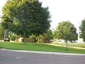
Corn Belt Park was created in 1951 on an old city dump site. It has become a central recreation area in El Paso. In 1959, a tennis court was built, which also served as a winter ice skating rink. In 1965, a shelter was added by the El Paso Junior Chamber of Commerce. In 1956, the park grew by adding three blocks of old railroad land. This created a parkway from Front Street to the high school. Public restrooms were planned in 1974. Corn Belt Park has brick fireplaces, picnic areas, and open green spaces. This makes it a useful community park.
South Pointe Park: Modern Recreation
South Pointe Park is on the southern edge of El Paso. It has modern recreation facilities. These include walking trails, sports fields, and playgrounds. We don't know the exact date it was established. But the park shows that the city wants to provide outdoor spaces for community activities and fun.
Bike Trail & Walking Path: A Path Through Town
The Bike Trail & Walking Path is a 5.4-mile path for walking and biking. It goes from about 1.5 miles north of El Paso to South Pointe Park. It effectively cuts through the middle of the community. The trail was built along an old railroad path. It offers a flat, easy route for both cyclists and walkers. The trail starts at South Pointe Park on the south side of the city. It goes through El Paso and ends near a creek north of town, among farm fields. Turning the old railway into a recreational path shows the city's commitment to reusing old structures for community benefit. The trail gives residents and visitors a nice route for exercise and fun.
Famous People from El Paso
- Chick Evans: A college sports coach who grew up in El Paso.
- Byron Keith: An actor known for his roles in TV shows like Batman (TV series) and 77 Sunset Strip. He was born in El Paso.
- Bern Shanks: A person who works to protect nature.
- Fulton J. Sheen: A Catholic archbishop and TV preacher. He was born in El Paso.
- David A. Strother: A voting rights activist who lived and died in El Paso.
- Elsa Swartz: A composer and music teacher who was born in El Paso.
- Ryan Unzicker: A racing driver who was born in El Paso.
- Clifford J. Vogelsang: An Illinois state senator, judge, and lawyer. He was born in El Paso.
See also
 In Spanish: El Paso (Illinois) para niños
 | Dorothy Vaughan |
 | Charles Henry Turner |
 | Hildrus Poindexter |
 | Henry Cecil McBay |


