
Logan County, Illinois facts for kids
Quick facts for kids
Logan County
|
|
|---|---|

Logan County Courthouse
|
|

Location within the U.S. state of Illinois
|
|
 Illinois's location within the U.S. |
|
| Country | |
| State | |
| Founded | February 15, 1839 |
| Named for | John A. Logan |
| Seat | Lincoln |
| Largest city | Lincoln |
| Area | |
| • Total | 619 sq mi (1,600 km2) |
| • Land | 618 sq mi (1,600 km2) |
| • Water | 0.9 sq mi (2 km2) 0.1% |
| Population
(2020)
|
|
| • Total | 27,987 |
| • Estimate
(2021)
|
27,992 |
| • Density | 45.21/sq mi (17.457/km2) |
| Time zone | UTC−6 (Central) |
| • Summer (DST) | UTC−5 (CDT) |
| Congressional district | 15th |
Logan County is a county in the state of Illinois, USA. It's like a special area within the state. In 2020, about 27,987 people lived there. The main town, or county seat, where the county government is located, is Lincoln.
Logan County is part of a larger area called the Lincoln, IL Micropolitan Statistical Area. This area is also connected to the bigger Springfield-Jacksonville-Lincoln, IL area.
Contents
History of Logan County
Logan County was created in 1839. It was named after a doctor and politician named John Logan. He was the father of a famous general, John Alexander Logan, who fought in the American Civil War.
-
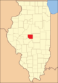
Logan County when it was first created in 1839
-
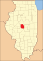
Logan County's shape changed a bit between 1841 and 1845
-

In 1845, part of Dewitt County joined Logan County, making it the size it is today


Geography of Logan County
Logan County covers a total area of about 619 square miles (1,603 square kilometers). Most of this area, about 618 square miles (1,601 square kilometers), is land. Only a tiny part, about 0.9 square miles (2.3 square kilometers), is water.
Climate and Weather in Logan County
| Weather chart for Lincoln, Illinois | |||||||||||||||||||||||||||||||||||||||||||||||
|---|---|---|---|---|---|---|---|---|---|---|---|---|---|---|---|---|---|---|---|---|---|---|---|---|---|---|---|---|---|---|---|---|---|---|---|---|---|---|---|---|---|---|---|---|---|---|---|
| J | F | M | A | M | J | J | A | S | O | N | D | ||||||||||||||||||||||||||||||||||||
|
1.7
32
15
|
1.6
38
19
|
3.1
50
29
|
3.6
63
39
|
4.4
74
50
|
4
83
61
|
4.4
86
64
|
4
84
62
|
3.1
78
53
|
2.8
66
41
|
3
51
31
|
2.6
38
21
|
||||||||||||||||||||||||||||||||||||
| temperatures in °F precipitation totals in inches source: The Weather Channel |
|||||||||||||||||||||||||||||||||||||||||||||||
|
Metric conversion
|
|||||||||||||||||||||||||||||||||||||||||||||||
In Lincoln, the average temperatures can go from a low of 15°F (-9°C) in January to a high of 86°F (30°C) in July. The coldest temperature ever recorded was -29°F (-34°C) in December 1914. The hottest was 113°F (45°C) in July 1936.
The amount of rain and snow changes throughout the year. February usually has the least, about 1.55 inches (39 mm). May typically has the most, around 4.42 inches (112 mm).
Getting Around Logan County (Transit)
- SHOW Bus is a local bus service.
- The Lincoln train station connects the county to other places by train.
Main Roads in Logan County
 Interstate 55
 Interstate 155
 U.S. Highway 136
 Illinois Route 10
 Illinois Route 54
 Illinois Route 121
Neighboring Counties
Logan County shares its borders with several other counties:
- Mason County to the northwest
- Tazewell County to the north
- McLean County to the northeast
- De Witt County to the east
- Macon County to the southeast
- Sangamon County to the south
- Menard County to the west
Population of Logan County
| Historical population | |||
|---|---|---|---|
| Census | Pop. | %± | |
| 1840 | 2,634 | — | |
| 1850 | 14,226 | 440.1% | |
| 1860 | 18,257 | 28.3% | |
| 1870 | 21,014 | 15.1% | |
| 1880 | 21,296 | 1.3% | |
| 1890 | 25,489 | 19.7% | |
| 1900 | 28,680 | 12.5% | |
| 1910 | 30,216 | 5.4% | |
| 1920 | 29,562 | −2.2% | |
| 1930 | 28,863 | −2.4% | |
| 1940 | 29,438 | 2.0% | |
| 1950 | 30,671 | 4.2% | |
| 1960 | 33,656 | 9.7% | |
| 1970 | 33,538 | −0.4% | |
| 1980 | 31,802 | −5.2% | |
| 1990 | 30,798 | −3.2% | |
| 2000 | 31,183 | 1.3% | |
| 2010 | 30,305 | −2.8% | |
| 2020 | 27,987 | −7.6% | |
| 2023 (est.) | 27,590 | −9.0% | |
| U.S. Decennial Census 1790-1960 1900-1990 1990-2000 2010-2013 |
|||
In 2010, there were 30,305 people living in Logan County. The population density was about 49 people per square mile. Most people (89.1%) were white, and 7.5% were black or African American. About 2.9% of the population were of Hispanic or Latino background.
Many people in Logan County have German (30.9%), American (17.4%), Irish (13.1%), or English (10.8%) roots. The average age of people living in the county was 39.4 years old.
Communities in Logan County

Cities in Logan County
- Atlanta
- Lincoln (This is the county seat)
- Mount Pulaski
Villages in Logan County
Census-Designated Places
These are areas that are like towns but are not officially incorporated as cities or villages.
Unincorporated Communities
These are smaller communities that are not officially part of any city or village.
Past Communities
- Postville (This community no longer exists as a town, but its historic courthouse is a state site.)
Townships in Logan County
Townships are smaller divisions within the county, often used for local government.
- Aetna
- Atlanta
- Broadwell
- Chester
- Corwin
- East Lincoln
- Elkhart
- Eminence
- Hurlbut
- Laenna
- Lake Fork
- Mt. Pulaski
- Oran
- Orvil
- Prairie Creek
- Sheridan
- West Lincoln
Education in Logan County
Logan County has several school districts that serve students from kindergarten through 12th grade.
School Districts for All Grades (K-12)
- Athens Community Unit School District 213
- Clinton Community Unit School District 15
- Delavan Community Unit School District 703
- Greenview Community Unit School District 200
- Hartsburg-Emden Community Unit School District 21
- Illini Central Community Unit School District 189
- Mount Pulaski Community Unit District 23
- Olympia Community Unit School District 16
- Warrensburg-Latham Community Unit District 11
- Williamsville Community Unit School District 15
High School Districts
- Lincoln Community High School District 404
Elementary School Districts
- Chester-East Lincoln Community Consolidated School District 61
- Lincoln Elementary School District 27
- New Holland-Middletown Elementary School District 88
- West Lincoln-Broadwell Elementary School District 92
Notable People from Logan County
Many interesting people have come from Logan County:
- Brian Cook, a professional basketball player in the NBA
- Norm Cook, also an NBA player
- Robert A. Emmitt, a farmer and politician from Oregon
- Terry Kinney, an actor
- Edward Madigan, who used to be the United States Secretary of Agriculture
- William Keepers Maxwell Jr., a famous editor and writer
See also
 In Spanish: Condado de Logan (Illinois) para niños
