
DeWitt County, Illinois facts for kids
Quick facts for kids
DeWitt County
|
|
|---|---|

DeWitt County Courthouse in Clinton
|
|

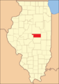
Location within the U.S. state of Illinois
|
|
 Illinois's location within the U.S. |
|
| Country | |
| State | |
| Founded | 1839 |
| Named for | DeWitt Clinton |
| Seat | Clinton |
| Largest city | Clinton |
| Area | |
| • Total | 405 sq mi (1,050 km2) |
| • Land | 398 sq mi (1,030 km2) |
| • Water | 7.6 sq mi (20 km2) 1.9% |
| Population
(2020)
|
|
| • Total | 15,516 |
| • Density | 38.31/sq mi (14.792/km2) |
| Time zone | UTC−6 (Central) |
| • Summer (DST) | UTC−5 (CDT) |
| Congressional district | 15th |
DeWitt County is a county located in the state of Illinois, USA. In 2020, about 15,516 people lived here. The main town and county seat is Clinton.
The county was created on March 1, 1839. It was formed from parts of Macon and McLean counties. DeWitt County was named after DeWitt Clinton. He was the seventh Governor of New York State.
DeWitt County is part of the larger Bloomington–Normal, IL area. This area is called a Metropolitan Statistical Area.
Contents
Discovering DeWitt County's Past
-
DeWitt County when it was first created in 1839.
-

DeWitt County from 1841 to 1845.
-

DeWitt County in 1845, when it became its current size.


DeWitt County has an interesting history. It was officially formed in 1839. Over the years, its shape changed a bit. By 1845, the county reached its current size.
Exploring DeWitt County's Geography
DeWitt County covers a total area of about 405 square miles. Most of this area, 398 square miles, is land. The remaining 7.6 square miles, or 1.9%, is water.
Understanding the Climate and Weather
| Weather chart for Clinton, Illinois | |||||||||||||||||||||||||||||||||||||||||||||||
|---|---|---|---|---|---|---|---|---|---|---|---|---|---|---|---|---|---|---|---|---|---|---|---|---|---|---|---|---|---|---|---|---|---|---|---|---|---|---|---|---|---|---|---|---|---|---|---|
| J | F | M | A | M | J | J | A | S | O | N | D | ||||||||||||||||||||||||||||||||||||
|
2.1
35
17
|
2
41
22
|
3.2
53
32
|
3.6
65
42
|
4.5
76
52
|
3.9
85
61
|
4.5
88
65
|
4.1
86
63
|
3
80
55
|
2.7
68
44
|
3.3
52
34
|
2.9
39
23
|
||||||||||||||||||||||||||||||||||||
| temperatures in °F precipitation totals in inches source: The Weather Channel |
|||||||||||||||||||||||||||||||||||||||||||||||
|
Metric conversion
|
|||||||||||||||||||||||||||||||||||||||||||||||
The weather in DeWitt County changes with the seasons. In Clinton, the county seat, January is usually the coldest month. Temperatures can drop to about 17°F. July is typically the warmest month. Temperatures can reach around 88°F.
The county has seen some extreme temperatures. The coldest ever recorded was -25°F in February 1905. The hottest was 113°F in July 1954. Rain and snow also vary throughout the year. July usually gets the most rain.
Neighboring Counties of DeWitt
DeWitt County shares its borders with several other counties:
- McLean County to the north
- Piatt County to the east
- Macon County to the south
- Logan County to the west
Getting Around: Local Transit
- SHOW Bus
Major Roads and Highways
Several important roads pass through DeWitt County:
 Interstate 74
 US Route 51
 US Route 150
 Illinois Route 10
 Illinois Route 48
 Illinois Route 54
DeWitt County's Population Story
| Historical population | |||
|---|---|---|---|
| Census | Pop. | %± | |
| 1840 | 3,247 | — | |
| 1850 | 5,002 | 54.0% | |
| 1860 | 10,820 | 116.3% | |
| 1870 | 14,768 | 36.5% | |
| 1880 | 17,010 | 15.2% | |
| 1890 | 17,011 | 0.0% | |
| 1900 | 18,972 | 11.5% | |
| 1910 | 18,906 | −0.3% | |
| 1920 | 19,252 | 1.8% | |
| 1930 | 18,598 | −3.4% | |
| 1940 | 18,244 | −1.9% | |
| 1950 | 16,894 | −7.4% | |
| 1960 | 17,253 | 2.1% | |
| 1970 | 16,975 | −1.6% | |
| 1980 | 18,108 | 6.7% | |
| 1990 | 16,516 | −8.8% | |
| 2000 | 16,798 | 1.7% | |
| 2010 | 16,561 | −1.4% | |
| 2020 | 15,516 | −6.3% | |
| 2023 (est.) | 15,365 | −7.2% | |
| U.S. Decennial Census 1790-1960 1900-1990 1990-2000 2010 |
|||

In 2010, there were 16,561 people living in DeWitt County. There were 6,811 households. Most people in the county are white, making up 96.8% of the population. About 2.1% of the people were of Hispanic or Latino background.
The average household had 2.39 people. The average family had 2.88 people. The median age for people in the county was 41.7 years old.
Towns and Villages in DeWitt County

DeWitt County has several communities. These include cities, villages, and smaller unincorporated areas.
Cities in DeWitt County
- Clinton (This is the county seat)
- Farmer City
Villages in DeWitt County
Townships in DeWitt County
DeWitt County is divided into thirteen smaller areas called townships:
- Barnett
- Clintonia
- Creek
- DeWitt
- Harp
- Nixon
- Rutledge
- Santa Anna
- Texas
- Tunbridge
- Wapella
- Waynesville
- Wilson
Unincorporated Communities
These are smaller places that are not officially cities or villages:
Education in DeWitt County
Students in DeWitt County attend various school districts. These districts cover different areas and grade levels.
School Districts for All Grades (K-12)
- Argenta-Oreana Community Unit School District 1
- Blue Ridge Community Unit School District 18
- Clinton Community Unit School District 15
- DeLand-Weldon Community Unit School District 57
- Heyworth Community Unit School District 4
- Le Roy Community Unit School District 2
- Maroa-Forsyth Community Unit School District 2
- Monticello Community Unit School District 25
- Mount Pulaski Community Unit District 23
- Olympia Community Unit School District 16
There are also specific districts for elementary and high school:
- Chester-East Lincoln Community Csd 61 (Elementary school)
- Lincoln Community High School District 404 (High school)
See also
 In Spanish: Condado de DeWitt (Illinois) para niños
