
Piatt County, Illinois facts for kids
Quick facts for kids
Piatt County
|
|
|---|---|

Piatt County Courthouse in Monticello
|
|

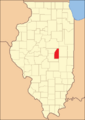
Location within the U.S. state of Illinois
|
|
 Illinois's location within the U.S. |
|
| Country | |
| State | |
| Founded | 1841 |
| Named for | James A. Piatt |
| Seat | Monticello |
| Largest city | Monticello |
| Area | |
| • Total | 439 sq mi (1,140 km2) |
| • Land | 439 sq mi (1,140 km2) |
| • Water | 0.3 sq mi (0.8 km2) 0.06% |
| Population
(2020)
|
|
| • Total | 16,673 |
| • Density | 37.98/sq mi (14.664/km2) |
| Time zone | UTC−6 (Central) |
| • Summer (DST) | UTC−5 (CDT) |
| Congressional districts | 13th, 15th |
Piatt County is a county located in the state of Illinois. In 2020, about 16,673 people lived there. The main town and county seat is Monticello.
Piatt County is also part of a larger area called the Champaign-Urbana Metropolitan Statistical Area. This means it's connected to the cities of Champaign and Urbana.
Contents
History of Piatt County
The first person to settle in this area was George Haworth, who was a Quaker. Later, other settlers like James Martin, Abraham Hanline, Solomon Carter, and William Cordell also moved here.
Piatt County was officially created in 1841. It was formed from parts of two other counties: Macon County and DeWitt County. Two local people, James A. Piatt and Jesse Warner, worked hard to make the county happen. The county was named after James A. Piatt because he won a coin toss against Jesse Warner!
-
Piatt County when it was first created in 1841

Abraham Lincoln, who later became president, used to practice law in Piatt County. He was a "circuit lawyer," meaning he traveled to different towns to work on cases. Lincoln and Stephen A. Douglas even planned their famous debates in Piatt County in 1858. There's a special marker south of Monticello to remember one of these important meetings.
The first building used as a courthouse was built in 1843. The current courthouse, which you can see today, was built much later in 1904.
Geography and Climate
Piatt County covers a total area of about 439 square miles. Almost all of this area is land, with only a tiny bit of water.
Weather in Piatt County
| Weather chart for Monticello, Illinois | |||||||||||||||||||||||||||||||||||||||||||||||
|---|---|---|---|---|---|---|---|---|---|---|---|---|---|---|---|---|---|---|---|---|---|---|---|---|---|---|---|---|---|---|---|---|---|---|---|---|---|---|---|---|---|---|---|---|---|---|---|
| J | F | M | A | M | J | J | A | S | O | N | D | ||||||||||||||||||||||||||||||||||||
|
1.6
32
14
|
1.7
37
19
|
3
49
30
|
3.4
62
40
|
4
73
51
|
4
83
60
|
3.8
85
64
|
4
84
62
|
2.9
78
54
|
2.6
66
42
|
2.9
49
31
|
2.4
36
21
|
||||||||||||||||||||||||||||||||||||
| temperatures in °F precipitation totals in inches source: The Weather Channel |
|||||||||||||||||||||||||||||||||||||||||||||||
|
Metric conversion
|
|||||||||||||||||||||||||||||||||||||||||||||||
The weather in Monticello, the county seat, changes throughout the year. In January, the average low temperature is about 14°F, and in July, the average high is around 85°F. The coldest temperature ever recorded was -25°F in January 1999, and the hottest was 105°F in July 1966.
The county gets rain and snow throughout the year. On average, January has about 1.61 inches of precipitation, while August gets the most with about 3.99 inches.
Main Roads in Piatt County
Many important roads pass through Piatt County, helping people travel around.
 Interstate 72
 Interstate 74
 U.S. Route 36
 U.S. Route 150
 Illinois Route 10
 Illinois Route 32
 Illinois Route 48
- 20px Illinois Route 105
Neighboring Counties
Piatt County shares its borders with several other counties in Illinois:
- McLean County to the north
- Champaign County to the east
- Douglas County to the southeast
- Moultrie County to the south
- Macon County to the southwest
- De Witt County to the west
People of Piatt County (Demographics)
| Historical population | |||
|---|---|---|---|
| Census | Pop. | %± | |
| 1850 | 1,606 | — | |
| 1860 | 6,127 | 281.5% | |
| 1870 | 10,953 | 78.8% | |
| 1880 | 15,583 | 42.3% | |
| 1890 | 17,062 | 9.5% | |
| 1900 | 17,706 | 3.8% | |
| 1910 | 16,376 | −7.5% | |
| 1920 | 15,714 | −4.0% | |
| 1930 | 15,588 | −0.8% | |
| 1940 | 14,659 | −6.0% | |
| 1950 | 13,970 | −4.7% | |
| 1960 | 14,960 | 7.1% | |
| 1970 | 15,509 | 3.7% | |
| 1980 | 16,581 | 6.9% | |
| 1990 | 15,548 | −6.2% | |
| 2000 | 16,365 | 5.3% | |
| 2010 | 16,729 | 2.2% | |
| 2020 | 16,673 | −0.3% | |
| 2023 (est.) | 16,714 | −0.1% | |
| US Decennial Census 1790-1960 1900-1990 1990-2000 2010-2013 |
|||
In 2010, there were 16,729 people living in Piatt County. This means there were about 38 people for every square mile. There were also 6,782 households, which are groups of people living together in one home.
Most people in the county (about 98%) are white. A small number of people are from other racial backgrounds. About 1% of the population is of Hispanic or Latino origin. Many families in Piatt County are married couples living together. The average age of people in the county was about 42.6 years old.
The median income for a household in the county was about $55,752 per year. This is the middle income level for all households. For families, the median income was higher, around $65,850. A small percentage of families and people live below the poverty line, meaning they have lower incomes.
Towns and Villages
Piatt County has one city and several villages and smaller communities.

City
- Monticello (This is the county seat, where the main government offices are.)
Villages
Census-Designated Places
These are areas that are like villages but are not officially incorporated as towns.
Other Small Communities
These are even smaller communities that are not officially incorporated.
Former Places
Townships
Counties in Illinois are divided into smaller areas called townships. Piatt County has several townships:
- Bement
- Blue Ridge
- Cerro Gordo
- Goose Creek
- Monticello
- Sangamon
- Unity
- Willow Branch
See also
 In Spanish: Condado de Piatt para niños
