
Champaign County, Illinois facts for kids
Quick facts for kids
Champaign County
|
|
|---|---|

The Champaign County Courthouse in Urbana
|
|

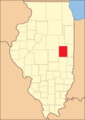
Location within Illinois
|
|

Illinois' location within the United States
|
|
| Country | United States |
| State | Illinois |
| Region | Central Illinois |
| Metro area | Champaign–Urbana Metropolitan |
| Incorporated | February 20, 1833 |
| County seat | Urbana |
| Largest city | Champaign |
| Area | |
| • Total | 998 sq mi (2,580 km2) |
| • Land | 996 sq mi (2,580 km2) |
| • Water | 2.1 sq mi (5 km2) |
| Area rank | 5th largest county in Illinois |
| Population
(2020)
|
|
| • Total | 205,865 |
| • Density | 206.28/sq mi (79.64/km2) |
| Time zone | UTC−6 (Central) |
| • Summer (DST) | UTC−5 (Central) |
| ZIP Code prefixes |
60949, 61801, 61802, 61815, 61816, 61820-61822, 61840, 61843, 61845, 61847, 61849, 61851-61853, 61859, 61862-61864, 61866, 61871-61875, 61877, 61878, 61880
|
| Area codes | 217/447 |
| Congressional district | 2nd, 13th, 15th |
| Elected countywide officials Champaign County, IL |
||
|---|---|---|
| Office | Name | Party |
| County Executive | Steve Summers | Democratic |
| Assessor | Paula Bates | Democratic |
| Auditor | George P. Danos | Democratic |
| County Board Chair | Jennifer Locke | Democratic |
| County Board Majority | Jennifer Locke | Democratic |
| Circuit Clerk | Susan W. McGrath | Democratic |
| County Clerk & Recorder | Aaron Ammons | Democratic |
| Coroner | Laurie Brauer | Democratic |
| Sheriff | Dustin Heuerman | Democratic |
| State's Attorney | Julia Rietz | Democratic |
| Treasurer | Cassandra Johnson | Democratic |
Champaign County is a county in the U.S. state of Illinois. As of the 2020 Census, its population was 205,865. This makes it the 10th-most populated county in Illinois. The main city, or county seat, is Urbana.
Champaign County is part of the Champaign–Urbana metropolitan area. The two main cities, Urbana and Champaign, are the only cities in the county. They are located around the campus of the University of Illinois.
Contents
History of Champaign County
Champaign County was officially started in 1833. Before that, it was part of Vermilion County. The county grew a lot when the Chicago Branch of the Illinois Central Railroad arrived. It grew even more when the University of Illinois was built. This university was a "land-grant" school, meaning it received land from the government to help it get started.
Later, the county also got an airport and a public transportation system called a mass transit district. In the 1990s, the northern part of the county faced some challenges when the Chanute Air Force Base closed down.
-
Champaign County when it was created in 1833
-
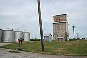
A country grain elevator in Champaign County


Geography and Landscape
Champaign County is about 27 miles wide (east to west) and 36 miles long (north to south). Its total area is 998 square miles. Most of this (996 square miles) is land, and a small part (2.1 square miles) is water. It is the fifth-largest county in Illinois by land area.
The county sits on a very flat plateau. Because it was so flat, it used to have many wetlands (swampy areas) with almost no natural way for water to drain. People started building drainage ditches in the 1870s to solve this problem. Before these ditches, many people got malaria because of the standing water.
The landscape of Champaign County was shaped by the Wisconsin glaciation, a period when huge sheets of ice covered the area about 20,000 years ago. These ice sheets left behind a thick layer of soil, up to 300 feet deep. They also created many moraines, which are small, flat areas with no natural water outlets.
Champaign County is located on a divide between the Ohio and Mississippi Rivers. This means that rivers flow out of the county in different directions: east, west, and south.
- The Kaskaskia River starts northwest of Champaign and drains the western part of that city. It flows southwest and joins the Mississippi near St. Louis, Missouri.
- The Embarras River drains the south-central part of the Champaign–Urbana. It starts in southeastern Champaign and flows through the University of Illinois campus. The Embarras River is a branch of the Wabash River and Ohio River systems.
- The Boneyard Creek drains the northeast part of Champaign, the central part of the University campus, and northern Urbana. It flows into the Saline Branch, which is a branch of the Vermilion and Wabash rivers.

Neighboring Counties
- McLean County – northwest
- Ford County – north
- Vermilion County – east
- Edgar County – southeast
- Douglas County – south
- Piatt County – west
Transportation

Main Roads
 Interstate 57
 Interstate 72
 Interstate 74
 US Route 45
 US Route 136
 US Route 150
 Illinois Route 10
 Illinois Route 47
- 25px Illinois Route 49
 Illinois Route 54
 Illinois Route 130
Airports
There are three public airports in Champaign County:
- University of Illinois Willard Airport (CMI) – serves Champaign–Urbana
- Rantoul National Aviation Center (Frank Elliott Field) (TIP) – in Rantoul
- Frasca Field (C16) – in Urbana
Train Travel
Champaign County has two train stations:
- The Illinois Terminal in downtown Champaign
- Rantoul station in Rantoul
Both stations are served by Amtrak's Illini and Saluki trains. These trains run once a day between Chicago and Carbondale. The Illinois Terminal also has the City of New Orleans train, which runs daily between Chicago and New Orleans. These passenger trains use tracks owned by the Canadian National Railway, which are also used by freight trains.
The Norfolk Southern Railway has two smaller train lines in the county. The Canadian National Railway also operates other smaller lines. These lines mostly carry freight.
Bus Services
Amtrak, Greyhound, and Peoria Charter offer bus services from Champaign–Urbana. You can travel to cities like Chicago, St. Louis, and Indianapolis.
Local Public Transit
The Champaign–Urbana Mass Transit District runs public city buses in Champaign, Urbana, and Savoy.
The Champaign County Area Rural Transit System (C-CARTS) provides transportation for people living in the county's rural areas. C-CARTS also has local bus routes in Rantoul and a route connecting Rantoul to Champaign–Urbana.
Renewable Energy
In August 2018, the Champaign County Board decided to allow solar farms on some farmland. Solar farms use solar cells to create electricity from sunlight. To build a solar farm, developers need a special permit from the county board. Many applications for these permits were submitted in the first month.
Climate and Weather
| Weather chart for Urbana, Illinois | |||||||||||||||||||||||||||||||||||||||||||||||
|---|---|---|---|---|---|---|---|---|---|---|---|---|---|---|---|---|---|---|---|---|---|---|---|---|---|---|---|---|---|---|---|---|---|---|---|---|---|---|---|---|---|---|---|---|---|---|---|
| J | F | M | A | M | J | J | A | S | O | N | D | ||||||||||||||||||||||||||||||||||||
|
1.9
32
16
|
2
38
21
|
3.2
49
30
|
3.7
62
40
|
4.8
74
51
|
4.2
83
60
|
4.7
85
64
|
4.4
83
62
|
3.2
78
54
|
2.8
65
43
|
3.5
50
33
|
2.8
37
22
|
||||||||||||||||||||||||||||||||||||
| temperatures in °F precipitation totals in inches source: The Weather Channel |
|||||||||||||||||||||||||||||||||||||||||||||||
|
Metric conversion
|
|||||||||||||||||||||||||||||||||||||||||||||||
In Urbana, the county seat, average temperatures range from a low of 16°F (about -9°C) in January to a high of 85°F (about 29°C) in July. The coldest temperature ever recorded was -25°F (about -32°C) in January 1999. The hottest was 109°F (about 43°C) in July 1954.
The average rainfall each month varies. It's usually lowest in January (1.90 inches) and highest in May (4.80 inches).
Population and People

| Historical population | |||
|---|---|---|---|
| Census | Pop. | %± | |
| 1840 | 1,475 | — | |
| 1850 | 2,649 | 79.6% | |
| 1860 | 14,629 | 452.2% | |
| 1870 | 32,737 | 123.8% | |
| 1880 | 40,863 | 24.8% | |
| 1890 | 42,159 | 3.2% | |
| 1900 | 47,622 | 13.0% | |
| 1910 | 51,829 | 8.8% | |
| 1920 | 56,959 | 9.9% | |
| 1930 | 64,273 | 12.8% | |
| 1940 | 70,578 | 9.8% | |
| 1950 | 106,100 | 50.3% | |
| 1960 | 132,436 | 24.8% | |
| 1970 | 163,281 | 23.3% | |
| 1980 | 168,392 | 3.1% | |
| 1990 | 173,025 | 2.8% | |
| 2000 | 179,669 | 3.8% | |
| 2010 | 201,081 | 11.9% | |
| 2020 | 205,865 | 2.4% | |
| 2023 (est.) | 205,644 | 2.3% | |
| U.S. Decennial Census 1790–1960 1900–1990 1990–2000 2010–2019 |
|||
In 2010, there were 201,081 people living in Champaign County. The population density was about 201.8 people per square mile.
The county's population is made up of different groups:
- 73.4% White
- 12.4% Black or African American
- 8.9% Asian
- 0.3% American Indian
- 0.1% Pacific Islander
- 2.2% from other races
- 2.7% from two or more races
About 5.3% of the population was of Hispanic or Latino origin. The most common ancestries were German (23.9%), Irish (12.2%), American (11.5%), and English (8.9%).
The average age in the county was 28.9 years. This is younger than many places, partly because of the large number of college students.
The median income for a household was $45,262. For a family, it was $65,785. About 20.5% of the population lived below the poverty line.
| Race / Ethnicity (NH = Non-Hispanic) | Pop 1980 | Pop 1990 | Pop 2000 | Pop 2010 | Pop 2020 | % 1980 | % 1990 | % 2000 | % 2010 | % 2020 |
|---|---|---|---|---|---|---|---|---|---|---|
| White alone (NH) | 146,970 | 144,824 | 139,143 | 142,470 | 125,280 | 87.28% | 83.70% | 77.44% | 70.85% | 60.86% |
| Black or African American alone (NH) | 14,492 | 16,534 | 19,881 | 24,553 | 28,215 | 8.61% | 9.96% | 11.07% | 12.21% | 13.71% |
| Native American or Alaska Native alone (NH) | 269 | 429 | 345 | 360 | 279 | 0.16% | 0.25% | 0.19% | 0.18% | 0.14% |
| Asian alone (NH) | 3,286 | 7,819 | 11,553 | 17,879 | 24,420 | 1.95% | 4.52% | 6.43% | 8.89% | 11.86% |
| Pacific Islander alone (NH) | 55 | 76 | 64 | 129 | 60 | 0.03% | 0.04% | 0.04% | 0.06% | 0.03% |
| Other race alone (NH) | 915 | 130 | 325 | 387 | 897 | 0.54% | 0.08% | 0.18% | 0.19% | 0.44% |
| Mixed race or Multiracial (NH) | — | — | 3,155 | 4,696 | 10,048 | — | — | 1.76% | 2.34% | 4.88% |
| Hispanic or Latino (any race) | 2,405 | 1,637 | 5,203 | 10,607 | 16,666 | 1.43% | 0.95% | 2.90% | 5.27% | 8.10% |
| Total | 168,392 | 173,025 | 179,669 | 201,081 | 205,865 | 100.00% | 100.00% | 100.00% | 100.00% | 100.00% |
Economy and Jobs
The University of Illinois plays a big role in the county's economy. It supports growth in many areas, including:
- Information Technology
- Micro/Nanotechnology
- Bio-Imaging
- Healthcare
- Logistics (moving goods)
- Distribution
- Agribusiness (farming-related businesses)
As of 2023, the top employers in Champaign County include:
- The University of Illinois
- Carle Foundation Hospital
- Champaign Schools Unit 4
- Kraft Heinz
- OSF Healthcare
- Parkland College
- Kirby Foods
- Christie Clinic
- Champaign County Government
- Urbana School District #116
- FedEx
- Plastipak
- Rantoul Foods
- Busey Bank
- SuperValu
Communities in Champaign County
Champaign County has many different communities, including cities, villages, and census-designated places. The largest city is Champaign, and the county seat is Urbana.
| Community |
Community type |
Population | Total Area |
Water Area |
Land Area |
Pop. Density |
|
|---|---|---|---|---|---|---|---|
| Bondville | village | 388 | 0.25 | 0.00 | 0.25 | 1,545.82 | |
| Broadlands | village | 316 | 0.32 | 0.00 | 0.32 | 981.37 | |
| Champaign (largest city) | city | 88,302 | 23.14 | 0.15 | 22.99 | 3,800 | |
| Fisher | village | 2,062 | 1.33 | 0.00 | 1.33 | 1,550.38 | |
| Foosland | village | 75 | 0.07 | 0.00 | 0.07 | 1,086.96 | |
| Gifford | village | 911 | 0.44 | 0.00 | 0.44 | 2,050 | |
| Homer | village | 1,073 | 0.98 | 0.00 | 0.98 | 1,094.90 | |
| Ivesdale | village | 265 | 0.72 | 0.00 | 0.72 | 370.11 | |
| Lake of the Woods | census-designated place | 2,403 | 1.77 | 0.08 | 1.68 | 1,428.66 | |
| Longview | village | 112 | 0.25 | 0.00 | 0.25 | 453.44 | |
| Ludlow | village | 308 | 0.40 | 0.00 | 0.40 | 775.82 | |
| Mahomet | village | 9,434 | 9.79 | 0.07 | 9.72 | 970.38 | |
| Ogden | village | 729 | 0.59 | 0.00 | 0.59 | 1,239.80 | |
| Penfield | census-designated place | 151 | 0.26 | 0.00 | 0.26 | 587.55 | |
| Pesotum | village | 550 | 0.58 | 0.01 | 0.57 | 966.61 | |
| Philo | village | 1,392 | 0.83 | 0.00 | 0.83 | 1,679.13 | |
| Rantoul | village | 12,371 | 8.59 | 0.10 | 8.49 | 1,457.13 | |
| Royal | village | 293 | 0.18 | 0.00 | 0.18 | 1,601.09 | |
| Sadorus | village | 402 | 1.03 | 0.00 | 1.03 | 391.43 | |
| Savoy | village | 8,857 | 3.30 | 0.07 | 3.23 | 2,739.56 | |
| Seymour | census-designated place | 317 | 0.09 | 0.00 | 0.09 | 3,500 | |
| Sidney | village | 1,208 | 0.63 | 0.01 | 0.62 | 1,935.90 | |
| St. Joseph | village | 3,810 | 2.10 | 0.02 | 2.08 | 1,829.09 | |
| Thomasboro | village | 1,034 | 1.00 | 0.00 | 1.00 | 1,034.00 | |
| Tolono | village | 3,604 | 2.06 | 0.00 | 2.06 | 1,748.67 | |
| Urbana (seat) | city | 38,336 | 11.90 | 0.07 | 11.83 | 3,240.57 | |
| Champaign County | county | 205,865 | 998 | 2.1 | 996 | 210 |
Townships
Townships are smaller local government areas. Champaign County adopted this system on November 8, 1859.
- Ayers
- Brown
- Champaign
- Champaign City
- Colfax
- Compromise
- Condit
- Crittenden
- Cunningham
- East Bend
- Harwood
- Hensley
- Kerr
- Ludlow
- Mahomet
- Newcomb
- Ogden
- Pesotum
- Philo
- Rantoul
- Raymond
- Sadorus
- Scott
- Sidney
- Somer
- South Homer
- St. Joseph
- Stanton
- Tolono
- Urbana
Other Small Places
These are smaller communities that are not officially cities or villages.
Education
Champaign County has many schools and school districts. Here are the K-12 school districts that serve the county:
- Arthur Community Unit School District 305
- Bement Community Unit School District 5
- Champaign Community Unit School District 4
- Fisher Community Unit School District 1
- Gibson City-Melvin-Sibley Community Unit School District 5
- Heritage Community Unit School District 8
- Mahomet-Seymour Community Unit School District 3
- Monticello Community Unit School District 25
- Paxton-Buckley-Loda Community Unit School District 10
- Tolono Community Unit School District 7
- Tuscola Community Unit School District 301
- Urbana School District 116
- Villa Grove Community Unit School District 302
There are also high school districts and elementary school districts:
- High School Districts:
- Armstrong Township High School District 225
- Rantoul Township High School District 193
- St. Joseph-Ogden Community High School District 305
- Elementary School Districts:
- Armstrong-Ellis Consolidated School District 61
- Gifford Community Consolidated School District 188
- Ludlow Community Consolidated School District 142
- Prairieview-Ogden Community Consolidated School District 197
- Rantoul City School District 137
- St. Joseph Community Consolidated School District 169
- Thomasboro Community Consolidated School District 130
The famous University of Illinois is also located in Champaign County.
Notable People
- Henry P. Rusk, who was a dean (a leader) in the Department of Agriculture at the University of Illinois.
See also
 In Spanish: Condado de Champaign (Illinois) para niños
