Big Muddy River facts for kids
Quick facts for kids Big Muddy River |
|
|---|---|

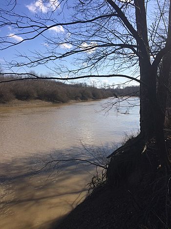
The Big Muddy River, south of Murphysboro, at a boat launch across from the Little Grand Canyon
|
|
| Physical characteristics | |
| Main source | Jefferson County southeast of Centralia, Illinois 38°28′27″N 89°05′25″W / 38.474216°N 89.0903471°W |
| River mouth | Confluence with the Mississippi River southwest of Murphysboro, Illinois 341 ft (104 m) 37°34′25″N 89°31′01″W / 37.5736608°N 89.5170413°W |
| Length | 156 mi (251 km) |
| Basin features | |
| Progression | Big Muddy River → Mississippi → Gulf of Mexico |
| GNIS ID | 404425 |
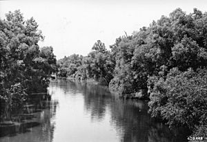
The Big Muddy River is a river in southern Illinois. It is about 156-mile-long (251 km). The river flows into the Mississippi River just south of Grand Tower. A large dam near Benton created Rend Lake on the Big Muddy.
The river gets its name because its bottom is mostly made of mud. This is true for almost its entire length.
Contents
The River's Journey and History
Where the Water Goes
The Big Muddy River collects water from a large area. This area is called its watershed. It covers about 2,344-square-mile (6,070 km2). In 1995, experts said the water quality was "fair" to "good." Some pollution comes from farms, mines, and towns.
How Glaciers Shaped the River
Long, long ago, huge sheets of ice called glaciers covered parts of Illinois. About 300,000 to 132,000 years ago, the Illinoian Glacier covered the Big Muddy area. When this glacier melted, it helped form the river's basin.
Later, another glacier, the Wisconsin Glacier, came close but did not cover the Big Muddy area. However, as this glacier melted, the Mississippi River became very full. Water from the Mississippi backed up into the Big Muddy basin. This created a large lake, much bigger than today's Rend Lake.
Over time, this ancient lake filled with silt and mud. This made the bottom of the lake very flat. When the Wisconsin Glacier finally melted, the Mississippi River's water level dropped. This allowed the ancient lake to drain away. A new river channel then formed in the flat, muddy lake bed. This is why the Big Muddy River is so muddy and winds around a lot.
Meeting the Mississippi
The Big Muddy River meets the Mississippi River in Jackson County. This is near the La Rue-Pine Hills Ecological Area. It's less than 1 mile (1.6 km) south of Grand Tower Island. The Pine Hills are tall bluffs that look over the Big Muddy.
During the melting of the Wisconsin Glacier, the Mississippi River's flood plain was often covered with water. In winter, when the meltwater stopped, the flood plain became a wide area of exposed mud. Strong winter winds blew this mud around. This created fine dust called "loess" that covered southern Illinois. At the edge of the flood plain, these winds formed hills of dust, known as "loess hills." The Pine Hills are an example of these loess hills. They stand hundreds of feet above the flood plain.
Before Rend Lake was built, much of the old lake bed was a swamp. This was a forested area that stayed wet most of the winter. It was also wet during rainy summers. When the Big Muddy River flooded, the water would spread out for miles across the flat, ancient lake bed.
Coal Along the River
The Big Muddy River basin has a lot of coal hidden deep under its mud. In some places, the river has worn away the sides of hills. This has shown the coal deposits. People believe the first coal mine in Illinois opened in 1810. It was on the banks of the Big Muddy in Jackson County.
The Big Muddy also cuts through the Shawnee Hills. This is south of Murphysboro, near where it meets Kinkaid Creek. From there, it flows south for about twenty miles. It then meets the Mississippi River directly south of Grand Tower. Near its mouth, a small part of the Big Muddy River forms the border between Jackson and Union counties.
Rivers and Lakes Connected to the Big Muddy
Many smaller rivers and creeks flow into the Big Muddy. These are called tributaries. Major tributaries include Beaucoup Creek, the Little Muddy River, Casey Creek, the Middle Fork of the Big Muddy, and Crab Orchard Creek. Smaller ones are Town Creek, Kinkaid Creek, and Shoal Creek.
The Big Muddy basin also includes several lakes. These are Kinkaid Lake, Rend Lake, Crab Orchard Lake, Devil's Kitchen Lake, Little Grassy Lake, and Cedar Lake.
The northernmost part of the Big Muddy's watershed is north of Kell. This is about 2 miles (3 km) into Marion County. This area is on Casey Creek, which some consider the main starting point of the river.
Cities and Counties Along the River
|
Many cities and towns are in the Big Muddy River watershed: |
The Big Muddy River drains parts of these counties:
col-end}} |
 | Sharif Bey |
 | Hale Woodruff |
 | Richmond Barthé |
 | Purvis Young |


