
Union County, Illinois facts for kids
Quick facts for kids
Union County
|
|
|---|---|

Union County Courthouse in Jonesboro
|
|

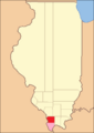
Location within the U.S. state of Illinois
|
|
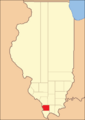
 Illinois's location within the U.S. |
|
| Country | |
| State | |
| Founded | January 2, 1818 |
| Seat | Jonesboro |
| Largest city | Anna |
| Area | |
| • Total | 422 sq mi (1,090 km2) |
| • Land | 413 sq mi (1,070 km2) |
| • Water | 8.7 sq mi (23 km2) 2.1% |
| Population
(2020)
|
|
| • Total | 17,244 |
| • Density | 40.86/sq mi (15.777/km2) |
| Time zone | UTC−6 (Central) |
| • Summer (DST) | UTC−5 (CDT) |
| Congressional district | 12th |
Union County is a place in Illinois, a state in the United States. It's like a big neighborhood or district. In 2020, about 17,244 people lived here. The main town, or county seat, is Jonesboro. Union County is in the southern part of Illinois, which people sometimes call "Little Egypt".
Contents
History
Union County was created on January 2, 1818. This was almost a year before Illinois became a state! It was formed from parts of Johnson County.
The county got its name from a special event. Two groups, the Baptists and the Dunkards, held a joint religious meeting. They called it a "union meeting" because they came together. The county's official seal even shows the leaders of these two groups shaking hands.
-
When Union County was first created in 1818, it was much larger.
-
In 1819, some of its land became Alexander County, making Union County its current size.


Geography
Union County covers about 422 square miles. Most of this area is land, around 413 square miles. The rest, about 8.7 square miles, is water.
Climate and Weather
| Weather chart for Jonesboro, Illinois | |||||||||||||||||||||||||||||||||||||||||||||||
|---|---|---|---|---|---|---|---|---|---|---|---|---|---|---|---|---|---|---|---|---|---|---|---|---|---|---|---|---|---|---|---|---|---|---|---|---|---|---|---|---|---|---|---|---|---|---|---|
| J | F | M | A | M | J | J | A | S | O | N | D | ||||||||||||||||||||||||||||||||||||
|
3.6
42
22
|
3.4
49
27
|
4.7
60
35
|
4.7
70
44
|
5.2
78
53
|
4.2
86
62
|
3.3
90
66
|
3.6
89
64
|
3.1
82
56
|
3.4
72
45
|
4.8
58
36
|
4.3
46
27
|
||||||||||||||||||||||||||||||||||||
| temperatures in °F precipitation totals in inches source: The Weather Channel |
|||||||||||||||||||||||||||||||||||||||||||||||
|
Metric conversion
|
|||||||||||||||||||||||||||||||||||||||||||||||
In Jonesboro, the county seat, temperatures change throughout the year. In January, it's usually cold, around 22 degrees Fahrenheit. In July, it's much warmer, often reaching 90 degrees Fahrenheit.
The lowest temperature ever recorded was -20 degrees Fahrenheit in January 1918. The highest was 112 degrees Fahrenheit in July 1901.
The amount of rain also changes. September usually has the least rain, about 3.13 inches. May often has the most, around 5.22 inches.
Major Roads
 Interstate 57
 U.S. Highway 51
 Illinois Route 3
 Illinois Route 127
 Illinois Route 146
Neighboring Counties
Union County shares its borders with several other counties:
- Jackson County – to the north
- Williamson County – to the northeast
- Johnson County – to the east
- Pulaski County – to the southeast
- Alexander County – to the south
- Cape Girardeau County, Missouri – to the west
- Perry County, Missouri – to the northwest
Protected Natural Areas
Union County has several special places where nature is protected:
- Brown Barrens Nature Preserve
- Crab Orchard National Wildlife Refuge (part of it)
- Cypress Creek National Wildlife Refuge (part of it)
- Lincoln Memorial Picnic Grounds
- Giant City State Park (part of it)
- McClure Shale Glade Nature Preserve
- Trail of Tears State Forest
- Shawnee National Forest (part of it)
- Union County State Fish and Wildlife Area
Demographics
| Historical population | |||
|---|---|---|---|
| Census | Pop. | %± | |
| 1820 | 2,362 | — | |
| 1830 | 3,239 | 37.1% | |
| 1840 | 5,524 | 70.5% | |
| 1850 | 7,615 | 37.9% | |
| 1860 | 11,181 | 46.8% | |
| 1870 | 16,518 | 47.7% | |
| 1880 | 18,102 | 9.6% | |
| 1890 | 21,549 | 19.0% | |
| 1900 | 22,610 | 4.9% | |
| 1910 | 21,856 | −3.3% | |
| 1920 | 20,249 | −7.4% | |
| 1930 | 19,883 | −1.8% | |
| 1940 | 21,528 | 8.3% | |
| 1950 | 20,500 | −4.8% | |
| 1960 | 17,645 | −13.9% | |
| 1970 | 16,071 | −8.9% | |
| 1980 | 17,765 | 10.5% | |
| 1990 | 17,619 | −0.8% | |
| 2000 | 18,293 | 3.8% | |
| 2010 | 17,808 | −2.7% | |
| 2020 | 17,244 | −3.2% | |
| 2023 (est.) | 16,667 | −6.4% | |
| US Decennial Census 1790-1960 1900-1990 1990-2000 2010-2013 2020 |
|||
In 2010, there were 17,808 people living in Union County. There were about 7,167 households, which are like homes where people live. The average household had about 2.41 people. The average age of people in the county was 42.9 years old.
The average income for a household was about $39,760 per year. For families, it was around $48,465. About 21.1% of all people in the county lived below the poverty line. This means they had a lower income compared to what is needed for basic living.
Communities
Union County has several towns and villages where people live.
Cities
Villages
Unincorporated Communities
These are smaller areas that are not officially cities or villages.
- Balcom
- La Rue
- Reynoldsville
- Ware
- Wolf Lake
Education
There are several school districts in Union County that help kids learn and grow.
Schools for All Grades (K-12)
- Cobden School Unit District 17
- Dongola School Unit District 66
- Goreville Community Unit School District 1
- Shawnee Community Unit School District 84
High Schools
- Anna Jonesboro Community High School District 81
- Vienna High School District 133
Elementary Schools
- Anna Community Consolidated School District 37
- Buncombe Consolidated School District 43
- Cypress School District 64
- Jonesboro Community Consolidated School District 43
- Lick Creek Community Consolidated School District 16
See also
 In Spanish: Condado de Union (Illinois) para niños
