
Marion County, Illinois facts for kids
Quick facts for kids
Marion County
|
||
|---|---|---|

Marion County Courthouse in Salem
|
||
|
||

Location within the U.S. state of Illinois
|
||
 Illinois's location within the U.S. |
||
| Country | ||
| State | ||
| Founded | 1823 | |
| Named for | Francis Marion | |
| Seat | Salem | |
| Largest city | Centralia | |
| Area | ||
| • Total | 576 sq mi (1,490 km2) | |
| • Land | 572 sq mi (1,480 km2) | |
| • Water | 3.7 sq mi (10 km2) 0.6% | |
| Population
(2020)
|
||
| • Total | 37,729 | |
| • Estimate
(2023)
|
36,673 |
|
| • Density | 65.50/sq mi (25.290/km2) | |
| Time zone | UTC−6 (Central) | |
| • Summer (DST) | UTC−5 (CDT) | |
| Congressional district | 15th | |

Marion County is a county located in the state of Illinois in the United States. In 2020, about 37,729 people lived here. The main town and county seat is Salem. Marion County is part of a larger area that includes Centralia and is connected to the bigger St. Louis area.
Contents
History of Marion County
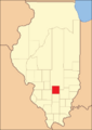
Marion County was created on January 24, 1823. It was formed from parts of Jefferson and Fayette counties. The county was named after Revolutionary War General Francis Marion. He was known as the "Swamp Fox" because of his clever tactics.
-
Marion County when it was first created in 1823

Geography of Marion County
Marion County covers a total area of 576 square miles. Most of this area, 572 square miles, is land. Only a small part, about 3.7 square miles, is water.
A special point in the county is where the Baseline meets the Third Principal Meridian. This spot is important because it was the starting point for surveying the Northwest Territory. You can find this marker south of Centralia, near U.S. 51.
Climate and Weather in Marion County
| Weather chart for Salem, Illinois | |||||||||||||||||||||||||||||||||||||||||||||||
|---|---|---|---|---|---|---|---|---|---|---|---|---|---|---|---|---|---|---|---|---|---|---|---|---|---|---|---|---|---|---|---|---|---|---|---|---|---|---|---|---|---|---|---|---|---|---|---|
| J | F | M | A | M | J | J | A | S | O | N | D | ||||||||||||||||||||||||||||||||||||
|
2.5
37
18
|
2.5
43
22
|
4
54
33
|
4
65
44
|
4.4
75
54
|
4.2
84
63
|
3.9
88
68
|
3.4
87
66
|
3.2
80
57
|
3.1
69
45
|
4.1
54
34
|
3.3
42
24
|
||||||||||||||||||||||||||||||||||||
| temperatures in °F precipitation totals in inches source: The Weather Channel |
|||||||||||||||||||||||||||||||||||||||||||||||
|
Metric conversion
|
|||||||||||||||||||||||||||||||||||||||||||||||
In Salem, the county seat, temperatures change throughout the year. In January, the average low is 18°F. In July, the average high is 88°F. The coldest temperature ever recorded was -23°F in January 1994. The hottest was 105°F in August 1983.
The amount of rain also changes. January usually gets about 2.46 inches of rain. May is often the wettest month, with about 4.37 inches.
Transportation in Marion County
- South Central Transit provides public transportation services.
Major Roads in Marion County
Several important highways pass through Marion County:
 Interstate 57
 U.S. Route 50
 U.S. Route 51
 Illinois Route 37
 Illinois Route 161
Neighboring Counties
Marion County shares its borders with several other counties:
- Fayette County to the north
- Clay County to the east
- Wayne County to the southeast
- Jefferson County to the south
- Washington County to the southwest
- Clinton County to the west
Population of Marion County
| Historical population | |||
|---|---|---|---|
| Census | Pop. | %± | |
| 1830 | 2,125 | — | |
| 1840 | 4,742 | 123.2% | |
| 1850 | 6,720 | 41.7% | |
| 1860 | 12,739 | 89.6% | |
| 1870 | 20,622 | 61.9% | |
| 1880 | 23,686 | 14.9% | |
| 1890 | 24,341 | 2.8% | |
| 1900 | 30,446 | 25.1% | |
| 1910 | 35,094 | 15.3% | |
| 1920 | 37,497 | 6.8% | |
| 1930 | 35,635 | −5.0% | |
| 1940 | 47,989 | 34.7% | |
| 1950 | 41,700 | −13.1% | |
| 1960 | 39,349 | −5.6% | |
| 1970 | 38,986 | −0.9% | |
| 1980 | 43,523 | 11.6% | |
| 1990 | 41,561 | −4.5% | |
| 2000 | 41,691 | 0.3% | |
| 2010 | 39,437 | −5.4% | |
| 2020 | 37,729 | −4.3% | |
| 2023 (est.) | 36,673 | −7.0% | |
| U.S. Decennial Census 1790-1960 1900-1990 1990-2000 2010 |
|||
In 2010, there were 39,437 people living in Marion County. There were 16,148 households. About 30.9% of these households had children under 18 living with them. The average age of people in the county was 41.4 years old.
Communities in Marion County
Cities
Villages
Townships
Marion County is divided into seventeen smaller areas called townships:
- Alma
- Carrigan
- Centralia
- Foster
- Haines
- Iuka
- Kinmundy
- Meacham
- Odin
- Omega
- Patoka
- Raccoon
- Romine
- Salem
- Sandoval
- Stevenson
- Tonti
Unincorporated Communities
These are smaller communities that are not officially part of a city or village:
See also
 In Spanish: Condado de Marion (Illinois) para niños
