Kell, Illinois facts for kids
Quick facts for kids
Kell, Illinois
|
|
|---|---|

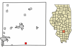
Location in Marion County, Illinois
|
|
| Country | United States |
| State | Illinois |
| County | Marion |
| Township | Haines |
| Area | |
| • Total | 1.00 sq mi (2.60 km2) |
| • Land | 1.00 sq mi (2.60 km2) |
| • Water | 0.00 sq mi (0.00 km2) |
| Elevation | 614 ft (187 m) |
| Population
(2020)
|
|
| • Total | 173 |
| • Density | 172.65/sq mi (66.66/km2) |
| Time zone | UTC-6 (CST) |
| • Summer (DST) | UTC-5 (CDT) |
| ZIP code |
62853
|
| Area code(s) | 618 |
| FIPS code | 17-39324 |
| GNIS ID | 2398333 |
| Wikimedia Commons | Kell, Illinois |
Kell is a small village located in Marion County, Illinois, in the United States. In 2020, about 173 people lived there. This was a decrease from 219 people in 2010.
Contents
Geography of Kell
Kell is found in the southern part of Marion County. It is located south-southeast of Salem, which is the main town of the county. The village is also about 5 miles northeast of Dix.
Land and Water Area
According to the U.S. Census Bureau, Kell covers a total area of about 1 square mile (2.60 square kilometers). Almost all of this area is land. Only a tiny part, about 0.20%, is water.
Local Waterways and Basins
Several small streams flow through or near Kell. Casey Creek starts in the northern part of the village and flows south. This creek eventually joins the Big Muddy River. The Big Muddy River then flows south into the Mississippi River.
The northwest part of Kell drains into Raccoon Creek. This creek flows west and joins Crooked Creek. Crooked Creek is part of the Kaskaskia River watershed, which also flows into the Mississippi River.
The eastern part of the village drains into Horse Creek. This creek flows southeast and is part of the Skillet Fork of the Little Wabash River. The Little Wabash River joins the Ohio River, which then flows into the Mississippi River.
Interestingly, the village has a ridge where water flows in different directions. The village water tower is built on top of this ridge.
Population in Kell
| Historical population | |||
|---|---|---|---|
| Census | Pop. | %± | |
| 1930 | 187 | — | |
| 1940 | 216 | 15.5% | |
| 1950 | 193 | −10.6% | |
| 1960 | 194 | 0.5% | |
| 1970 | 173 | −10.8% | |
| 1980 | 283 | 63.6% | |
| 1990 | 213 | −24.7% | |
| 2000 | 231 | 8.5% | |
| 2010 | 219 | −5.2% | |
| 2020 | 173 | −21.0% | |
| U.S. Decennial Census | |||
In the year 2000, there were 231 people living in Kell. These people lived in 84 households, and 68 of these were families. The population density was about 228.7 people per square mile. This means that, on average, there were 228.7 people living in every square mile of the village.
Community Makeup
All the people living in Kell in 2000 were identified as White.
About 35.7% of the households had children under 18 living with them. Most households, 73.8%, were married couples living together. About 7.1% of households had a female head with no husband present. The average household had 2.75 people, and the average family had 3.09 people.
Age Distribution
The population of Kell was spread out across different age groups.
- 27.3% were under 18 years old.
- 6.5% were between 18 and 24 years old.
- 28.1% were between 25 and 44 years old.
- 25.1% were between 45 and 64 years old.
- 13.0% were 65 years or older.
The median age in the village was 40 years. This means half the people were younger than 40 and half were older.
Household Income
In 2000, the median income for a household in Kell was $40,909. For families, the median income was $41,719. Males earned a median income of $31,806, while females earned $21,250. The average income per person in the village was $17,002. No families or people were reported to be living below the income level that defines poverty.
See also
 In Spanish: Kell (Illinois) para niños
 | Calvin Brent |
 | Walter T. Bailey |
 | Martha Cassell Thompson |
 | Alberta Jeannette Cassell |


