Harrisburg, Illinois facts for kids
Quick facts for kids
Harrisburg
|
||
|---|---|---|
|
City
|
||
| City of Harrisburg | ||
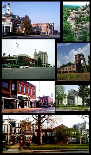
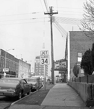
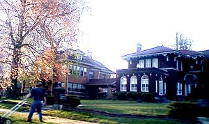
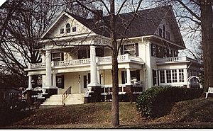
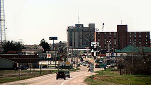
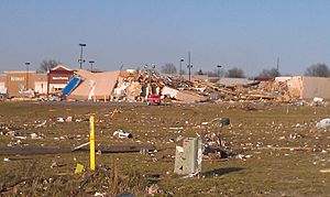
From top left: Northern side of square, Garden of the Gods, Saline County Courthouse and Clearwave Building, O'Gara mine tipple, southern side of square, Poplar Street homes, Harrisburg Township High School
|
||
|
||
| Nickname(s):
The Burg, H-burg
|
||
| Motto(s):
Gateway to the Shawnee National Forest
|
||
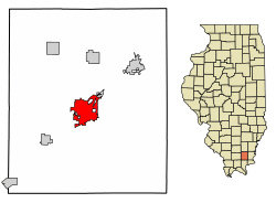
Location of Harrisburg in Saline County, Illinois
|
||
| Country | United States | |
| State | Illinois | |
| County | Saline | |
| Settled | 1847 | |
| Founded | 1853 | |
| Incorporated | 1889 | |
| Area | ||
| • Total | 6.81 sq mi (17.63 km2) | |
| • Land | 6.61 sq mi (17.12 km2) | |
| • Water | 0.20 sq mi (0.51 km2) 3.11% | |
| Elevation | 397 ft (121 m) | |
| Population
(2020)
|
||
| • Total | 8,219 | |
| • Density | 1,243.04/sq mi (479.97/km2) | |
| Time zone | UTC−6 (CST) | |
| • Summer (DST) | UTC−5 (CDT) | |
| ZIP code |
62946
|
|
| Area code(s) | 618, 730 | |
| FIPS code | 17-33136 | |
| Website | www.thecityofharrisburgil.com | |
Harrisburg is a city in Saline County, Illinois, United States. It is the main city of Saline County. Harrisburg is about 55 miles (88 km) southwest of Evansville, Indiana. It is also 111 miles (178 km) southeast of St. Louis, Missouri. In 2020, about 8,219 people lived there.
Harrisburg is known as the "Gateway to the Shawnee National Forest". It is also famous for the Ohio River flood of 1937. Other notable events include the 2012 Leap Day tornado outbreak. The city was once a major center for bituminous coal mining. This was especially true between 1900 and 1937.
At its busiest, Harrisburg had about 16,000 people in the early 1930s. It had one of the biggest downtown areas in Southern Illinois. However, the city's economy slowed down. This happened because people used less high-sulfur coal. Also, the railroad was removed, and flood risks made it hard for the city to grow.
Contents
History of Harrisburg
Early Settlers and Native Americans
Long ago, the Harrisburg area was home to Native American tribes. These included the Shawnee and Piankashaw. European settlers arrived in the late 1600s, mostly along the Mississippi River. American settlers came later, around 1790.
The town of Harrisburg was planned near important early trade routes. Before the War of 1812, people in this area lived in cabins. These cabins were often near blockhouses for protection. The first land was claimed in 1814. By 1840, there were more settlers than Native Americans.
How Harrisburg Began
Harrisburg was officially planned after Saline County was created in 1847. The city got its name from James Alexander Harris. He built a farmhouse and planted corn in the area around 1820.
Harris and others gave land for the town in 1852. People wanted the county seat to be more central. The old county seat was in Raleigh. The new spot was chosen because it was pretty. It was a 60-foot (18 m) sandstone bluff overlooking the Saline River. This spot was also in the center of the county. Harrisburg became a village in 1853 and the county seat in 1859.
Industrial Growth and Railroads
During the American Civil War, Harrisburg had woolen mills. This made it an important industrial town in Southern Illinois. Several factories for wood and flour also opened. The Cairo and Vincennes Railroad was finished in 1872. This railroad helped the town grow even more.
Many businesses opened, like brick factories and sawmills. The Woolcott Milling Company built a large flour mill in 1874. It could produce hundreds of barrels of flour each day. Another big mill, the Southern Illinois Milling & Elevator Company, opened in 1891.
By 1889, Harrisburg had 1,500 people and became a city. Coal mining became very important. Even with these early advantages, roads and water systems were not very good until 1900.
The Coal and Rail Era
Coal mining started in Harrisburg in 1854. The Cairo and Vincennes Railroad helped transport coal and miners. Around 1890, Harrisburg became a major coal-mining center. It was a key spot on the railroad route.
Big coal companies like Big Creek Coal and O'Gara Coal operated here. O'Gara Coal bought many mines and made Harrisburg its main office in 1905. They employed 6,000 men and produced a lot of coal.
By 1905, many mines were active. Immigrants came from Europe to work in the mines. The city's population quickly grew from 5,000 to 10,000 people. In 1913, an interurban trolley line connected Harrisburg to nearby towns. This made travel easier for many people.
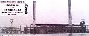
The Central Illinois Public Service Company bought the Muddy Power Station in 1916. This plant generated electricity for a large area.
The 1920s were a time of great wealth for Harrisburg. New hotels, theaters, and large buildings were constructed. The city's population grew to 15,000 people. A complex highway system was also built. During this time, a famous gangster named Charles Birger was active in the town. He was known for protecting local businesses. The area around Harrisburg became a huge coal field.
Economic Challenges and Recovery
Harrisburg's population peaked at 15,659 in 1930. Even during the Great Depression, the coal industry kept the city strong. However, the Ohio River flood of 1937 caused huge damage. About 4,000 people lost their homes, and 80% of the city was underwater. Many mines were closed, which hurt the economy.
The interurban trolley line closed in 1933. The city's population dropped by 27% between 1930 and 1940. After World War II, new coal companies started, but coal began to lose favor to other energy sources.
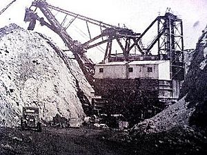
By 1957, the last passenger train left the city. The population continued to decline. In 1968, Sahara Coal Company used a giant shovel called "GEM of Egypt" to mine coal. It was 8 stories high and weighed 1,000 tons! But coal mining still decreased. The train depot was torn down in 1972. Many downtown shops closed as larger stores opened on the main highway.
The Clean Air Act Amendments of 1990 led to less demand for high-sulfur coal. Sahara Coal Company closed in 1993, and 865 jobs were lost. This ended the era of big coal mining in Harrisburg. The old railroad tracks were replaced by the Tunnel Hill State Trail in 1996.
After the coal industry declined, Harrisburg focused on its history. The Saline County Area Historical Museum opened. It shows pioneer life with old cabins and buildings.
The Harrisburg-Raleigh Airport helps connect the city. New industrial zones were created to bring in different types of jobs.
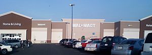
In the 2000s, Harrisburg saw some economic growth. New coal mines producing low-sulfur coal opened. Other companies like Nationwide Glove Factory and American Needle also provided jobs. In 2008, a large Wal-Mart Supercenter opened, creating 150 new jobs.
However, the early 2010s brought new challenges. The city's movie theater closed in 2010. The population dropped to its lowest since 1900. Then, in February 2012, a powerful EF4 tornado hit Harrisburg. It caused huge damage, destroying homes and businesses. Eight people died, and 110 were injured. This was a very difficult time for the city.
In 2016, a new movie theater opened. In 2018, Mason Ramsey, a young boy, became famous after yodeling in the Harrisburg Walmart. Harrisburg remains a retail center for Saline County.
Geography of Harrisburg
Harrisburg is located at 37°44′2″N 88°32′45″W / 37.73389°N 88.54583°W. The city's center and some neighborhoods are on sandstone bluffs. These bluffs were once like islands above lowlands. The Saline River flows nearby and used to flood often. When the area was drained, homes were built in the floodplain, which led to more flooding problems later. The bluffs in Harrisburg are the start of the Shawnee Hills to the south.
Gateway to the Shawnee National Forest
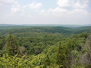
South of Harrisburg lies the Shawnee National Forest. This huge forest covers over 270,000 acres (1,092 km²). Many visitors come here each year. The forest has many roads, streams, waterfalls, and lakes. There are also campgrounds and picnic spots.
The forest is home to many different plants and animals. You can find over 500 types of wildlife, including mammals, birds, reptiles, and fish. Some rare and protected species live here too. The main office for the Shawnee National Forest has been in Harrisburg since 1933.
Earthquakes and Fault Lines
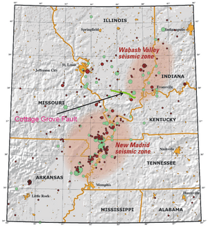
After an earthquake in 1968, scientists found a new fault line under Saline County. This fault is called the Cottage Grove Fault. It's a small crack in the Earth's rock. It is connected to the Wabash Valley Fault System. This area can have earthquakes, including the very powerful New Madrid earthquakes that happened in 1812.
City Layout and Buildings
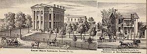
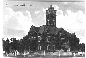
In the early 1900s, Harrisburg grew quickly. Because of the land, buildings were often built close together and had multiple stories. The Saline County courthouse and town square have changed over time. The first courthouse was built in 1861. A new, larger one was built in 1906. Part of the old courthouse clock is now in a small park.
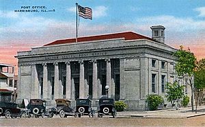
Harrisburg once had 25 miles (40 km) of brick streets, but only a few blocks remain. The city has some historic buildings. Two buildings, the City Hall and the Saline County Poor Farm, are listed on the National Register of Historic Places.
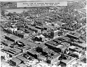
The town square used to have many coal mining offices, shops, and pharmacies. Over time, many businesses moved to Route 45. The courthouse was replaced again in 1967 with a more modern building.
The Harrisburg Mitchell-Carnegie Library was built in 1908. It served the community until 2000. During the Ohio River flood of 1937, it was used as a temporary hospital. Today, it is a church.
Harrisburg has three city parks: Memorial Park, Gaskins City Park, and Dorris Heights Park. Memorial Park is the largest, with a pool and a lagoon. The Sunset Lawn Cemetery is the biggest in the county. It has many old tombstones and crypts.
In 2012, Harrisburg High School was put on a list of endangered buildings. Students worked to help save the school.
Harrisburg Neighborhoods
Harrisburg has several neighborhoods that joined the city over time:
- Dorris Heights – A subdivision north of Harrisburg, established in 1923.
- Buena Vista – Located south and north of Route 13, west of the main village.
- Wilmoth Addition – An area north of Old Harrisburg.
- Old Harrisburg Village – The oldest part of the city, around the town square. It has many old houses and narrow brick streets.
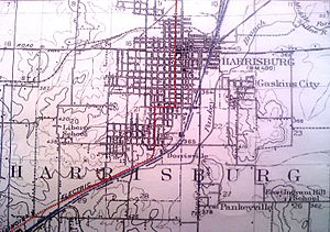
- Gaskins City – East of the Harrisburg Levee, annexed in 1905. It has the Harrisburg Medical Center and Shawnee Hills Country Club. A large part of Gaskins City was destroyed by the 2012 tornado.
- Garden Heights – South of Gaskins City.
- Dorrisville – South of Harrisburg, established in 1905 and annexed in 1923. It has the Saline County Area Historical Museum. Many houses here were damaged in the 2012 tornado.
- Liberty – A community southwest of Harrisburg. It was home to the first coal mine in the county to ship coal by rail.
- Ledford – A former coal mining town along Route 45. It had its own stores and schools.
Climate in Harrisburg
Harrisburg has four distinct seasons. Summers are warm, with average temperatures around 78.7°F (25.9°C) in July. Winters are cold, with average temperatures around 33.4°F (0.8°C) in January. Temperatures can go above 100°F (38°C) in summer and below 0°F (-18°C) in winter. Rain is heaviest in spring. Snow usually falls from November to April.
| Climate data for Harrisburg, Illinois (1991–2020 normals, extremes 1888–present) | |||||||||||||
|---|---|---|---|---|---|---|---|---|---|---|---|---|---|
| Month | Jan | Feb | Mar | Apr | May | Jun | Jul | Aug | Sep | Oct | Nov | Dec | Year |
| Record high °F (°C) | 78 (26) |
80 (27) |
94 (34) |
96 (36) |
100 (38) |
106 (41) |
113 (45) |
111 (44) |
109 (43) |
98 (37) |
87 (31) |
78 (26) |
113 (45) |
| Mean daily maximum °F (°C) | 42.9 (6.1) |
47.7 (8.7) |
58.1 (14.5) |
69.4 (20.8) |
78.2 (25.7) |
86.0 (30.0) |
89.1 (31.7) |
88.2 (31.2) |
82.4 (28.0) |
71.2 (21.8) |
57.4 (14.1) |
46.8 (8.2) |
68.1 (20.1) |
| Daily mean °F (°C) | 33.4 (0.8) |
38.0 (3.3) |
47.1 (8.4) |
57.6 (14.2) |
67.3 (19.6) |
75.5 (24.2) |
78.7 (25.9) |
76.9 (24.9) |
69.8 (21.0) |
58.3 (14.6) |
46.8 (8.2) |
37.8 (3.2) |
57.3 (14.1) |
| Mean daily minimum °F (°C) | 24.0 (−4.4) |
28.3 (−2.1) |
36.1 (2.3) |
45.7 (7.6) |
56.5 (13.6) |
65.1 (18.4) |
68.4 (20.2) |
65.6 (18.7) |
57.3 (14.1) |
45.4 (7.4) |
36.3 (2.4) |
28.9 (−1.7) |
46.5 (8.1) |
| Record low °F (°C) | −22 (−30) |
−23 (−31) |
−8 (−22) |
22 (−6) |
28 (−2) |
40 (4) |
45 (7) |
41 (5) |
23 (−5) |
18 (−8) |
−3 (−19) |
−11 (−24) |
−23 (−31) |
| Average precipitation inches (mm) | 3.79 (96) |
3.13 (80) |
4.90 (124) |
5.26 (134) |
4.31 (109) |
4.92 (125) |
3.49 (89) |
3.58 (91) |
3.10 (79) |
3.76 (96) |
3.97 (101) |
3.38 (86) |
47.59 (1,209) |
| Average precipitation days (≥ 0.01 in) | 7.8 | 6.3 | 8.9 | 10.9 | 9.4 | 7.9 | 6.9 | 6.0 | 6.3 | 6.2 | 7.6 | 8.1 | 92.3 |
| Source: NOAA | |||||||||||||
Natural Disasters in Harrisburg
Flood Risks
Harrisburg has faced many floods over the years. The Ohio River flood of 1937 was the worst. Most of the city was underwater, except for a small area called "Crusoe's Island." About 10,000 people were stuck on this island for weeks. After the flood, a levee was built to protect the city. Even with the levee, heavy rains can still cause flooding.
The 2008 Flood
In March 2008, Harrisburg had another severe flood. Over 11 inches (29 cm) of rain fell in two days. Many homes and businesses were flooded. Some businesses had over 2 feet (0.6 m) of water inside. This flood was called the worst in 71 years.
The 2012 Tornado
On February 29, 2012, an EF4 tornado hit Harrisburg. It touched down near Carrier Mills and moved through the city. The tornado caused massive damage, especially in the southern part of the city. Homes and businesses were destroyed or leveled. Eight people died, and 110 were injured. The Harrisburg Medical Center was also badly damaged. The tornado had winds of about 180 mph (290 km/h). About 40% of the city was damaged or destroyed. This event received national attention.
Population of Harrisburg
| Historical population | |||
|---|---|---|---|
| Census | Pop. | %± | |
| 1860 | 453 | — | |
| 1870 | 590 | 30.2% | |
| 1880 | 934 | 58.3% | |
| 1890 | 1,723 | 84.5% | |
| 1900 | 2,202 | 27.8% | |
| 1910 | 10,749 | 388.1% | |
| 1920 | 15,054 | 40.1% | |
| 1930 | 15,659 | 4.0% | |
| 1940 | 11,453 | −26.9% | |
| 1950 | 10,999 | −4.0% | |
| 1960 | 9,171 | −16.6% | |
| 1970 | 9,535 | 4.0% | |
| 1980 | 10,410 | 9.2% | |
| 1990 | 9,289 | −10.8% | |
| 2000 | 9,860 | 6.1% | |
| 2010 | 9,017 | −8.5% | |
| 2020 | 8,219 | −8.8% | |
| U.S. Decennial Census | |||
In 2010, Harrisburg had 9,017 people. Most residents were white (88.5%). About 6.5% were black or African-American. There were also smaller numbers of American Indian, Asian, and other groups. About 2.3% of the population was Hispanic.
Media in Harrisburg
The Daily Register is the main newspaper in Harrisburg. It has been reporting news for southeastern Illinois since 1869. Another newspaper, The Eldorado Daily Journal, is also available.
Harrisburg has one TV station, WSIL-TV, on channel 3. It is the ABC affiliate for southern Illinois. The city also has radio stations like WEBQ 1240 AM (and 93.7 FM), which plays country music. WOOZ 99.9 FM Z100 also plays country music.
Transportation in Harrisburg
The Rides Mass Transit District provides bus service in Harrisburg. The Bulldog Route is a bus service that runs within the city from Monday to Saturday.
Notable People from Harrisburg
- William Badders, a US Navy sailor who received the Medal of Honor.
- Charlie Birger, a well-known gangster from the Prohibition era.
- John E. Bradley, a state representative.
- Danny Fife, a baseball pitcher for the Minnesota Twins.
- Virginia Gregg, an actress born in Harrisburg (1916).
- Chuck Hunsinger, a running back for the Chicago Bears.
- John H. Pickering, a founding partner of a law firm.
- Mason Ramsey, known as the "Walmart Yodeling Kid."
- General Green Berry Raum, a Civil War general.
- John Romonosky, a baseball player in the 1950s.
- Dale Swann, a character actor born in Harrisburg.
- Henry Turner, a doctor who first described Turner syndrome.
- Stanley B. Weaver, an Illinois state legislator.
See also
 In Spanish: Harrisburg (Illinois) para niños
 | Jackie Robinson |
 | Jack Johnson |
 | Althea Gibson |
 | Arthur Ashe |
 | Muhammad Ali |


