Ogasawara, Tokyo facts for kids
Quick facts for kids
Ogasawara
小笠原村
|
|||||||||||||
|---|---|---|---|---|---|---|---|---|---|---|---|---|---|
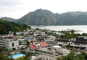
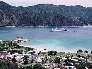
The main settlement on Chichijima
|
|||||||||||||
|
|||||||||||||
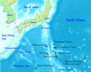
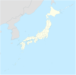
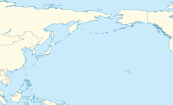
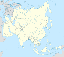
Location of the islands of Ogasawara Village
|
|||||||||||||
| Country | Japan | ||||||||||||
| Region | Kantō | ||||||||||||
| Prefecture | Tokyo Metropolis | ||||||||||||
| Area | |||||||||||||
| • Total | 106.88 km2 (41.27 sq mi) | ||||||||||||
| Population
(October 1, 2023)
|
|||||||||||||
| • Total | 2,930 | ||||||||||||
| • Density | 27.4/km2 (71/sq mi) | ||||||||||||
| Time zone | UTC+09:00 (JST) | ||||||||||||
| City hall address | Nishimachi, Chichi-jima, Ogasawara-mura, Tōkyō-to 100-2101 |
||||||||||||
|
|||||||||||||
Ogasawara (小笠原村, Ogasawara-mura) is a special village in Japan. Even though it's part of Tokyo Metropolis, it's actually made up of many islands far away in the Pacific Ocean. These islands include the Bonin Islands, Volcano Islands, and a few other remote islands like Nishinoshima, Minamitorishima, and Okinotorishima.
Contents
History of Ogasawara Village
For a long time, the Ogasawara islands were not officially organized into towns or villages. This changed in 1940. At that time, five different local areas were created on the main islands of Chichijima, Hahajima, and Iwojima.
After World War II, the United States took control of the islands. They managed them for many years. Then, in 1968, the islands were given back to Japan. That's when all these smaller areas were combined to form the single Ogasawara Village we know today.
Future Airport Plans
In August 2020, the Tokyo Metropolitan Government started discussing plans for a possible airport on the islands. Building an airport would make it much easier and faster to travel to and from Ogasawara. The mayor of Ogasawara Village, Kazuo Morishita, said that having an airport has been a long-held dream for the people living there. Governor Koike of Tokyo also agreed that an airport would be very important for keeping the islanders safe and connected.
Geography of the Islands
Ogasawara Village is made up of several groups of islands and some single, isolated islands. The two main groups are:
- The Bonin Islands (called Ogasawara Guntō in Japanese). This group includes:
- Mukōjima rettō
- Chichijima rettō (where most people live)
- Hahajima rettō (another main inhabited island)
- The Volcano Islands (called Kazan-rettō in Japanese). This group includes:
- Kita Iwojima (North Sulphur Island)
- Iwojima (Sulphur Island)
- Minami Iwojima (South Sulphur Island)
There are also other important islands that are part of Ogasawara Village:
- Nishinoshima: This is a single island west of Hahajima. It's also known as Rosario Island.
- Okinotorishima: This island is very far south. Its name means "Remote Bird Island."
- Minamitorishima: This island is very far east. It's also known as Marcus Island.
Most of the people in Ogasawara Village live on Chichi-jima (about 2,300 people) and Haha-jima (about 500 people). The main office for the village government is located in Omura, which is on Chichi-jima. There is also an air base on Iwojima, which is part of the Volcano Islands, where about 400 soldiers are stationed.
Population of Ogasawara
The number of people living in Ogasawara has stayed pretty much the same over the past few decades. Here's how the population has changed:
| Historical population | ||
|---|---|---|
| Year | Pop. | ±% |
| 1980 | 1,879 | — |
| 1990 | 2,361 | +25.7% |
| 2000 | 2,824 | +19.6% |
| 2010 | 2,785 | −1.4% |
| 2020 | 2,929 | +5.2% |
Education on the Islands
Ogasawara Village runs the public elementary and junior high schools for the islands.
- Ogasawara Village Municipal Ogasawara Elementary School is on Chichi-jima.
- Ogasawara Village Municipal Ogasawara Junior High School is also on Chichi-jima.
- Ogasawara Village Municipal Haha-jima Elementary School and Junior High School is on Haha-jima.
The Tokyo Metropolitan Government Board of Education is in charge of Ogasawara High School, which is located on Chichi-jima.
 | Delilah Pierce |
 | Gordon Parks |
 | Augusta Savage |
 | Charles Ethan Porter |


