
List of regions of Japan facts for kids

Japan is divided into eight main areas called regions. These regions are not official government divisions, but they are used a lot! For example, you'll see them on maps, in school geography books, and in weather reports. Many businesses and schools even use their region's name in their own name, like Kinki Nippon Railway or Tōhoku University.
Each region is made up of one or more of Japan's 47 prefectures. Think of prefectures like states or provinces. Japan has four main islands: Hokkaidō, Shikoku, and Kyūshū. Each of these islands forms its own region. The largest island, Honshū, is so big that it's divided into five different regions. Okinawa Prefecture is usually grouped with Kyūshū, but sometimes people think of it as its own ninth region.
Contents
Japan's Eight Regions
Here's a table showing the eight main regions of Japan. You can see their population, how big they are, and which prefectures belong to each region.
| Region | Other names | Population | Area in km2 | Prefectures contained |
|---|---|---|---|---|
| Hokkaidō | Northern Sea Circuit | 5.4 million | 83,000 | Hokkaidō |
| Tōhoku | Northeast, Ōu Region | 8.9 million | 67,000 | Akita, Aomori, Fukushima, Iwate, Miyagi, Yamagata |
| Kantō | N/A | 43.3 million | 32,000 | Chiba, Gunma, Ibaraki, Kanagawa, Saitama, Tochigi, Tōkyō |
| Chūbu | Central Region | 21.4 million | 67,000 | Aichi, Fukui, Gifu, Ishikawa, Nagano, Niigata, Shizuoka, Toyama, Yamanashi |
| Kansai | Kinki Region | 22.5 million | 33,000 | Hyōgo, Kyōto, Mie, Nara, Ōsaka, Shiga, Wakayama |
| Chūgoku | Middle Country | 7.3 million | 32,000 | Hiroshima, Okayama, Shimane, Tottori, Yamaguchi |
| Shikoku | Four Provinces | 3.8 million | 19,000 | Ehime, Kagawa, Kōchi, Tokushima |
| Kyūshū & Okinawa | Nine Provinces | 14.3 million | 44,000 | Fukuoka, Kagoshima, Kumamoto, Miyazaki, Nagasaki, Ōita, Okinawa, Saga |
Regions and Major Islands
Here's a list of Japan's main islands and how the traditional regions fit into them, moving from the northeast to the southwest. The eight main regions are shown in bold.
- Hokkaidō (This is both an island and a region!)
- Honshū (Japan's largest island, divided into five regions)
- Tōhoku region (the northern part of Honshū)
- Kantō region (the eastern part of Honshū, home to Tokyo)
- Nanpō Islands (a group of islands that are part of Tokyo)
- Chūbu region (the central part of Honshū)
- Hokuriku region (northwestern Chūbu)
- Kōshin'etsu region (northeastern Chūbu)
- Tōkai region (southern Chūbu)
- Kansai (or Kinki) region (the south-central part of Honshū)
- Chūgoku region (the western part of Honshū)
- San'in region (northern Chūgoku)
- San'yō region (southern Chūgoku)
- Shikoku (an island and a region)
- Kyūshū (an island and a region)
- Northern Kyūshū
- Southern Kyūshū
- Ryukyu Islands (a chain of islands stretching south from Kyūshū)
- Satsunan Islands
- Okinawa (often grouped with Kyūshū)
Different Ways to Divide Japan
Sometimes, different organizations in Japan, like government offices or sports leagues, use slightly different ways to group prefectures into regions. This is because they have different needs for how they organize things. For example, the way regions are set up for weather forecasts might be different from how they are set up for baseball tournaments.

Images for kids
-
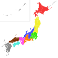
Football regions of Japan, showing how sports leagues divide the country.

See also
 In Spanish: Anexo:Regiones de Japón para niños
- Geography of Japan
- Prefectures of Japan
