Nagasaki Prefecture facts for kids
Quick facts for kids Nagasaki Prefecture |
|||||||||
|
|||||||||
 |
|||||||||
| Capital | Nagasaki | ||||||||
| Region | Kyushu (Saikaidō) | ||||||||
| Island | Kyūshū | ||||||||
| Governor | Hodo Nakamura (since March 2010) | ||||||||
| Area (rank) | 4,104.48 km² (37th) | ||||||||
| - % water | 8.5% | ||||||||
| Population (2009) | |||||||||
| - Population | 1,440,727 (26th) | ||||||||
| - Density | 351 /km² | ||||||||
| Districts | 4 | ||||||||
| Municipalities | 21 | ||||||||
| ISO 3166-2 | JP-42 | ||||||||
| Website | www.pref.nagasaki.jp/en/ | ||||||||
| Prefectural Symbols | |||||||||
| - Flower | Unzentsutsuji (Rhododendron serpyllifolium) | ||||||||
| - Tree | Sawara (Chamaecyparis pisifera) | ||||||||
| - Bird | Mandarin Duck (Aix galericulata) | ||||||||
| - Fish | |||||||||
 Symbol of Nagasaki Prefecture |
|||||||||
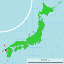
Nagasaki Prefecture (which is called 長崎県 (Nagasaki-ken) in Japanese) is a special area, like a state or province, in Japan. It's located on the big island of Kyūshū. The main city and capital of Nagasaki Prefecture is Nagasaki.
Contents
A Look Back in Time
Nagasaki Prefecture was formed by combining different older areas of Japan. It was created by joining the western part of what was known as Hizen Province. It also included the islands of Tsushima Province and Iki Province.
Exploring Nagasaki's Geography
Nagasaki is found on the western coast of the island of Kyūshū. Its southwestern coastline touches the Sea of Japan and the East China Sea. To its east, Nagasaki shares a border with Saga Prefecture.
This prefecture is unique because it has many islands. There are 505 islands in Nagasaki that do not have people living on them.
Major Cities in Nagasaki
Here are some of the important cities you can find in Nagasaki Prefecture:
- Gotō
- Hirado
- Iki
- Isahaya
- Matsuura
- Minamishimabara
- Nagasaki (This is the capital city!)
- Ōmura
- Saikai
- Sasebo
- Shimabara
- Tsushima
- Unzen
Beautiful National Parks
About 18% of all the land in Nagasaki Prefecture is protected as a National Park. These parks help keep nature safe and beautiful.
Shrines and Temples
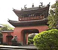
Nagasaki is home to many important religious sites. Some of the main Shinto shrines (called ichinomiya) in the prefecture include Chiriku Hachiman-gū, Amanotanagoa jinja, and Kaijin jinja. Shinto shrines are places of worship in Japan's traditional Shinto religion.
More to Explore
If you want to learn more about Japan's geography and history, check out these pages:
Images for kids
-
Kuichi Uchida's image of Nagasaki in 1872
-
Grave of William Adams in Hirado
See also
 In Spanish: Prefectura de Nagasaki para niños
 | Aaron Henry |
 | T. R. M. Howard |
 | Jesse Jackson |


