
Chiba Prefecture facts for kids
Quick facts for kids
Chiba Prefecture
千葉県
|
|||||||||||||||
|---|---|---|---|---|---|---|---|---|---|---|---|---|---|---|---|
| Japanese transcription(s) | |||||||||||||||
| • Japanese | 千葉県 | ||||||||||||||
| • Rōmaji | Chiba-ken | ||||||||||||||
|
Cape Inubō
Lake Tega
Kujūkuri Beach
Narita Shinshō Temple
Yatsu Tidal-flat
Kamogawa Seaworld
|
|||||||||||||||
|
|||||||||||||||
| Anthem: Chiba kenminka | |||||||||||||||
 |
|||||||||||||||
| Country | Japan | ||||||||||||||
| Region | Kantō | ||||||||||||||
| Island | Honshu | ||||||||||||||
| Capital | Chiba | ||||||||||||||
| Subdivisions | Districts: 6, Municipalities: 54 | ||||||||||||||
| Area | |||||||||||||||
| • Total | 5,157.61 km2 (1,991.36 sq mi) | ||||||||||||||
| Area rank | 28th | ||||||||||||||
| Population
(June 1, 2019)
|
|||||||||||||||
| • Total | 6,278,060 | ||||||||||||||
| • Rank | 6th | ||||||||||||||
| • Density | 1,217.2421/km2 (3,152.643/sq mi) | ||||||||||||||
| GDP | |||||||||||||||
| • Total | JP¥ 21,280 billion US$ 195.2 billion (2019) |
||||||||||||||
| ISO 3166 code | JP-12 | ||||||||||||||
|
|||||||||||||||


.jpg)


.jpg)


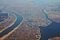
Chiba Prefecture (千葉県, Chiba-ken) is a prefecture (like a state or province) in Japan. It's located in the Kantō region on the island of Honshu. Chiba Prefecture has about 6.2 million people (as of June 2019) and covers an area of about 5,157 square kilometers. It shares borders with Ibaraki Prefecture to the north, Saitama Prefecture to the northwest, and Tokyo to the west.
Chiba City is the capital and largest city in Chiba Prefecture. Other important cities include Funabashi, Matsudo, Ichikawa, and Kashiwa. Chiba Prefecture is on Japan's eastern Pacific coast, just east of Tokyo. It's part of the Greater Tokyo Area, which is one of the most populated city areas in the world. Most of Chiba Prefecture is on the Bōsō Peninsula. This peninsula forms the eastern side of Tokyo Bay, separating it from Kanagawa Prefecture. Chiba Prefecture is also home to Narita International Airport, the Tokyo Disney Resort, and the Keiyō Industrial Zone.
Contents
What's in a Name?
The name of Chiba Prefecture in Japanese comes from two kanji characters. The first, 千, means "thousand," and the second, 葉, means "leaf."
This name first appeared a long time ago for a regional office called the Chiba Kuni no Miyatsuko (千葉国造). Later, a part of the Taira clan moved to the area where Chiba City is today, during the late Heian period. This group adopted the name and became the Chiba clan. They had a lot of power in the area until the Azuchi–Momoyama period.
The name "Chiba" was chosen for the prefecture when it was created in 1873. This decision was made by a group of governors from different prefectures who met to organize how local areas in Japan would be managed.
The word Keiyō (京葉) refers to the Tokyo-Chiba region. It's made from the second character of Tokyo (京) and the second character of Chiba (葉). These can also be read as "kei" and "yō." You'll see this word in names like the Keiyō Line (a train line) and the Keiyō Industrial Zone.
A Look Back in Time

People have lived in Chiba Prefecture since ancient times. We know this from the many remains found from the Jōmon period. The prefecture has the largest kaizuka (ancient shell mounds) in Japan. This shows that many people lived here and used the rich seafood from the Pacific Ocean and Tokyo Bay. You can also find Kofun (ancient burial mounds) all over the prefecture. The biggest group is in Futtsu, near Tokyo Bay.
Early History
During the Asuka period (538–710), the way Chiba Prefecture was governed changed a lot. The old area of Fusa Province was split into two parts: Shimōsa Province in the north and Kazusa Province in the south. Later, Awa Province in the very south of Chiba Prefecture was separated from Kazusa in 718. These areas were governed separately until they were combined into Chiba Prefecture after the Meiji Restoration.
Modern Times

Chiba Prefecture was officially created on June 15, 1873. This happened when two smaller prefectures, Kisarazu Prefecture and Inba Prefecture, joined together.
During the Russo-Japanese War (1904–1905), Chiba Prefecture became important for defense. Forts were built along Tokyo Bay to protect Japan's capital from attacks.
In September 1923, a huge earthquake, the Great Kanto earthquake, caused a lot of damage in Chiba Prefecture. The southern part of the Bōsō Peninsula was hit especially hard.
During the 1930s, the northern and central parts of Chiba became a major area for making military goods. Military bases and forts were built along most of the coast. After the United States took control of Saipan in World War II, parts of northern Chiba, especially Chiba City and Chōshi, were heavily bombed. Much of the industrial areas were destroyed.
After Japan surrendered in World War II, American forces controlled Chiba Prefecture from 1945 to 1952. Many cities in the prefecture were used as bases. The rich farms in Chiba helped protect the people from food shortages after the war.

After the war, there was a big effort to expand industries in the north of the prefecture. A large land reclamation project created new land along the coast of Tokyo Bay. Many factories, warehouses, and docks were built on this new land, forming the Keiyō Industrial Zone. This area became a very important center for heavy industry and large ports in Japan.
Narita International Airport opened in 1978 in Narita. It was built to replace the busy Tokyo International Airport (Haneda Airport). Today, most international flights to Japan land in Chiba Prefecture.
On March 11, 2011, a huge earthquake and tsunami hit Japan. While the damage in Chiba Prefecture was less severe than in other areas, 20 people died. An oil refinery in Ichihara caught fire, and the news showed it widely. Also, soil liquefaction (where soil acts like a liquid during an earthquake) damaged homes in areas built on reclaimed land, especially in Urayasu.
Where is Chiba?

Chiba Prefecture is bordered by the Tone River and Ibaraki Prefecture to the north. To the west, it meets Tokyo and Saitama Prefecture at the Edo River. The Pacific Ocean is to its east, and Tokyo Bay is to its south.
Most of Chiba is on the hilly Boso Peninsula, which is a big area for growing rice. The east coast, called the Kujūkuri Plain, is especially good for farming. The most populated part of Chiba, in the northwest, is part of the Kantō region and is very close to the big cities of Tokyo and Saitama. The Kuroshio Current flows near Chiba, which helps keep the weather mild. It's warmer in winter and cooler in summer compared to Tokyo.
Parks and Nature
Chiba Prefecture has many beautiful natural areas. Most of the coast, except for the large industrial zone, is protected as two national parks and one prefectural natural park. About 6% of Chiba's land is designated as Natural Parks.
- Suigo-Tsukuba Quasi-National Park covers a large area around the Tone River and Mount Tsukuba. It protects both nature and the unique culture of the area.
- Minami Boso Quasi-National Park protects much of the southern coastal areas of Chiba Prefecture. It stretches from Cape Futtsu on Tokyo Bay to Cape Inubō in the northeast. This park also protects cultural sites, especially temples related to Nichiren.
Chiba Prefecture also has eight smaller prefectural natural parks. These parks help protect nature and culture, and they offer places for people to relax and enjoy the outdoors.
Cities and Towns

Chiba Prefecture has 54 municipalities. These include 37 cities, 16 towns, and one village.
| Flag, short name w/o suffix | Full name | District (-gun) |
Area (km2) (January 2021) |
Population (March 2021) |
LPE code (w/o pref. [12...], checksum [-x]) |
||
|---|---|---|---|---|---|---|---|
| Japanese | transcription | translation | |||||
(Prefectural capital, designated major city) |
千葉市 | Chiba-shi | Chiba City | – | 271.76 | 981,738 | 100 |
| 銚子市 | Chōshi-shi | Chōshi City | – | 84.20 | 57,533 | 202 | |
| 市川市 | Ichikawa-shi | Ichikawa City | – | 57.45 | 496,657 | 203 | |
(Core city) |
船橋市 | Funabashi-shi | Funabashi City | – | 61.38 | 641,499 | 204 |
| 館山市 | Tateyama-shi | Tateyama City | – | 110.05 | 44,692 | 205 | |
| 木更津市 | Kisarazu-shi | Kisarazu City | – | 138.95 | 136,118 | 206 | |
| 松戸市 | Matsudo-shi | Matsudo City | – | 61.38 | 492,367 | 207 | |
| 野田市 | Noda-shi | Noda City | – | 103.55 | 152,227 | 208 | |
| 茂原市 | Mobara-shi | Mobara City | – | 99.92 | 86,446 | 210 | |
| 成田市 | Narita-shi | Narita City | – | 213.84 | 130,689 | 211 | |
| 佐倉市 | Sakura-shi | Sakura City | – | 103.69 | 169,059 | 212 | |
| 東金市 | Tōgane-shi | Tōgane City | – | 89.12 | 57,560 | 213 | |
| 旭市 | Asahi-shi | Asahi City | – | 130.45 | 63,507 | 215 | |
| 習志野市 | Narashino-shi | Narashino City | – | 20.97 | 174,990 | 216 | |
(Core city) |
柏市 | Kashiwa-shi | Kashiwa City | – | 114.74 | 433,941 | 217 |
| 勝浦市 | Katsuura-shi | Katsuura City | – | 93.96 | 16,723 | 218 | |
| 市原市 | Ichihara-shi | Ichihara City | – | 368.17 | 268,038 | 219 | |
| 流山市 | Nagareyama-shi | Nagareyama City | – | 35.32 | 200,298 | 220 | |
| 八千代市 | Yachiyo-shi | Yachiyo City | – | 51.39 | 200,538 | 221 | |
| 我孫子市 | Abiko-shi | Abiko City | – | 43.15 | 130,290 | 222 | |
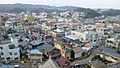
| 鴨川市 | Kamogawa-shi | Kamogawa City | – | 191.14 | 31,554 | 223 | |
| 鎌ケ谷市 | Kamagaya-shi | Kamagaya City | – | 21.08 | 109,370 | 224 | |
| 君津市 | Kimitsu-shi | Kimitsu City | – | 318.81 | 81,355 | 225 | |
| 富津市 | Futtsu-shi | Futtsu City | – | 205.47 | 42,280 | 226 | |
| 浦安市 | Urayasu-shi | Urayasu City | – | 17.30 | 169,749 | 227 | |
| 四街道市 | Yotsukaidō-shi | Yotsukaidō City | – | 34.52 | 93,233 | 228 | |
| 袖ケ浦市 | Sodegaura-shi | Sodegaura City | – | 94.93 | 63,975 | 229 | |
| 八街市 | Yachimata-shi | Yachimata City | – | 74.94 | 66,430 | 230 | |
| 印西市 | Inzai-shi | Inzai City (In[ba] West City) |
– | 123.79 | 103,677 | 231 | |
| 白井市 | Shiroi-shi | Shiroi City | – | 35.48 | 61,673 | 232 | |
| 富里市 | Tomisato-shi | Tomisato City | – | 53.88 | 49,470 | 233 | |
| 南房総市 | Minami-Bōsō-shi | Minami-Boso City (South Boso City) |
– | 230.10 | 35,454 | 234 | |
| 匝瑳市 | Sōsa-shi | Sōsa City (after Sōsa District) |
– | 101.52 | 34,427 | 235 | |
| 香取市 | Katori-shi | Katori City (after Katori District) |
– | 262.35 | 71,391 | 236 | |
| 山武市 | Sanmu-shi | Sanmu City | – | 146.77 | 48,196 | 237 | |
| いすみ市 | Isumi-shi | Isumi City | – | 157.50 | 35,570 | 238 | |
| 大網白里市 | Ōami-Shirasato-shi | Ōami-Shirasato City (merger of Ōami Town & Shirasato Village) |
– | 58.08 | 47,722 | 239 | |
| 酒々井町 | Shisui-machi | Shisui Town | Inba | 19.01 | 20,278 | 322 | |
| 栄町 | Sakae-machi | Sakae Town | 32.51 | 19,902 | 329 | ||
| 神崎町 | Kōzaki-machi | Kōzaki Town | Katori | 19.90 | 5,663 | 342 | |
| 多古町 | Tako-machi | Tako Town | 72.80 | 13,804 | 347 | ||
| 東庄町 | Tōnoshō-machi | Tōnoshō Town | 46.25 | 13,085 | 349 | ||
| 九十九里町 | Kujūkuri-machi | Kujūkuri Town | Sanbu | 24.46 | 14,652 | 403 | |
| 芝山町 | Shibayama-machi | Shibayama Town | 43.24 | 6,916 | 409 | ||
| 横芝光町 | Yokoshiba-Hikari-machi | Yokoshiba-Hikari Town (merger of Yokoshiba Town & Hikari Town) |
67.01 | 22,271 | 410 | ||
| 一宮町 | Ichinomiya-machi | Ichinomiya Town ([Kazusa] provincial shrine Town) |
Chōsei | 22.99 | 11,622 | 421 | |
| 睦沢町 | Mutsuzawa-machi | Mutsuzawa Town | 35.59 | 6,761 | 422 | ||
| 長生村 | Chōsei-mura | Chōsei Village | 28.25 | 13,656 | 423 | ||
| 白子町 | Shirako-machi | Shirako Town | 27.50 | 10,280 | 424 | ||
| 長柄町 | Nagara-machi | Nagara Town | 47.11 | 6,664 | 426 | ||
| 長南町 | Chōnan-machi | Chōnan Town | 65.51 | 7,368 | 427 | ||
| 大多喜町 | Ōtaki-machi | Ōtaki Town | Isumi | 129.87 | 8,762 | 441 | |
| 御宿町 | Onjuku-machi | Onjuku Town | 24.85 | 6,769 | 443 | ||
| 鋸南町 | Kyonan-machi | Kyonan Town | Awa | 45.17 | 7,027 | 463 | |
| 千葉県 | Chiba-ken | Chiba Prefecture | – | 5,157.50 | 6,275,916 | 000 ISO: JP-12 |
|
Chiba's Economy
Big Industries
Chiba Prefecture is home to one of Japan's largest industrial areas. Before World War II, factories in Chiba mainly made brewed products like soy sauce, sake, and mirin (a sweet cooking sake). After the war, manufacturing grew a lot.
In 1950, a big Kawasaki Steel factory was built here. At the same time, the local government started a huge land reclamation project. They used dredging to create large areas of new land along the waterfront. Many factories, warehouses, and docks were built on this new land around Tokyo Bay. This area became the Keiyō Industrial Zone.
Today, Chiba Prefecture is 6th in Japan for industrial output. Most of its industry focuses on oil, chemicals, steel, and machine industries. These industries make up 45% of the prefecture's exports. The government has also funded over 80 industrial parks to bring more development inland.
Farming and Food

Chiba Prefecture also has the second-highest agricultural output in Japan. Only Hokkaidō produces more farm products. Chiba actually grows more vegetables than Hokkaidō.
Peanuts are a special product of Chiba. About 78% of all peanuts in Japan come from this prefecture. You can find fresh peanuts in markets, and they are often eaten boiled as a snack. Miso paste mixed with peanuts is also made in Chiba.
Chiba Prefecture leads the country in growing several vegetables, including carrots, cabbage, daikon radish, and negi (Japanese green onions). It also grows loquats, nashi (Japanese pears), tomatoes, and spinach. Chiba is the second-largest producer of corn. Rice is also grown, and nori (seaweed) is harvested in large amounts from Tokyo Bay.


The traditional food in Chiba Prefecture is similar to the rest of Japan. Chiba grows a lot of rice and vegetables, and its coastal areas provide plenty of fish and seafood. Chōshi has been a major center for making soy sauce for a long time, and Chiba is still the top producer in Japan. Kikkoman, a famous soy sauce company, has its main office in Noda, Chiba. These are all important parts of Japanese cuisine.
Some local products are grown in large amounts and have led to unique dishes. Peanuts, as mentioned, are a big deal. Takenoko (whole bamboo shoots) are harvested in the central Boso Peninsula. The takenoko from Ōtaki can even be eaten raw as "takenoko sashimi" because they don't have as much of a certain natural chemical usually found in raw bamboo shoots.
Futomaki or futomakizushi, meaning "fat roll," is a large sushi roll. The futomaki made in Chiba Prefecture can be up to 10 centimeters wide. These rolls often use different ingredients to create a pattern, like a flower or a kanji character, when they are sliced.
Climate
Chiba Prefecture has a humid subtropical climate. This means it has hot, humid summers and mild, cool winters. The tsuyu (rainy season) lasts for about 50 days from June to July. The average yearly temperature is about 15.7 degrees Celsius. The average high is 19.6 degrees Celsius, and the average low is 12.3 degrees Celsius.
| Climate data for Chiba, Chiba | |||||||||||||
|---|---|---|---|---|---|---|---|---|---|---|---|---|---|
| Month | Jan | Feb | Mar | Apr | May | Jun | Jul | Aug | Sep | Oct | Nov | Dec | Year |
| Mean daily maximum °C (°F) | 9 (48) |
9 (48) |
12 (53) |
17 (63) |
22 (71) |
24 (75) |
27 (81) |
29 (85) |
26 (79) |
21 (69) |
16 (61) |
12 (53) |
19 (66) |
| Mean daily minimum °C (°F) | 1 (33) |
1 (34) |
4 (39) |
9 (49) |
14 (57) |
18 (64) |
21 (70) |
23 (74) |
19 (67) |
13 (56) |
8 (46) |
3 (37) |
11 (52) |
| Average precipitation mm (inches) | 48.3 (1.90) |
66 (2.6) |
94 (3.7) |
109.2 (4.30) |
96.5 (3.80) |
139.7 (5.50) |
106.7 (4.20) |
121.9 (4.80) |
177.8 (7.00) |
157.5 (6.20) |
83.8 (3.30) |
48.3 (1.90) |
1,249.7 (49.2) |
| Source: weather.com | |||||||||||||
Education
Universities in Chiba

Chiba Prefecture has many universities. Here are some of them:
- Chiba
- Chiba University
- Chiba Economic University
- The Open University of Japan
- The Meteorological College of Japan
- Heisei Teikyo University
- Shukutoku University
- Tokyo Information Sciences University
- Tokyo Dental College
- Kanda University of International Studies
- Tokyo University of Career Development
- Funabashi
- Toho University – Narashino Campus
- Nihon University – Funabashi Campus
- Matsudo
- Nihon University – Matsudo Campus
- Ryutsu Keizai University
- Seitoku University
- Ichikawa
- Chiba Commerce University
- Wayo Women's University
- Kashiwa
- University of Tokyo – Kashiwa Campus
- Chiba University – Kashiwanoha Campus
- Kaichi International University
- Nishogakusha University – Kasiwa Campus
- Reitaku University
- Narashino
- Chiba Institute of Technology
- Nihon University – Narashino and Mimomi Campus
- Ichihara
- Heisei Teikyo University – Ichihara Campus
- Yachiyo
- Shumei University
- Tokyo Seitoku University
- Sakura
- Keiai University – Sakura Campus
- Noda
- Tokyo University of Science – Noda Campus
- Nagareyama
- Edogawa University
- Toyo Gakuen University
- Urayasu
- Juntendo University – Urayasu Campus
- Meikai University
- Ryotokuji University
- Abiko
- Chuo Gakuin University
- Kawamura Gakuen Woman's University
- Kisarazu
- Seiwa University
- Togane
- Josai International University
- Inzai
- Juntendo University – Sakura Campus
- Kamogawa
High Schools
The Chiba Prefectural Board of Education is in charge of public high schools in the prefecture.
Culture and Museums
Museums to Explore

Chiba Prefecture has one national museum and several prefectural and local museums.
- The National Museum of Japanese History in Sakura teaches about Japan's history, old findings, and folk culture.
- The main Chiba prefectural museum is the Natural History Museum and Institute, Chiba in Chiba City. It has six smaller museums around the prefecture.
- The Chiba Prefectural Museum of Art is also in Chiba City.
- The Chiba Prefectural Boso-no-mura in Sakae shows what local life was like in the late Edo period.
- The Chiba Prefectural Otone Museum in Katori focuses on the culture of the Tone River area.
- Rebuilt Japanese castles like Sekiyado and Ōtaki also have local history museums.
- The Chiba Museum of Science and Industry in Ichikawa is built on an old factory site.
- The Coastal Branch of Natural History Museum and Institute, Chiba in Katsuura focuses on the ocean environment of the Pacific coast. Many other towns and villages in Chiba also have their own museums.
Libraries and Archives
The Chiba Prefectural Library has three locations. The main one, the Chiba Prefectural Central Library, is in Chiba City. It has a general collection and a research collection for the prefecture. The Chiba Prefectural West Library in Matsudo focuses on natural history and fine arts. The Chiba Prefectural East Library in Asahi has a research collection about the prefecture's literature and history.
The Chiba Prefectural Archives keep a collection of rare books and materials from all over the prefecture. They also have documents about how Chiba Prefecture is run. Every city and town in Chiba has its own local library. Many shrines and temples also keep old records related to their history.
Sports in Chiba
.jpg)
Chiba Prefecture hosts two major athletic events in Japan: the International Chiba Ekiden (a long-distance relay race) and the Chiba International Cross Country (a running race).
Many professional sports teams are based in Chiba:
American Football
- X-League: Obic Seagulls (Narashino)
- X-League: IBM Big Blue (Yachiyo)
Soccer
- J.League (J1): Kashiwa Reysol (Kashiwa)
- J.League (J2): JEF United Ichihara Chiba (Chiba, Ichihara)
Baseball
- NPB: Chiba Lotte Marines (Chiba)
Basketball
- B.League: Chiba Jets Funabashi (Funabashi)
Rugby
- Nihon IBM Big Blue (Yachiyo)
- Kubota Spears (Funabashi)
- NEC Green Rockets (Abiko)
Futsal
- F.League: Bardral Urayasu (Urayasu)
Volleyball
- V.Challenge League II: Chiba Zelva (Chiba)
Getting Around Chiba
Narita International Airport
Most visitors flying into Tokyo from other countries land at Narita International Airport. This airport is in Narita, in the northern part of the prefecture. You can get to Tokyo from Narita by train using the East Japan Railway's Narita Express or the Keisei Electric Railway's Skyliner.
Train Lines


Chiba Prefecture has many train lines that connect its cities and towns, and also link to Tokyo.
- East Japan Railway Company (JR East)
- Sōbu Main Line (including Chūō-Sōbu Line and Sōbu Line (Rapid))
- Jōban Line (including Jōban Line (Local) and Jōban Line (Rapid))
- Narita Line
- Uchibō Line
- Sotobō Line
- Keiyō Line
- Musashino Line
- Tōgane Line
- Kashima Line
- Kururi Line
- Keisei
- Main Line
- Narita Sky Access
- Chiba Line
- Chihara Line
- Higashi Narita Line
- Shin-Keisei Line
- Hokuso Line
- Toyo Rapid Line
- Shibayama Railway
- Tobu
- Noda Line
- Tsukuba Express
- Tokyo Metro Tozai Line
- Toei Shinjuku Line
- Nagareyama Line
- Choshi Electric Railway
- Kominato Railway
- Isumi Railway
- Disney Resort Line
Monorails and People Movers
- Chiba Urban Monorail
- Yamaman Yukarigaoka Line
Roads and Highways
Chiba has a good network of roads and expressways:
- Joban Expressway
- Narita Airport Expressway
- Higashi Kanto Expressway
- Tokyo Gaikan Expressway
- Tateyama Expressway
- Shuto Expressway
- Keiyo Road
- Togane Road
- Tokyo Bay Aqua Line
Fun Things to Do in Chiba

The Tokyo Disney Resort is located in Urayasu, right near the western border of the prefecture. The Kamogawa Sea World is in Kamogawa.
There are also many other cool places to visit on the Chiba peninsula:
- Nokogiriyama
- Kujūkuri Beach
- Onjuku beach
Famous People from Chiba
- Jun Ishikawa – a composer
- Yoshiko Sakakibara – a voice actress
- Yuuri – a singer and songwriter
- Hassei Takano – an actor
- Kei Shindō – a voice actress
Police Force

Chiba's police force is one of the ten largest in Japan, with over 10,000 members. This includes the police who work at Narita Airport. Like in all prefectures, the police are watched over by a public safety commission. Its five members are chosen by the governor and approved by the local assembly.
International Friends
Chiba Prefecture has special "sister city" relationships with places around the world:
 Wisconsin, United States (since 1990)
 Wellingborough, Northamptonshire, United Kingdom
 Juanjuí, Peru
 Düsseldorf, Germany (since 2019)
Images for kids
-
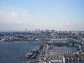
Chiba City
-
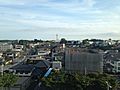
Ichikawa
-
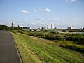
Narita
-
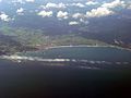
Kamogawa
-
Katori
-
Katsuura


See also
 In Spanish: Prefectura de Chiba para niños
