Ohio Valley in Kentucky facts for kids
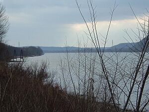
The Ohio Valley is a special area in Kentucky. It stretches for about 658 miles (1,059 km) along the Ohio River. This valley includes parts of 25 counties and crosses five different regions of the state. It's a very important place for Kentucky. More than 45% of people in Kentucky live in counties right next to the Ohio River. Even though these counties are only a small part of the state's land, they are home to many people.
The Ohio Valley in Kentucky can be divided into different sections. Each part has its own unique features.
Contents
Exploring the Ohio Valley in Eastern and Northern Kentucky
The Ohio River valley looks quite similar from its start in Pittsburgh, Pennsylvania all the way to just northeast of Louisville, Kentucky. This includes the part that flows through the Cumberland Plateau and the Eden Shale hill region of Northern Kentucky.
Throughout this long stretch, the river is in a narrow valley. It is surrounded by hills that are about 100 to 400 feet (120 m) tall. These hills often have a steep angle of 45 degrees. The river itself varies in width here. It can be from about 1/4 of a mile to over 4/10 of a mile wide.
The Ohio Valley Near Louisville
The Ohio Valley changes a lot when it reaches the Louisville area. For the first time as you travel downstream, there are no tall cliffs or bluffs overlooking the river. The river also becomes much wider and shallower here. It goes from about 4/10 of a mile wide to over 9/10 of a mile wide near the canal entrance.
Then, it gets narrower again, becoming less than 3/10 of a mile wide. This happens as it gets closer to the Falls of the Ohio. These falls are the only natural barrier along the entire river. They were formed by very hard coral rock that the river could not wear away. You can even see many fossils in this coral rock!
The flat land next to the river, called the flood plain, is very wide here. It stretches about 10 miles (16 km) on the Kentucky side. On the Indiana side, it extends about four miles (6 km). This wide, flat area is east of the Muldraugh Escarpment. This escarpment, also known as Muldraugh Hill, is a tall hill. It separates the Bluegrass and Pennyroyal Plateau Regions in Kentucky. In Indiana, it's known as the "karst plateau." This 400 feet (120 m) tall hill is easy to see from most parts of Louisville. It creates a beautiful background for the city.
From Muldraugh Hill to Owensboro
At West Point, Kentucky, the river crosses the Muldraugh Escarpment. Now, the river is bordered by the largest bluffs along its entire length. These bluffs are from 400 to 500 feet tall. In many places, they are almost straight up and down. However, the flood plain here is about twice as wide as it is in Northern Kentucky. The river in this section is usually around 4/10 of a mile wide.
From Owensboro to the Mississippi River
Near Rockport, Indiana, the bluffs above the river become much smaller. They are about 60 feet (18 m) tall or less. This is because the river enters a much flatter area. The river itself starts to look more like the Mississippi River. It gets wider, going from about 1/2 a mile wide to over 8/10 of a mile. You will also see many more islands and oxbow lakes here.
This part of the river has 35 islands. Many of the oxbow lakes in this area have been turned into wildlife management areas. These areas are mostly for waterfowl, like ducks and geese. The Ballard WMA is one example, and it is the largest wildlife area in the state.


