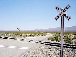
Garlock, California facts for kids
Quick facts for kids
Garlock
|
|
|---|---|
| Country | United States |
| State | California |
| County | Kern County |
| Elevation | 2,169 ft (661 m) |
| Reference #: | 671 |

Garlock, once called Eugeneville, is a small, quiet place in Kern County, California, United States. It's not a city with a mayor or a town council. Instead, it's an unincorporated community. This means it's a settlement without its own local government.
Garlock is located about 6.25 miles (10.1 km) east-southeast of Saltdale. It sits at an elevation of 2,169 feet (661 meters) above sea level.
Today, Garlock is known as a ghost town. A ghost town is a place where most people have left, and very few, if any, still live there.
Contents
A Town's Beginning: From Cow Wells to Gold Rush
Before it was called Garlock, this area had other names like El Paso City or Cow Wells. It was an important stop for people traveling through the desert. The town provided much-needed water for cattlemen and freighters. This helped them avoid dangerous dry riverbeds in Red Rock Canyon.
Gold Discovery and Growth
In the 1880s, people started finding gold in the canyons of the El Paso Mountains. This led to the building of an arrastra in 1887. An arrastra was a simple machine used to crush gold ore. It often used a heavy stone pulled by an animal in a circular path.
A big discovery happened in 1893 when a large gold nugget, worth $1,900, was found in Goler Heights. This exciting find started a gold rush!
The Garlock Mill
In 1894, a man named Eugene Garlock from Tehachapi brought an eight-stamp mill to the area. A stamp mill is a machine that crushes rocks to get the gold out. Miners would say they were going "down to the Garlock mill" or "down to the Garlock." Eventually, the place just became known as "Garlock."
A post office served the community from 1896 to 1904, and again from 1923 to 1926. The original site of Garlock, sometimes called Old Garlock, was about three miles southwest of the later town.
California Historical Landmark
Garlock is recognized as an important historical site in California. It is registered as California Historical Landmark #671. This special designation was given on December 1, 1958.
The historical marker for Garlock can be found about 7.4 miles (11.9 km) west of State Highway 395 on Garlock Road. It is also about 13.4 miles (21.6 km) northeast of the Cantil post office.
What the Landmark Says
The California Historical Landmark marker tells us: NO. 671 SITE OF THE TOWN OF GARLOCK - In 1896, Eugene Garlock constructed a stamp mill near this spot to crush gold ore from the Yellow Aster Mine on Rand Mountain. Known originally as Cow Wells by prospectors and freighters during the 1880s and early 1890s, the town of Garlock continued to thrive until 1898, when water was piped from here to Randsburg and the Kramer-Randsburg rail line was completed.
This means Garlock was important for crushing gold ore. But its boom ended around 1898. This happened when water was piped directly to the nearby town of Randsburg, and a new railroad line was finished. These changes made Garlock less necessary as a water stop and milling center, leading to its decline.
See also
 In Spanish: Garlock (California) para niños


