Oliver, Pennsylvania facts for kids
Quick facts for kids
Oliver, Pennsylvania
|
|
|---|---|

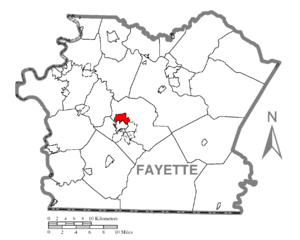
Location of Oliver in Fayette County
|
|
| Country | United States |
| State | Pennsylvania |
| County | Fayette |
| Township | North Union |
| Area | |
| • Total | 2.22 sq mi (5.75 km2) |
| • Land | 2.22 sq mi (5.75 km2) |
| • Water | 0.00 sq mi (0.00 km2) |
| Population
(2020)
|
|
| • Total | 2,538 |
| • Density | 1,142.73/sq mi (441.28/km2) |
| Time zone | UTC-4 (EST) |
| • Summer (DST) | UTC-5 (EDT) |
| ZIP code |
15401
|
| Area code(s) | 724 |
| FIPS code | 42-56704 |
Oliver is a community in Fayette County, Pennsylvania, United States. It is called a census-designated place (CDP). This means it's an area that the government counts for population. However, it does not have its own local government like a city or town. In 2020, about 2,538 people lived in Oliver. It is located within North Union Township.
Contents
Where is Oliver?
Oliver is in the central part of Fayette County. You can find its exact spot at 39°54′52″N 79°43′2″W / 39.91444°N 79.71722°W. It shares a border to the south with Uniontown. Uniontown is the main city and county seat of Fayette County. To the southeast, Oliver is next to a community called East Uniontown.
Roads and Travel
A major road, U.S. Route 119, goes through Oliver. This road helps people travel around the area. The Mon–Fayette Expressway also starts near Oliver, branching off US-119.
US 119 goes northeast about 10 miles (16 km) to Connellsville. The Mon–Fayette Expressway goes northwest and north about 42 miles (68 km) to Jefferson Hills, which is south of Pittsburgh. Both US-119 and the Mon–Fayette Expressway go southwest about 29 miles (47 km) to Morgantown, West Virginia.
Land Area and Climate
According to the United States Census Bureau, Oliver covers a total area of about 2.2 square miles (5.7 km2). All of this area is land.
The climate in Oliver has small differences between high and low temperatures. There is also enough rainfall all year. This type of weather is known as a marine west coast climate. On climate maps, it is shown as "Cfb".
People of Oliver
| Historical population | |||
|---|---|---|---|
| Census | Pop. | %± | |
| 2020 | 2,538 | — | |
| U.S. Decennial Census | |||
In the year 2000, there were 2,925 people living in Oliver. There were 1,267 households and 819 families. A household is a group of people living in one home. The population density was about 1,324.1 inhabitants per square mile (511.2/km2) people per square mile. There were 1,375 homes in total.
Diversity in Oliver
Most people in Oliver were White (91.45%). About 6.91% were African American. Smaller groups included Native American (0.24%), Asian (0.48%), and Pacific Islander (0.03%). About 0.10% were from other races, and 0.79% were from two or more races. About 0.51% of the population was Hispanic or Latino.
Households and Families
Out of the 1,267 households, 26.0% had children under 18 living with them. About 41.0% were married couples living together. In 18.5% of homes, a female head of household lived without a husband. About 35.3% were not families.
Many homes (32.2%) had only one person living there. About 17.4% of homes had someone living alone who was 65 years old or older. The average household had 2.25 people. The average family had 2.82 people.
Age and Income
The population in Oliver was spread out by age. About 21.2% were under 18 years old. About 8.3% were between 18 and 24. People aged 25 to 44 made up 24.7%. Those aged 45 to 64 were 24.5%. About 21.3% were 65 years or older. The average age was 41 years.
The median income for a household was $23,333. The median income for a family was $34,402. This means half of the households earned more than this amount, and half earned less. About 18.5% of all people lived below the poverty line. This included 31.3% of those under 18 and 15.2% of those 65 or older.
See also
 In Spanish: Oliver (Pensilvania) para niños
 | Sharif Bey |
 | Hale Woodruff |
 | Richmond Barthé |
 | Purvis Young |

