Olivine Ice Plateau facts for kids
Quick facts for kids Olivine Ice Plateau |
|
|---|---|

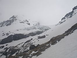
Upper Forgotten River and edge of the Olivine Ice Plateau
|
|
| Location | Five Finger Range |
| Coordinates | 44°26′26″S 168°22′00″E / 44.440594°S 168.366606°E |
| Highest elevation | 2200m |
| Lowest elevation | 700m |
The Olivine Ice Plateau is a large area of ice, like a big, flat glacier, located in the beautiful South Island of New Zealand. It's found within the Olivine Wilderness Area and Mount Aspiring National Park. This special place gets its name from a green mineral called olivine, which is very common in the rocks underneath the ice.
Discovering the Olivine Ice Plateau
The Olivine Ice Plateau is a type of glacier that covers a wide, flat area. It's not just one big block of ice; it connects to other glaciers too! To the west, it stretches towards the Forgotten River Col and into the Forgotten River. To the north, it joins up with the Andy Glacier, which then feeds into a river called the Arawhata River.
This ice plateau is one of many glaciers you can find in this part of New Zealand. It's located near the start of several important rivers, including the Arawhata, Dart, Hollyford, and Matukituki rivers.
Exploring the Area
People started exploring and mapping this icy region in the 1930s. A person named J.T. Holloway was important in creating the first maps of the area.
In recent years, since the 2010s, the glacier has been getting smaller. This means it has "retreated," or moved back. Because of this, it's now rockier when you try to reach the plateau from the Forgotten River Col.
A Challenge for Trampers
The Olivine Ice Plateau is a very special place for New Zealand trampers. Trampers are people who love to go on long walks or hikes, often in wild and remote places. They "revere" or deeply respect the Olivine Ice Plateau because it's so far away and hard to reach. It offers a truly challenging adventure for those who visit.
 | Janet Taylor Pickett |
 | Synthia Saint James |
 | Howardena Pindell |
 | Faith Ringgold |

