
Olt (river) facts for kids
Quick facts for kids Olt |
|
|---|---|

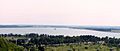
The Avrig reservoir on the Olt
|
|
 |
|
| Country | Romania |
| Counties | Harghita, Covasna, Brașov, Sibiu, Vâlcea, Olt, Teleorman |
| Cities | Sfântu Gheorghe, Râmnicu Vâlcea, Slatina |
| Physical characteristics | |
| Main source | Hășmaș Mountains Bălan, Harghita 1,440 m (4,720 ft) |
| River mouth | Danube near Turnu Măgurele 43°42′46″N 24°48′1″E / 43.71278°N 24.80028°E |
| Length | 615 km (382 mi) |
| Basin features | |
| Progression | Danube→ Black Sea |
| Basin size | 24,050 km2 (9,290 sq mi) |
| Tributaries |
|
| River code | VIII.1 |
The Olt is a very important river in Romania. It is the longest river that flows entirely within Romania's borders. The Olt is about 615 kilometers (382 miles) long. Its basin, which is the area of land where all the water drains into the river, covers about 24,050 square kilometers (9,286 square miles).
The Olt River starts high up in the Hășmaș Mountains. These mountains are part of the eastern Carpathian Mountains. The river begins near a town called Bălan. It flows close to where another big river, the Mureș, also begins.
As it flows, the Olt passes through several Romanian counties. These include Harghita, Covasna, Brașov, Sibiu, Vâlcea, and Olt. In ancient Roman times, this river was known as Alutus or Aluta. The modern Olt County and the historical region of Oltenia are named after this river.
The Olt River eventually flows into the mighty Danube river. This happens near the town of Turnu Măgurele. On average, about 174 cubic meters (6,145 cubic feet) of water flow out of the Olt into the Danube every second.
Contents
Cities and Towns Along the Olt

Many cities and towns are located along the Olt River. Some of the main cities include Sfântu Gheorghe, Râmnicu Vâlcea, and Slatina. Other important cities on its banks are Miercurea Ciuc and Făgăraș.
The Olt River flows through many communities from its source to its mouth. These include:
- Bălan
- Miercurea Ciuc
- Sfântu Gheorghe
- Făgăraș
- Avrig
- Râmnicu Vâlcea
- Drăgășani
- Slatina
- Piatra-Olt
- Drăgănești-Olt
- Izbiceni
- Giuvărăști
Rivers Joining the Olt
Many smaller rivers flow into the Olt River. These are called tributaries. They add water to the Olt as it makes its way to the Danube.
- From the Left Side:
- Râul Negru
- Bârsa
- Homorod
- Șercaia
- Mândra
- Sebeș
- Sâmbăta
- Viștea
- Ucea
- Arpaș
- Cârțișoara
- Porumbacu
- Avrig
- Sărata
- Sebeș
- Topolog
- Teslui
- Milcov
- Dârjov
- Iminog
- From the Right Side:
- Valea Crișului
- Arcuș
- Debren
- Baciu
- Vâlcele
- Hăghig
- Aita
- Baraolt
- Cormoș
- Homorod
- Cincu
- Cibin
- Lotrioara
- Lotru
- Muereasca
- Olănești
- Govora
- Bistrița
- Luncavăț
- Pesceana
- Olteț
- Caracal
- Vlădila
- Suhat
- Crușov
Dams and Hydropower Plants
The Olt River is very important for providing water and electricity. To help with this, many reservoirs and dams have been built along the river and its tributaries. There are 44 reservoirs in the Olt river basin.
On the Olt River itself, there are 24 reservoirs that help produce hydroelectricity. Hydropower plants use the force of flowing water to create electricity. There are also three such reservoirs on the Lotru River, which is a tributary of the Olt.
Some of the places where you can find hydropower plants on the Olt River include:
- Voila
- Viștea
- Arpaș
- Avrig
- Râmnicu Vâlcea
- Slatina
- Drăgănești
- Izbiceni
In 1996, all the hydropower plants in the Olt basin together produced a lot of energy: 2,980 GWh (gigawatt-hours). This energy helps power homes and businesses.
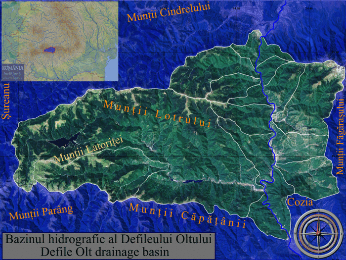
Clickable map of the (ro:Defileul Oltului)/(en:Olt Defile) drainage basin
Gallery
-
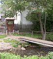
Olt – Close to the source, at Siculeni
-
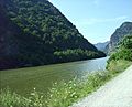
The Olt River at Turnu Roșu
-
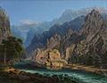
Carol Popp de Szathmary, Olt Valley
-
Slatina storage reservoir on the Olt river


- More pictures: Raft ride (rafting) on Olt
See also
 In Spanish: Río Olt para niños
- Olt Defile
- Limes Alutanus
