Oostflakkee facts for kids
Quick facts for kids
Oostflakkee
|
|||
|---|---|---|---|
|
Former municipality
|
|||
|
|||
 |
|||
| Country | Netherlands | ||
| Province | South Holland | ||
| Municipality | Goeree-Overflakkee | ||
| Area | |||
| • Total | 107.44 km2 (41.48 sq mi) | ||
| • Land | 74.69 km2 (28.84 sq mi) | ||
| • Water | 32.75 km2 (12.64 sq mi) | ||
| Population
(1 January 2007)
|
|||
| • Total | 10,163 | ||
| • Density | 136/km2 (350/sq mi) | ||
| Source: CBS, Statline. | |||
| Time zone | UTC+1 (CET) | ||
| • Summer (DST) | UTC+2 (CEST) | ||
| Website | www.oostflakkee.nl | ||
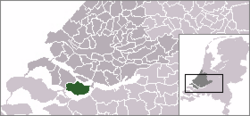
Oostflakkee was a former municipality located on the island of Goeree-Overflakkee in the western Netherlands. It was part of the province of South Holland. In 2007, about 10,000 people lived there.
The area covered around 107 square kilometers, with a good part of it being water. On January 1, 2013, Oostflakkee joined with three other municipalities – Goedereede, Dirksland, and Middelharnis – to form the new, larger municipality of Goeree-Overflakkee.
Contents
What Was Oostflakkee?
Oostflakkee was a municipality that no longer exists on its own. It was located on the eastern side of the island of Goeree-Overflakkee. This area is known for its beautiful water landscapes and quiet towns.
How Oostflakkee Was Created
The former municipality of Oostflakkee was not always one big area. It was created in 1966. This happened when three smaller municipalities decided to join together. These were Den Bommel, Ooltgensplaat, and Oude Tonge.
After they joined, Oostflakkee included several communities. These communities were Achthuizen, Langstraat, Den Bommel (which included Zuidzijde), Ooltgensplaat, Oude-Tonge, and Zuidzijde.
Towns and Communities
Oostflakkee was made up of several unique towns and small communities. Each one had its own special features.
Oude Tonge: The Main Town
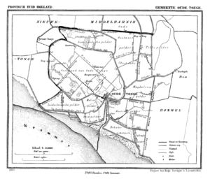
Oude Tonge was the most important town in the former municipality. It had a large industrial area, which meant many businesses and factories were located there. It also had a big bus station, making it a central point for travel.
Den Bommel: A Harbor Town
Den Bommel is quite similar to Stad aan 't Haringvliet. It has a nice harbor and a beach. These are located right on the shores of the Haringvliet. A few kilometers east of Den Bommel, you would find Zuidzijde. This is a very small town with a neat-looking water tower.
Ooltgensplaat: The Eastern Gem
Ooltgensplaat is the town furthest to the east on the island. It has its own harbor on the Volkerak. The town is also home to a very old and beautiful municipal building.
Other Small Towns
Achthuizen and Langstraat are two other small towns. They are located close to Ooltgensplaat. These communities add to the quiet charm of the area.
The "De Omloop" Event
Ooltgensplaat is famous for a special yearly event called "De Omloop." This is a very long walk that covers over 100 kilometers around the island. Participants have to complete the walk within 24 hours. Thousands of people come every year for this event. They either take part in the walk or come to watch and support. It is held every year in the second half of August.
 | Roy Wilkins |
 | John Lewis |
 | Linda Carol Brown |


