
Orchard, Texas facts for kids
Quick facts for kids
Orchard, Texas
|
|
|---|---|

Orchard's distinctive water tower
|
|

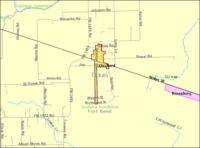
Location of Orchard, Texas
|
|
| Country | United States |
| State | Texas |
| County | Fort Bend |
| Area | |
| • Total | 0.36 sq mi (0.94 km2) |
| • Land | 0.36 sq mi (0.94 km2) |
| • Water | 0.00 sq mi (0.00 km2) |
| Elevation | 125 ft (38 m) |
| Population
(2020)
|
|
| • Total | 313 |
| • Density | 869/sq mi (333.0/km2) |
| Time zone | UTC-6 (Central (CST)) |
| • Summer (DST) | UTC-5 (CDT) |
| ZIP code |
77464
|
| Area code(s) | 979 |
| FIPS code | 48-54192 |
| GNIS feature ID | 1343307 |
Orchard is a small city located in western Fort Bend County, Texas, United States. It is part of the larger Houston metropolitan area. The city is situated along State Highway 36 and the BNSF Railway. It lies between the cities of Rosenberg in Fort Bend County and Wallis in Austin County. In 2020, the population of Orchard was 313 people.
Contents
Exploring Orchard's Location
Orchard is found at specific coordinates: 29.602015 degrees North and 95.968821 degrees West. Most of the city is located north of the BNSF Railway tracks. The streets in Orchard are set up in a grid, running north-south and east-west.
Key Roads and Nearby Towns
Missouri Street is a main road that runs north-south through Orchard. It crosses State Highway 36 and the railroad tracks. This street goes north all the way to Brazos Elementary School.
Another important road is Kibler Road, which runs east-west. The center of Orchard is located along Kibler Road. To the west, Kibler Road starts at FM 1489. To the east, it ends at Long Lane. FM 1489 also crosses State Highway 36 to the west of Orchard. It goes south towards Tavener and north towards Simonton.
Orchard is about 6 miles (9.7 km) southeast of Wallis when traveling on State Highway 36. It is also about 10 miles (16 km) northwest of Rosenberg on the same highway.
City Size and Land Area
According to the United States Census Bureau, the city of Orchard covers a total area of about 0.36 square miles (0.94 square kilometers). All of this area is land, meaning there are no large bodies of water within the city limits.
-
Map of Orchard
-
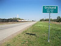
City limit sign on Hwy 36 looking southeast
-
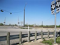
Intersection of Hwy 36 and FM 1489
-
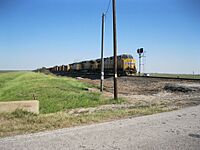
Union Pacific freight train at Long Lane


Orchard's Population Over Time
| Historical population | |||
|---|---|---|---|
| Census | Pop. | %± | |
| 1980 | 408 | — | |
| 1990 | 373 | −8.6% | |
| 2000 | 408 | 9.4% | |
| 2010 | 352 | −13.7% | |
| 2020 | 313 | −11.1% | |
| U.S. Decennial Census 2020 Census |
|||
The population of Orchard has changed over the years. In 2000, there were 408 people living in the city. By 2020, the population had decreased slightly to 313 people.
Who Lives in Orchard?
In 2000, there were 147 households in Orchard. A household is a group of people living together in one home. Most of these households (61.2%) were married couples living together. About 39.5% of households had children under 18 living with them.
The population of Orchard includes people of different ages. In 2000, about 28.4% of the population was under 18 years old. About 8.8% of the population was 65 years old or older. The average age in Orchard was 33 years.
Education in Orchard
Students in Orchard are served by the Brazos Independent School District. This school district was formerly known as the Wallis-Orchard Independent School District.
Local Schools
Children living in Orchard attend Brazos Elementary School, which is located within the city limits. After elementary school, students go to Brazos Middle School. For high school, students attend Brazos High School.
Community College Options
For students who want to continue their education after high school, Wharton County Junior College is the designated community college for the Brazos Independent School District.
-
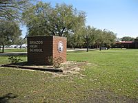
Brazos High School, located on Hwy 36 in Wallis
-
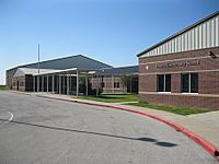
Brazos Elementary School in Orchard


See also
 In Spanish: Orchard (Texas) para niños
