
Wallis, Texas facts for kids
Quick facts for kids
Wallis, Texas
|
|
|---|---|
.jpg)
View of Wallis along Highway 36 in 2020
|
|

Location of Wallis, Texas
|
|
 |
|
| Country | United States |
| State | Texas |
| County | Austin |
| Area | |
| • Total | 1.51 sq mi (3.91 km2) |
| • Land | 1.50 sq mi (3.87 km2) |
| • Water | 0.01 sq mi (0.04 km2) |
| Elevation | 128 ft (39 m) |
| Population
(2020)
|
|
| • Total | 1,292 |
| • Density | 871.57/sq mi (336.42/km2) |
| Time zone | UTC-6 (Central (CST)) |
| • Summer (DST) | UTC-5 (CDT) |
| ZIP code |
77485
|
| Area code(s) | 979 |
| FIPS code | 48-76240 |
| GNIS feature ID | 1376626 |
Wallis is a city in the southeastern part of Austin County, Texas, United States. It is located along State Highway 36 and the BNSF Railway. The city is found between the towns of Rosenberg and Sealy. In 2020, the city's population was 1,292 people.
Contents
Wallis City Location and Roads
Wallis is located at specific map coordinates: 29.630649 degrees North and 96.062751 degrees West.
Texas State Highway 36 runs through Wallis. It goes northwest from Wallis to Sealy and east-southeast to Rosenberg. The BNSF Railway tracks run right next to Highway 36.
Other important roads meet in Wallis. Texas State Highway 60 starts in western Wallis and heads south. Farm to Market Road 1093 goes northeast to Simonton and west-southwest to Eagle Lake. Farm to Market Road 1952 begins in eastern Wallis and travels south and east.
The city of Wallis covers a total area of about 3.9 square kilometers (1.5 square miles). A very small part of this area, about 0.04 square kilometers (0.01 square miles), is water.
Wallis City History
Early Settlers and New Name
In 1830, the first Anglo-American settlers came to live in this area of Texas. It was located between the Brazos and San Bernard rivers. When the community got its first post office in 1873, it was called Bovine Bend.
After 1880, a railroad called the Gulf, Colorado and Santa Fe Railway was built through the community. It connected Galveston to Brenham. At this time, the town was renamed Wallis Station. This new name honored J. E. Wallis, who was a director of the railroad company.
In 1887, another railroad, the San Antonio and Aransas Pass Railway, reached Wallis. This line was being built east towards Houston.
Growth and Development in Wallis
Around 1890, many Czech immigrants started moving into the Wallis area. By 1904, the town had grown to 631 people. In 1911, the town officially dropped "Station" from its name and became simply Wallis.
Seven years later, in 1918, the local school had 100 students. Between 1925 and 1943, the population of Wallis increased from 800 to 900 residents. By 1943, the town had 39 businesses.
Wallis Population Changes
After a slight decrease to 690 people in 1949, the population grew again to 1,075 by 1966. Ten years later, in 1976, Wallis had a bank, a library, and a newspaper. It also had two schools and eight churches.
In 1991, Wallis had 1,411 people and 15 businesses. The population then decreased to 1,311 in 2000 and to 1,252 in 2010. In 2013, the BNSF Railway still used the old Gulf, Colorado and Santa Fe Railway tracks. However, the other east-west railroad line was no longer in use.
-
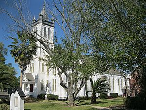
Guardian Angel Catholic Church on Demel Street
-
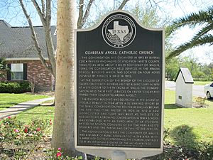
Historical marker at Guardian Angel Catholic Church
-
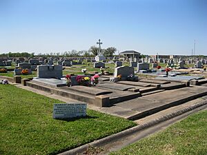
Guardian Angel Cemetery on FM 1952 south of Wallis


Wallis Population Information
| Historical population | |||
|---|---|---|---|
| Census | Pop. | %± | |
| 1880 | 29 | — | |
| 1980 | 1,138 | — | |
| 1990 | 1,001 | −12.0% | |
| 2000 | 1,172 | 17.1% | |
| 2010 | 1,252 | 6.8% | |
| 2020 | 1,292 | 3.2% | |
| U.S. Decennial Census | |||
Wallis Population in 2020
As of the 2020 United States census, Wallis had 1,292 people. There were 729 households and 447 families living in the city.
The population was made up of different groups:
| Race | Number | Percentage |
|---|---|---|
| White (NH) | 653 | 50.54% |
| Black or African American (NH) | 156 | 12.07% |
| Native American or Alaska Native (NH) | 4 | 0.31% |
| Asian (NH) | 7 | 0.54% |
| Some Other Race (NH) | 5 | 0.39% |
| Mixed/Multi-Racial (NH) | 44 | 3.41% |
| Hispanic or Latino | 423 | 32.74% |
| Total | 1,292 |
Wallis Population in 2000
In the year 2000, there were 1,172 people living in Wallis. There were 422 households and 314 families. The population density was about 768 people per square mile.
About 35.5% of households had children under 18 living with them. Most households (58.8%) were married couples. About 21.3% of all households were single individuals. About 12.1% of households had someone aged 65 or older living alone.
The average household had 2.77 people, and the average family had 3.23 people.
The age breakdown of the population was:
- 28.1% were under 18 years old.
- 9.2% were between 18 and 24.
- 27.6% were between 25 and 44.
- 21.8% were between 45 and 64.
- 13.2% were 65 years or older.
The average age in Wallis was 35 years.
The median income for a household was $36,328. For a family, the median income was $40,000. About 6.4% of families and 10.8% of the population lived below the poverty line. This included 13.3% of those under 18 and 15.6% of those 65 or older.
Wallis City Leadership
The current mayor of Wallis is Jerry Delso. He was elected on May 12, 2012.
Wallis Education and Schools
Wallis is part of the Brazos Independent School District. This school district used to be called Wallis-Orchard Independent School District.
The city is home to the Brazos High School, whose sports teams are called the Cougars.
The community college for students in the Brazos ISD area is Wharton County Junior College.
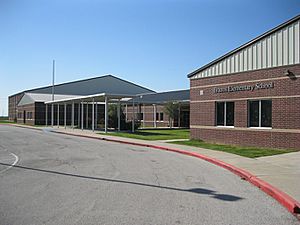
-
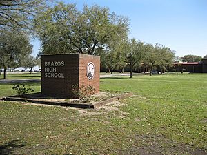
Brazos High School on Hwy. 36 in Wallis
-
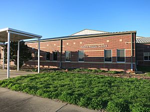
Brazos Middle School behind H.S. in Wallis
-
Brazos Elementary School in Orchard


Wallis in Media
Wallis was one of the main towns featured in a 2009 documentary film. This film was called The Heart of Texas.
Also, the very first scene of the movie Urban Cowboy was filmed near Wallis. It took place on a farm just outside the city, on FM 1952.
See also
 In Spanish: Wallis (Texas) para niños
